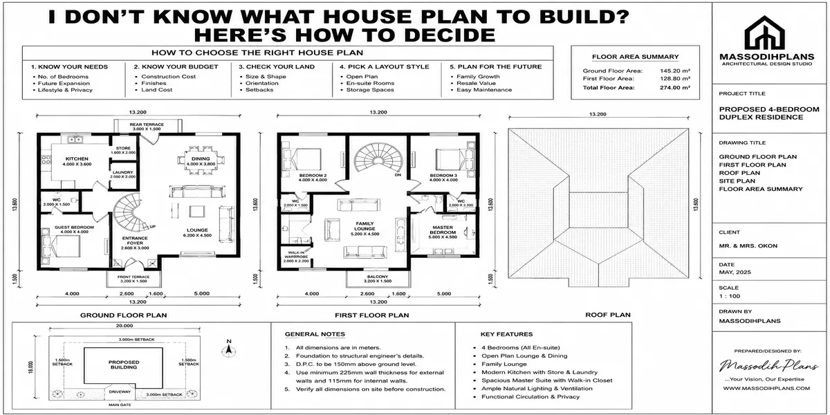
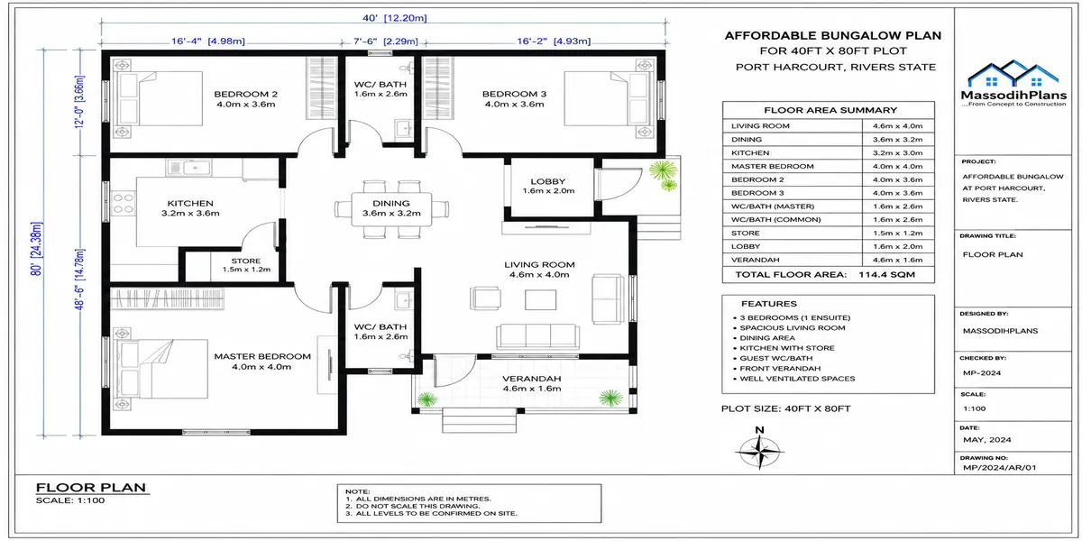
Before You Touch That Land, Read This: What a Layout Plan Really Means for Your Future
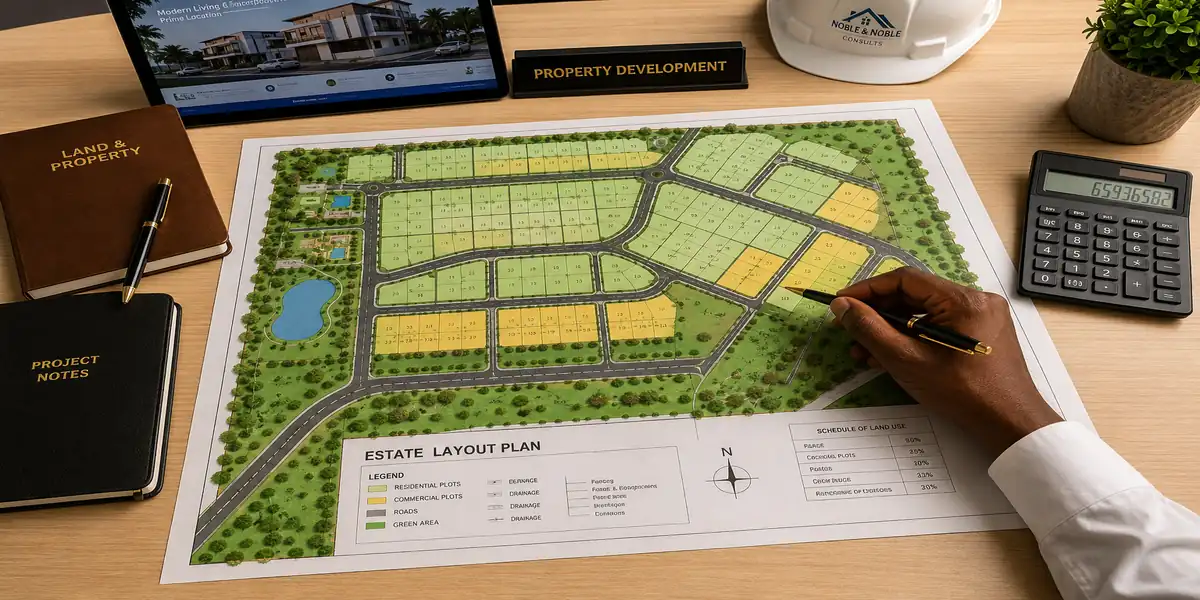
A well-structured layout plan balances access, density, and green space
If you are asking “what is a layout plan and why does my land need one,” here is the short answer first: a layout plan is the document that tells you, your builder, and your government exactly how a piece of land should be divided, used, and connected roads, plots, drainage, utilities, and open spaces before a single block is laid. Without it, you are not developing land. You are gambling with it.
I have sat across the table from landowners who bought a plot with excitement, only to discover two years later that their access road was never legally reserved, or that their neighbor’s building now blocks their drainage outlet. In my experience, almost every serious land dispute I’ve reviewed traces back to one missing document: a proper layout plan. This guide will walk you through what it is, why it matters, and how it’s handled differently but with the same underlying logic around the world.
What Exactly Is a Layout Plan?
A layout plan is a technical drawing, usually prepared by a licensed town planner, that shows how a piece of land will be subdivided and organized before development begins. It typically includes:
- Plot boundaries and sizes
- Road networks and access points
- Land use zones (residential, commercial, institutional, green space)
- Drainage channels and utility corridors
- Setbacks and building lines
Think of it as the “constitution” for that piece of land. Every future building, every road extension, every utility connection refers back to it.
Why Uncontrolled Growth Happens Without a Layout Plan
From what I have seen in practice, when land is sold and built on without a layout plan guiding it, the same problems repeat themselves almost everywhere in the world, just at different scales:
Uncontrolled growth and sprawl
- Haphazard building without setbacks
- Encroachment on public or reserved land
- Informal settlements growing faster than services can reach them
Transportation breakdown
- Roads too narrow to widen later because buildings already sit on the reserve
- No parking allowance, so cars spill onto the road
- Poor pedestrian paths, forcing people to walk in traffic
Land use conflict
- A workshop or noisy business springing up next to family homes
- Markets forming in places with no drainage or waste plan
- Places of worship built without considering neighboring density
Infrastructure strain
- Water and electricity providers unable to extend service to unplanned pockets
- No sewage plan, leading to reliance on failing septic systems
- Utility companies charging more to reach disorganized layouts
I have encountered this issue firsthand on sites where a client wanted to connect to the water mains, only to find out the access route their engineer needed ran straight through a neighbor’s fence because no layout plan had reserved that corridor.
Land Use Distribution: The Heart of Every Layout Plan
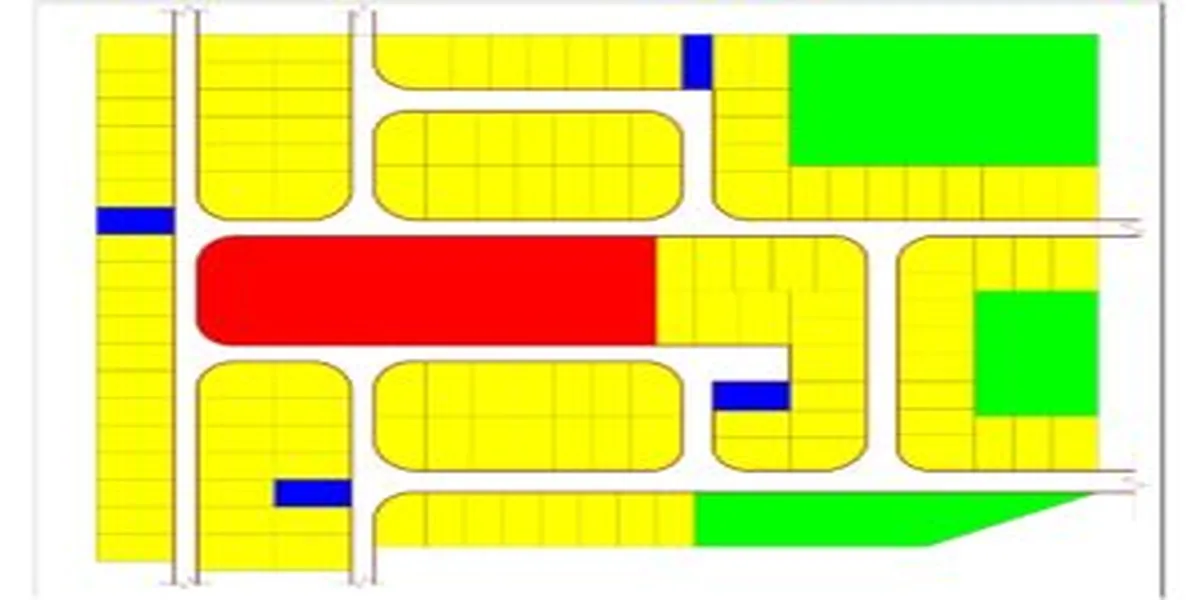
Land use distribution simply means deciding, on paper, what percentage of the land goes to what purpose before anyone builds anything. A balanced layout typically allocates land roughly like this, though the exact ratio depends on density targets and local regulation:
- Residential plots: the largest share, usually 45–60%
- Roads and circulation: 15–25%
- Open space, parks, and recreation: 10–15%
- Commercial and mixed-use nodes: 5–10%
- Institutional (schools, clinics, worship, civic buildings): 5–10%
In one housing layout project I reviewed, the original informal subdivision had allocated almost no land to open space or institutional use. By the time residents wanted to build a school, there was nowhere left to put it. That is the practical cost of skipping this step.
Zoning Hierarchy Explained
Zoning is how land use distribution becomes enforceable. Most planning systems, whatever country you’re in, use some version of this hierarchy:
Primary zoning: the broad category (residential, commercial, industrial, agricultural)
Sub-zoning: density and building type within that category (low-density single family vs. high-density apartments)
Overlay zones: special rules layered on top, such as flood-risk overlays, heritage overlays, or environmental protection overlays
A common misconception I encounter is that zoning is just bureaucracy. In practice, zoning is what stops a factory from being built directly beside a nursery school, or a nightclub from opening next to a hospital.
Circulation Systems and Road Hierarchy
Circulation is about how people, vehicles, and emergency services move through the development. A functional road hierarchy usually looks like this:
- Arterial roads: connect the development to the wider city or region
- Collector roads: gather traffic from local streets and feed it to arterials
- Local access roads: serve individual plots directly
- Pedestrian paths and cycle routes: increasingly required in modern layouts
If I were advising a client today, I would recommend never accepting a plot where the only access is a single narrow local road with no secondary exit because that is exactly the kind of layout that traps residents during flooding, fire, or any emergency requiring quick evacuation.
Plot Arrangement and Physical Planning Standards
Good plot arrangement balances privacy, sunlight, ventilation, and efficient land use. Planning standards commonly govern:
- Minimum plot size and frontage width
- Setbacks from front, rear, and side boundaries
- Plot coverage ratio (how much of the plot a building can occupy)
- Height restrictions relative to plot size and road width
During site analysis assignments in my training, we were taught that setbacks are not decoration they exist to allow light, air movement, firefighting access, and future road widening. I have seen this mistake repeatedly: landowners building right up to the boundary line to “maximize space,” only to be forced into costly demolition years later when road expansion comes through.
Infrastructure Planning: Water, Drainage, Electricity, Sewage
A layout plan is where infrastructure gets reserved space before it’s needed. This includes:
- Water supply corridors and reservoir/tank locations
- Underground or overhead electricity distribution routes
- Sewage and waste management systems
- Drainage channels sized for worst-case rainfall, not average rainfall
Skipping this step is why so many developments end up retrofitting drainage after flooding has already damaged roads and buildings a far more expensive fix than planning it from the start.
Flood Control and Drainage: A Non-Negotiable Layer
This is one of the layers I feel most strongly about, because the consequences of ignoring it are severe and irreversible. A proper layout plan identifies:
- Natural drainage channels and floodplains, and keeps building off them
- Engineered drainage networks sized for the catchment area
- Retention or detention areas to slow down stormwater
- Erosion-prone slopes that need protective planning
I have worked with clients who wanted to build directly on a natural water channel because “it’s dry most of the year.” The evidence from projects I have worked on points to one conclusion every time: that dry channel becomes a flood corridor the first heavy rainy season, and no amount of good architecture protects a building sited on a floodplain.
Environmental Management and Open Space Allocation
Environmental management within a layout plan covers green space preservation, tree retention, wetland protection, and pollution control (noise, air, water). Open space is not a luxury add-on it performs real functions:
- Absorbing stormwater runoff
- Providing recreational and social gathering areas
- Improving air quality and reducing urban heat
- Creating buffer zones between incompatible land uses
Development Control, Setbacks, and Approval Processes
Development control is the enforcement side of planning the process that checks whether a proposed building actually matches the approved layout plan and zoning. A typical approval pathway includes:
- Submission of the layout plan or building plan to the relevant planning authority
- Technical review against zoning, setback, and infrastructure standards
- Site inspection
- Approval, conditional approval, or rejection with required amendments
- Ongoing compliance monitoring during construction
Both classroom learning and field experience support this conclusion: developers who engage a planner early, before buying land, spend far less time and money than those who buy first and try to fix problems afterward.
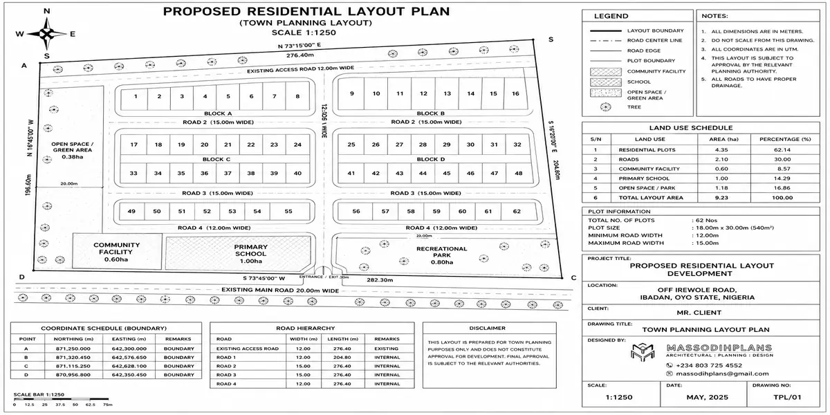
town planning layout plan
Population Projections and Urban Growth Strategy
Layout plans are not static they are built around a projected population and a growth strategy for 10, 20, or even 50 years ahead. This is why a competent planner asks questions like:
- What is the expected population density at full build-out?
- Will the road network still function at double today’s traffic?
- Can utilities be phased in as demand grows, without redesigning from scratch?
Smart growth planning tries to concentrate development where infrastructure already exists, rather than sprawling endlessly outward and making services more expensive to deliver.
GIS and Mapping Integration
Modern layout planning increasingly relies on Geographic Information Systems (GIS) to overlay topography, flood risk, soil type, and existing infrastructure onto proposed layouts. This lets planners catch conflicts like a proposed road crossing a floodplain before construction, not after.
Global Reality Layer: How Different Countries Approach Layout Planning
The technical logic behind layout planning is universal land use, circulation, drainage, and infrastructure always need coordinating. But the legal and institutional systems vary. Here is how it plays out across several countries:
Nigeria:
Layout plans are typically prepared under state Urban and Regional Planning laws, submitted to state Ministries of Lands/Physical Planning, and enforced through Development Control units. Enforcement capacity varies significantly between states, which is why informal, unapproved layouts remain common.
United States:
Planning is highly localized. Zoning ordinances are set at the municipal or county level, and subdivision layouts must go through a Planning Commission before a plat is recorded. Standards can differ dramatically between neighboring towns.
Canada:
Land use planning falls under provincial legislation, with municipalities implementing Official Plans and zoning bylaws. Subdivision approval typically requires conformity with both.
United Kingdom:
Development is governed by the Town and Country Planning framework, with Local Plans setting policy and planning permission required for most new layouts, assessed against national and local planning policy.
Australia:
States and territories run their own planning schemes, but most use a structure of zones and overlays similar to the one described above, administered through local councils.
Switzerland:
Spatial planning is coordinated at cantonal level with strict zoning between building zones and non-building (agricultural/protected) zones, reflecting the country’s strong land conservation priorities.
Germany:
Municipalities prepare a binding land-use plan (Bebauungsplan) that specifies permitted uses, building lines, and density down to the plot level before construction is approved.
Norway:
Municipal master plans and detailed zoning plans (reguleringsplan) guide development, with strong emphasis on public consultation before approval.
New Zealand:
District Plans under the Resource Management framework set out zoning and subdivision rules, with recent reforms aiming to simplify approval timelines.
Netherlands:
The bestemmingsplan (zoning plan) is legally binding at the municipal level and dictates land use down to individual parcels, reflecting the country’s long tradition of dense, coordinated land management.
Sweden:
Municipalities hold strong planning authority through detailed development plans (detaljplan), balancing housing growth with public space and infrastructure capacity.
Denmark:
Local plans (lokalplan) set binding rules for land use and building form, closely tied to national planning policy on compact urban growth.
Ireland:
Local Authorities prepare Development Plans that guide zoning, with planning permission required for subdivisions and new layouts under national planning legislation.
Luxembourg:
Communal development plans (PAG) and detailed plans (PAP) regulate land use, with strong coordination given the country’s limited land area.
Austria:
Land use planning is a state (Länder) responsibility, with local zoning plans determining permitted development and density.
Singapore:
One of the most centralized systems in the world: the Urban Redevelopment Authority’s Master Plan sets statutory land use for the entire city-state, reviewed roughly every five years.
Belgium:
Regional governments (Flanders, Wallonia, Brussels) each administer their own spatial planning frameworks, with municipal zoning plans guiding subdivision approval.
France:
The Plan Local d’Urbanisme (PLU) governs land use at the municipal level, setting zones, density limits, and building rules for any new layout.
United Arab Emirates:
Development authorities such as Dubai Municipality and the Department of Urban Planning in Abu Dhabi issue master plans and layout approvals, often within large-scale, developer-led master communities.
Finland:
A three-tier system of regional, general, and detailed (asemakaava) plans governs land use, with municipalities holding significant planning autonomy.
South Africa:
Spatial Development Frameworks guide land use under national planning legislation, with municipalities responsible for approving subdivisions and layouts against local zoning schemes.
The lesson across every one of these systems is the same: no matter which country you’re building in, a layout plan is the legal and practical bridge between raw land and a functioning community. Skipping it, or ignoring it, causes the same problems everywhere congestion, disputes, flooding, and wasted investment.
Human Lifestyle Layer
A layout plan shapes daily life in ways people rarely connect back to a drawing. Whether a child can safely walk to school, whether an ambulance can reach a house in an emergency, whether a family can hear themselves think over traffic noise all of it traces back to decisions made (or skipped) at the layout stage.
Construction Experience Layer
On projects I’ve worked on, the smoothest builds always started with a landowner who had their layout and approvals sorted before construction began. The ones that dragged on, went over budget, or ended in disputes almost always had one thing in common: someone started building before the paperwork and planning were settled.
Investment Layer
For property developers, a proper layout plan is not just a compliance requirement it is what protects resale value. Plots within an approved, well-serviced layout consistently hold and appreciate in value better than similar plots in informal subdivisions, because buyers, banks, and insurers all recognize the reduced risk.
Mistakes to Avoid
- Buying land before checking its zoning and approved layout status
- Building on natural drainage channels or floodplains
- Ignoring setbacks to “maximize” plot coverage
- Assuming informal roads will eventually become legal access
- Starting construction before development control approval
Quick Summary
A layout plan organizes land use, roads, drainage, and utilities before development starts. It protects investment value, prevents disputes, and determines whether a community will function smoothly for decades. The legal process differs by country, but the underlying planning logic is universal.
Frequently Asked Questions
Do I need a layout plan for a single residential plot, or only for large developments?
Even a single plot exists within a wider layout and zoning context, so checking the approved layout and zoning for that area is essential before you build, regardless of plot size.
Can a layout plan be changed after approval?
Yes, through a formal variation or amendment process with the relevant planning authority, though changes usually require justification and can affect neighboring plots.
What happens if I build without following the approved layout?
Consequences range from stop-work orders and fines to demolition, depending on the jurisdiction and severity of the deviation.
How long does layout plan approval typically take?
This varies widely by country and authority workload, from a few weeks in efficient, digitized systems to many months in areas with heavier backlogs.
Conclusion
A layout plan is not paperwork standing between you and your land it is the tool that protects your investment, your family’s safety, and your community’s future. Whether you’re developing in Lagos or London, Toronto or Dubai, the same principle holds: plan first, build second.
If you’re at the stage of choosing a plan for your land, browse the MassodihPlans Plans Library for ready-designed options suited to different plot layouts, or explore MassodihPlans Services if you need a custom layout and building plan prepared for your specific site. For those new to the process, MassodihPlans Plan School breaks down planning and construction basics step by step. And if this is your first time here, start from the Homepage to see everything MassodihPlans offers.
Reference: the UN-Habitat resource on urban planning
To have a full knowledge about this lesson, please read the following parts of the lesson below:
- Estate Layout Design in Nigeria: International Planning Principles That Actually Work
- How to Plan a Residential Estate in Nigeria: Lessons from UK and US Communities
- Step-by-Step Guide to Preparing an Estate Layout Plan in Nigeria
- Estate Layout Planning Standards in Nigeria: Roads, Drainage, Open Spaces and Plot Sizes
- How to Invest in Nigerian Real Estate from Abroad: Complete Guide for Diaspora Investors
- What Makes a Good Estate Layout Plan? A Practical Guide for Nigeria and Beyond
- Housing Estate Layout Plan: Why Every Estate Needs One in Nigeria and Beyond
- Estate Development Cost Breakdown: What Developers Should Budget For
- Estate Layout Design Services for Property Developers in Nigeria
- How to Design an Estate Layout Plan That Works in Nigeria and Abroad
- How Much Does It Cost to Develop an Estate in Nigeria? A Town Planner’s Honest Breakdown
- Best Real Estate Investment Opportunities in Uyo Right Now
- Industrial Estate Layout Design in Nigeria: Smart Master Plan for Small Industrial Plots
- Small Residential Estate Layout Design in Nigeria: Smart Master Plan Ideas for Limited Land
- Nigerian Estate Master Plan for Small Plots: Modern Residential Layout Strategies That Maximize Space
- How Drainage Should Influence Your House Site Planning in Nigeria Today
- How Topography Influences Flooding Around Nigerian Homes and Cities Today
- How to Understand Land Use Before Buying Property in Nigeria Safely
- How Land Use Affects the Type of Building You Can Develop in Nigeria Today
- 10 Things to Check Before Building a House on Any Plot in Nigeria Today
- How to Choose the Right House Plan Based on Your Plot Size in Nigeria Today
- How to Evaluate Land in Lagos Before Choosing a House Plan to Build Safely (15 Best Ways)
- How to Choose the Right Residential Location in Lagos Before You Build
- 10 Best House Plans for Small Plots in Nigeria: What Buyers Should Consider
Author
Massodih Okon is a Nigerian built-environment professional with academic and professional experience in urban and regional planning, geography, architectural design, Landscape Design, GIS and land development.
He holds a Master’s degree in Urban and Regional Planning from the University of Uyo and a first degree in Geography and Regional Planning.
Through MassodihPlans, he publishes practical guides on Nigerian house plans, building design, physical planning, site planning, development approval and residential construction. Read the full author profile →