The Estate Layout Plan Guide Nigerian Developers Wish They Had Earlier

A registered town planner reviewing an estate layout plan, the most important document in any Nigerian estate development project
A lot of estate developments in Nigeria fail not because the developer lacked money, not because the land was bad, and not because buyers were not available. They fail because the estate layout plan was wrong from the beginning.
I have designed estate layouts, reviewed failed ones, and sat with developers who spent millions developing an estate that could not get planning approval because the layout was fundamentally flawed. I have also watched developers who invested properly in a good layout plan sell out their estates within months and move straight into Phase 2.
The difference between those two outcomes is almost always the layout plan.
This article will teach you exactly how to design an estate layout plan that works in Nigeria one that gets approved, attracts buyers, functions properly as a community, and holds its value over time. I will not give you theory without practice. Everything here comes from field experience, real projects, and hard lessons.
What Is an Estate Layout Plan?
An estate layout plan is a technical document that shows how a piece of land will be divided and developed for residential, commercial, or mixed-use purposes.
It is not just a drawing showing rectangular boxes on paper. A proper estate layout plan shows:
- How the land is divided into individual plots
- Where roads run, including their widths and connections
- Where drainage channels go
- Where open spaces, parks, and public facilities are located
- Where utilities (water, electricity) will be routed
- What setbacks apply to each plot
- How the estate connects to the existing road network
- Where the gate, security post, and estate management facilities are located
Think of it this way. If the estate is a body, the layout plan is the skeleton. Everything else the buildings, the landscaping, the amenities grows on top of it. If the skeleton is wrong, nothing above it can be fully right.
During my undergraduate studies in Town Planning at the University of Uyo, one thing our lecturers constantly emphasized was that a layout plan is not a product for the planning office alone. It is a document that shapes how hundreds or thousands of people will live, work, and move through space for decades. That responsibility should be taken seriously.
Why Most Nigerian Estate Layout Plans Fail
Before I tell you what to do right, let me tell you what I have seen go wrong repeatedly.
In my experience, most failed estate layout plans in Nigeria have one or more of these problems:
1. Roads that are too narrow
The developer wanted to squeeze in more plots, so road widths were reduced to 3.5 or 4 metres. The result is a road that cannot accommodate two cars passing simultaneously, cannot be served by emergency vehicles, and becomes a permanent traffic bottleneck.
2. No drainage provision
The layout shows plots and roads but no drainage channels. During the first rainy season, surface water floods roads, enters basements, and destroys foundations. This is not a maintenance problem. It is a design problem.
3. Plot shapes that violate planning standards
Irregular triangular plots, plots with very narrow frontages, plots with acute angles at corners these do not meet planning standards and make building design very difficult for buyers.
4. No open spaces
Nigerian planning regulations require open spaces as a percentage of gross site area. A layout that allocates every square metre to plots will be rejected by the planning authority and even if it somehow gets approved, the estate will feel congested and become unattractive very quickly.
5. Poor connection to the external road network
An estate that has only one entrance and exit point becomes extremely difficult to manage under normal conditions and dangerous in emergencies. Access roads must connect to the public road network at adequate points.
6. Ignoring natural drainage paths
Every site has natural pathways that water follows. A good layout works with these paths. A bad layout ignores them and builds roads and plots directly across natural drainage channels. The result is guaranteed flooding.
I have seen this mistake repeatedly. And what breaks my heart is that it is completely avoidable if the layout is designed properly from the start.
Step 1: Understand Your Site Before You Design Anything
This is where every good estate layout plan begins. Not on the drawing board. On the ground.
Before a single line is drawn, you need to understand the site you are working with. This means:
Site Analysis
Topography: Is the site flat or does it slope? In which direction does it slope? How steep is the slope? Topography determines how water will drain, where roads can efficiently run, and which areas are suitable for building.
Soil conditions: Is the soil firm and stable, or soft and waterlogged? A geotechnical investigation (soil test) tells you this. In coastal areas of Nigeria Lagos, Warri, Calabar, Uyo, Port Harcourt many sites have soft alluvial or peat soils that require special foundations and affect drainage design significantly.
Existing vegetation: Are there large trees that should be preserved? Are there wetland areas that should not be built on? Mature trees add value to an estate and should be worked into the layout design where possible rather than cleared indiscriminately.
Natural drainage: Where does water naturally flow across and off the site? These paths must be respected and designed into the drainage system, not blocked by buildings or roads.
Existing access: Where does the site currently connect to public roads? How wide are those roads? What is the traffic volume on the adjacent public road? This determines where the estate entrance can go.
Adjacent land uses: What is on the land next to your site? Residential, commercial, industrial, agricultural? This affects what uses are appropriate in the parts of your estate nearest to the boundary.
During site analysis assignments at the University of Uyo, we were taught to walk a site at least twice once during the dry season and once during the rainy season before committing to a layout design. I carried that habit into professional practice. A site that looks perfectly dry in January may have standing water in July that changes the entire drainage design.
Step 2: Establish Your Planning Framework
Once you understand the site, the next step is establishing the planning framework the rules within which your layout must be designed.
This means finding out:
Applicable Planning Regulations
Every state in Nigeria has its own physical planning laws and standards. The specific planning authority you will be submitting to whether LASPPPA in Lagos, FCDA in Abuja, the State Ministry of Lands in Akwa Ibom, or another equivalent body will have specific standards covering:
- Minimum plot sizes for different development types
- Maximum plot coverage (the percentage of a plot that can be built on)
- Minimum setbacks from road boundaries, side boundaries, and rear boundaries
- Minimum road widths for different road categories
- Minimum open space requirements
- Maximum density (number of plots per hectare)
- Requirements for public facilities depending on estate size
From a planning perspective, I strongly recommend getting the applicable planning regulations and development standards document from your state’s planning authority before you begin design. Not after. Before.
I have worked with clients who designed a complete layout and paid for drawings before understanding the applicable standards. The layout had to be substantially redesigned, wasting months and significant money.
Population Projection and Density Planning
How many people will live in this estate when fully developed? This is not a question for later. It drives every infrastructure decision.
If each residential plot houses one family of 5 people on average, and you are planning 100 plots, your estate will eventually house approximately 500 people. That means you need roads, drainage, water supply, electricity, and community facilities sized for 500 people, with some headroom for growth.
Getting the population projection right helps you size infrastructure correctly from the start, avoiding the painful and expensive experience of upgrading infrastructure that was undersized when the estate was originally built.
Step 3: Design Your Road Network
Roads are the most important element of the estate layout. They determine everything else: how plots are arranged, how drainage is routed, how utilities are distributed, how emergency vehicles can reach any corner of the estate.
Road Hierarchy in a Nigerian Estate
A well-designed estate road network has a clear hierarchy. This is not just about width. It is about function and traffic capacity.
Estate Access Road (Primary Collector): This is the main road from the public highway into the estate. It must be wide enough for traffic to flow comfortably in both directions simultaneously, with space for pedestrians. Recommended carriageway width: 9 to 12 metres, plus 1.5 metre walkways on each side if possible.
In practice for most Nigerian residential estates, a 9-metre wide carriageway with defined walkways and a proper entrance gate structure is the minimum standard that planning authorities will accept for an access road serving more than 50 plots.
Internal Collector Streets: These distribute traffic within the estate from the access road to the residential streets. Recommended carriageway width: 6 to 9 metres.
Residential Streets: These give direct frontage access to individual plots. They carry the least traffic. Recommended carriageway width: 4.5 to 6 metres.
Cul-de-sacs: Short dead-end streets serving small clusters of plots. They reduce through traffic, create quieter residential environments, and improve plot yield efficiency. Maximum recommended length: 75 to 100 metres. They must have a turning circle or hammerhead at the closed end so vehicles can turn around without reversing onto other plots.
Road Alignment Principles
Roads should ideally:
- Follow the natural contours of the land as much as possible, reducing the need for expensive cut-and-fill earthworks
- Connect to the external road network at appropriate points
- Avoid running along natural drainage channels (drainage channels should run alongside roads, not underneath them)
- Create block shapes that yield efficient rectangular plots
- Avoid creating very sharp corners or very acute-angle intersections, which are dangerous for vehicles and create awkward corner plots
One thing I have encountered many times during design reviews is developers who drew roads straight across a sloping site without considering the gradients involved. A road that climbs at 15 percent gradient may work for a pedestrian, but it is extremely difficult for heavily loaded trucks delivering construction materials during the development phase and creates significant drainage challenges during rainfall.
Step 4: Arrange Your Plots
Plot arrangement is where the art of estate layout design becomes most visible and where the differences between a good planner and a mediocre one become most obvious.
Plot Shape and Dimensions
The best residential plots are rectangular, or as close to rectangular as possible. They are easier to build on, easier to value, easier to sell, and easier to comply with setback requirements.
Recommended plot dimension ratios: width to depth ratio between 1:1.5 and 1:2.5. A plot that is 15 metres wide and 30 metres deep (1:2) is excellent. A plot that is 8 metres wide and 40 metres deep (1:5) is technically large but very difficult to design a comfortable house on.
Minimum plot widths in most Nigerian planning standards:
- High-density residential: 7 to 9 metres minimum frontage
- Medium-density residential: 12 to 15 metres minimum frontage
- Low-density residential: 18 to 20 metres minimum frontage
Common plot sizes in Nigerian residential estates:
- 300 sqm to 450 sqm: typically for high-density or affordable housing layouts
- 600 sqm to 900 sqm: typical medium-density residential
- 1,000 sqm and above: low-density, high-end residential
Plot Orientation
In Nigeria’s tropical climate, the orientation of plots relative to the sun and prevailing wind significantly affects the comfort of the buildings on them. South-facing plots with the wider facade facing south receive better natural light and ventilation in buildings designed to face that direction.
This is not always possible across an entire estate, but where the layout allows it particularly on larger estates orienting the primary building frontages to face south or southeast is a genuine quality-of-life benefit that well-designed estates provide.
Corner Plots
Corner plots are special cases because they have two road frontages. Planning standards typically require that corner plots are wider than standard plots to accommodate the additional setback required at the corner. In practice, I size corner plots at 20 to 30 percent larger than standard plots in the same zone to absorb the additional setback requirements and still provide a comparable buildable area.
Step 5: Apply Setbacks and Building Lines
Setbacks are the minimum distances that must be maintained between a building and the plot boundaries. They are not optional. They are planning law.
Getting setbacks right in the layout plan is critical because they directly determine how much of each plot is actually buildable. A developer who does not understand setbacks will sell plots with the expectation that buyers can fill the entire plot with building and then buyers discover they can only use 40 or 50 percent of the plot area for building. This creates disputes.
Typical Nigerian Residential Setback Standards
These vary by state and development zone, but typical standards are:
Front setback (from road boundary to building line):
- High-density residential: 3 metres
- Medium-density residential: 4.5 to 6 metres
- Low-density residential: 6 to 9 metres
Rear setback:
- Typically 3 metres minimum across all zones
Side setbacks:
- High-density: 1.5 metres each side
- Medium-density: 2 to 3 metres each side
- Low-density: 3 metres each side
Corner plot additional setback:
- Additional 1.5 to 3 metres setback from the secondary road frontage
Building Lines vs Setback Lines
The setback line is the minimum distance from the road or boundary within which nothing can be built.
The building line is the line along which the main face of the building is expected to be constructed, creating a consistent street edge.
In a well-designed estate, building lines create visual order along streets. When every house on a street is built to the same building line, the street looks organised and coherent. When buildings are set back at random distances, the street looks chaotic even if each individual building is well designed.
I once reviewed a plan where the developer had marked setback lines on the layout but not building lines. The result, after construction began, was that every house on the main estate road was set back at a different distance. Some were 3 metres from the road, some were 8 metres, one was practically on the road boundary. It looked completely disorganized. The developer came back to ask what went wrong. I had to explain that setback lines set a minimum — buildings can be further back than the setback, but without a defined building line, there is nothing to enforce consistency.
Always define both the setback line and the building line on your layout plan.
Step 6: Plan Your Drainage System
Let me be very direct about this: drainage is not optional and it is not something you plan “later.” Drainage must be designed as part of the layout, not added as an afterthought.
How Estate Drainage Works
A properly functioning estate drainage system works in layers:
Plot-level drainage: Each plot should be graded so surface water flows toward the road and into the roadside drain. Finished floor levels of buildings are set above the surrounding ground level and above the road level to prevent water from the road entering the building.
Road drainage: Roadside drains either open concrete channels or covered drains with inspection chambers collect surface water from roads and plots and channel it toward primary drains.
Primary drains: These are larger channels that collect from multiple roads and direct water toward the outfall.
Outfall: The point where drainage water leaves the estate and enters either a natural watercourse, a public drain, or a drainage reserve.
This cascade must be designed. The sizes of drains at each level must be calculated based on rainfall intensity, catchment area, and runoff coefficients for the surface types.
Drainage Design Principles
Roads should slope gently to one side or crown to both sides to drain surface water efficiently. Typical road cross-fall: 1 in 40 to 1 in 60 (2 to 2.5 percent).
Roadside drains should be sized to handle at least a 1-in-10-year rainfall event (the volume of rainfall expected to be exceeded only once in every 10 years on average). In flood-prone areas, design to a 1-in-25-year or 1-in-50-year event.
Natural drainage channels running through or alongside the site must be preserved and incorporated into the drainage design. They must never be built on.
Where the site is low-lying and outfall drainage is difficult, a retention pond may be needed to hold peak rainfall volumes and release them gradually. On a project I worked on in a coastal community in Akwa Ibom, the site was so flat and close to the water table that we had to design a central retention pond as part of the estate’s green open space. The pond served double duty it was the estate’s drainage buffer and its most attractive open space feature. Houses facing the pond sold first and at a premium.
Step 7: Allocate Open Spaces and Public Facilities
This is one of the most underappreciated aspects of estate layout design. Developers often view open spaces as “wasted land” area that could have been plots. This thinking is wrong, and experience has consistently shown it to be wrong.
Why Open Spaces Matter
Open spaces in an estate serve multiple functions:
- They provide areas for children to play safely
- They reduce the density feeling in the estate, making it more pleasant to live in
- They allow rainwater to infiltrate the ground rather than running off, reducing flooding pressure
- They provide space for trees and planting that improve air quality and reduce heat
- They create social gathering spaces that build community
- They increase the value of surrounding plots (plots overlooking a park command a premium)
Nigerian physical planning standards typically require open space allocations of 10 to 20 percent of gross site area for residential developments.
Types of Open Space in a Nigerian Estate
Local park or recreation ground: A larger open space accessible to all estate residents. Minimum recommended size: 0.4 hectares per 1,000 residents.
Children’s play area: A small play space with equipment within easy walking distance of every residential plot. Minimum size: 500 sqm to 1,000 sqm.
Estate garden or landscape buffer: Decorative green areas along the main estate road or estate boundaries that create visual identity and improve the estate’s appearance.
Drainage reserve: Open land maintained as a buffer along natural drainage channels. This is both environmental management and flood risk management.
Community Facilities
For estates above a certain population threshold, planning standards require provision of land for community facilities:
- Primary school (typically required for estates expected to house 500 or more school-age children)
- Place of worship
- Neighbourhood market or commercial area
- Health facility
- Community hall or estate club
In my experience, developers who reserve and sell plots for these facilities at carefully planned locations within the estate often find those plots among the most valuable in the entire development. A church or school operator will typically pay a significant premium for a well-located plot in a growing estate.
Step 8: Plan Infrastructure Corridors
Infrastructure corridors are the spaces reserved for routing utilities through the estate water supply pipes, electricity cables, and in future-ready developments, telecommunications ducts.
Water Supply
Estate water supply typically routes from a central point (the borehole and pump station) through a reticulation pipe network to connection points at each plot. The pipe network runs through road reserves alongside roads or through dedicated utility corridors.
Planning the pipe route on the layout at the design stage allows the reticulation to be installed efficiently during road construction, before plots are developed. Trying to install a water supply network after buildings are partially constructed is significantly more expensive and disruptive.
Electricity
Electricity distribution cables run either overhead on poles or underground in trenches. Underground cabling is more expensive but significantly more reliable and aesthetically better for a premium estate. The layout plan should show the transformer location, the distribution routes, and metering positions.
Street light positions should also be shown on the layout typically at intersections and at regular intervals along roads, with maximum spacing of 30 to 40 metres in residential streets.
Telecommunications
This is something I advise all estate developers to plan for even if they are not installing it immediately. Reserve underground duct spaces along road reserves during road construction. The cost of installing empty ducts during road construction is minimal. The cost of breaking up finished roads to install telecommunications later is enormous.
Step 9: Design for Security
Security is a genuine concern in Nigerian estate development, and a well-designed layout contributes significantly to estate security.
CPTED Principles in Nigerian Estates
CPTED stands for Crime Prevention Through Environmental Design. It is a set of design principles that reduce crime opportunities through spatial planning. During my academic training, this formed part of our planning coursework, and field experience has shown me it works in Nigerian contexts too.
Key principles:
Natural surveillance: Design spaces so that activity can be seen by residents and passers-by. Avoid creating hidden corners, blind spots behind buildings, or enclosed spaces that cannot be overlooked. Open spaces should be overlooked by surrounding buildings, not screened from them.
Territorial definition: Clear physical and visual boundaries that define private, semi-private, and public space. A well-defined estate perimeter, a clear estate entrance, and well-marked plot boundaries all contribute to this.
Access control: Limiting the number of entry points to the estate reduces the risk of unauthorized access. However, there must always be at least two access points for emergency vehicle access.
Maintenance and activity: Well-maintained, actively used spaces are safer than neglected ones. This is another reason why open spaces and community facilities must be real, usable spaces, not just buffers to satisfy regulatory requirements.
Street Lighting in the Layout
Street lighting positions must be shown on the layout plan. Poor street lighting is one of the most common security failures in Nigerian estates. It is also one of the easiest to solve at the design stage.
Position street lights at:
- Every road intersection
- Every pedestrian pathway crossing
- The entrance gate and gate house approach
- At regular intervals (30 to 40 metres maximum) along all roads
Step 10: Integrate GIS and Modern Mapping Tools
Modern estate layout design in Nigeria increasingly uses Geographic Information Systems (GIS) tools, drone surveys, and digital mapping. This is not just for large projects. Even small estate developers benefit from these tools.
What GIS Adds to Estate Layout Design
Accuracy: GIS-based site plans are geometrically accurate in a way that traditional hand-drawn plans cannot guarantee. When dimensions on a layout plan must be precise enough to issue individual plot titles, accuracy matters enormously.
Flood risk analysis: GIS allows you to overlay the site with digital elevation models and drainage catchment maps to identify areas at flood risk before you commit to a layout.
Context analysis: GIS lets you visualize your site in the context of surrounding roads, land uses, utilities, and development, helping you make better decisions about access, land use allocation, and infrastructure routing.
Integration with title documentation: GIS-produced plans can be georeferenced to the state coordinate system, making them directly compatible with survey plans filed at the surveyor-general’s office and with state land registries.
Over the years, I have noticed that planning authorities in the more advanced Nigerian states are increasingly expecting GIS-compatible submissions for large estate developments. This trend will only accelerate as land administration in Nigeria continues to modernize.
What a Complete Estate Layout Plan Must Show
Before you submit for planning approval, your layout plan must show all of the following clearly:
Identification information:
- Title block with estate name, location, scale, drawing number, date
- Name and seal of the registered town planner who prepared the plan
- North point
- Scale bar
Site context:
- Surrounding road network
- Adjacent land uses and developments
- The site boundary clearly demarcated
Internal layout:
- All roads with widths and names or reference numbers
- All plot boundaries with plot numbers and dimensions
- Setback lines and building lines on each plot
- Open spaces with labels and areas
- Community facility locations with labels
- Drainage channels with indicative widths
- Estate entrance, gate house, and security facilities
Infrastructure:
- Borehole and pump station location
- Transformer and electrical substation location
- Street light positions
- Utility corridor locations
Legend and notes:
- Colour coding and legend for different land uses
- Planning notes citing applicable development standards
- List of proposed land uses and their areas in tabular form
I have reviewed layouts submitted for planning approval where half of these elements were missing. The planning authority sent them back for revision without processing. The developer lost months. A complete, well-prepared submission almost always moves faster.
The Planning Approval Process for Estate Layouts in Nigeria
Designing a good layout plan is necessary but not sufficient. You still need to get it approved by the relevant planning authority.
Who Approves Estate Layout Plans in Nigeria?
This depends on the state and the size of the development:
- Lagos: Lagos State Physical Planning Permit Authority (LASPPPA) for major developments, with some LCDA-level approval for minor ones
- Abuja FCT: Federal Capital Development Authority (FCDA), Development Control Department
- Akwa Ibom: Ministry of Land and Town Planning / Uyo Capital Territory Development Authority
- Rivers State: Rivers State Urban Development Board and Ministry of Urban Development
- Other states: Equivalent state ministry responsible for land and urban development
For very large developments (typically above 50 hectares or involving new town development), Federal approval through the Federal Ministry of Works and Housing may also be required in addition to state approval.
What Triggers a Rejection?
Based on my experience, the most common reasons planning applications for estate layouts are rejected or sent back for revision are:
- Road widths below minimum standards
- Plot sizes below minimum standards for the zone
- Inadequate open space allocation
- No drainage provision shown
- Access road not connecting adequately to the public road network
- Layout prepared by someone without NITP registration
- Missing survey plan or improper land title documentation
- Failure to comply with applicable local planning regulations
Addressing all of these before submission rather than after rejection saves enormous amounts of time and money.
Phased Development: The Smart Approach
Not every estate developer has the capital to fully develop an entire estate at once. Phased development is the standard approach for most medium to large estate projects, and a good layout plan should make phasing possible from the outset.
How to Phase an Estate Layout
Design the overall master plan for the full site, then divide it into phases that each make sense as independent, functional units.
Each phase should have:
- Its own road access (or shared with Phase 1 where appropriate)
- Complete drainage serving that phase
- Water supply capable of serving that phase
- Electricity supply for that phase
- Perimeter security for that phase
Phase 1 should always be the portion of the site with the best existing access and the lowest infrastructure cost, to generate early sales revenue that funds subsequent phases.
One lesson I learned early in my career confirmed by every project I have worked on since is that the size of Phase 1 should be calibrated to the market absorption rate in that location. If the local market can absorb 30 to 40 new residential plots per year, Phase 1 should be 30 to 50 plots, not 150. Overshooting the market in Phase 1 ties up capital in completed infrastructure that is not generating revenue.
Common Mistakes in Nigerian Estate Layout Plans
Let me summarize the most critical mistakes I have seen in practice, so you can avoid them:
Mistake 1: Designing the layout before doing the site analysis The layout must respond to the site. Not the other way around.
Mistake 2: Road widths below the applicable minimum standards This is the single most common reason for planning rejection.
Mistake 3: Zero or inadequate open space Open spaces are mandatory under Nigerian planning law. Ignoring them does not save land it guarantees rejection.
Mistake 4: Ignoring the drainage and routing water without a plan Surface water will go somewhere. Design where it goes, or it will design its own route through your estate.
Mistake 5: Creating plots that violate minimum dimension standards A plot with a 5-metre frontage on a residential street is not approvable in most Nigerian states. Know the minimum dimensions and design accordingly.
Mistake 6: Having only one access point Single-access estates are dangerous, have no redundancy for emergencies, and are often not approvable for estates above a certain size.
Mistake 7: Not designing the estate in context Your estate does not exist in isolation. Roads in your estate should align with roads in adjacent developments. Drainage from your estate should not flow onto your neighbour’s land.
Mistake 8: Preparing the layout without a registered town planner This is both illegal (planning applications must be prepared by registered professionals) and counterproductive. The expertise of a good town planner saves significantly more than their fee.
The Human Layer: What Makes an Estate Actually Good to Live In
So far I have talked about standards, dimensions, drainage, and approvals. Let me talk now about something that does not appear in any planning regulation but makes an enormous difference: what makes an estate actually pleasant to live in.
From what I have seen in practice, the estates that become genuinely beloved communities share certain design qualities:
Trees: Estates that preserved mature trees or planted substantial new ones feel completely different from those that were cleared bare. Trees provide shade, reduce heat, absorb rainwater, reduce dust, attract birds, and make streets beautiful.
Walkability: Estates where residents can walk safely from their plot to the neighbourhood shop, to the children’s play area, and to the estate gate without having to compete with vehicles are significantly more comfortable and community-building than those where every movement requires a car.
Visual identity: An estate with a distinctive entry feature a well-designed gate, a row of flowering trees along the main road, a water feature at the central open space has a character that residents feel proud of. This is not vanity. It translates directly into property value.
Mixed plot sizes: Estates that provide only one plot size serve only one income bracket. Estates that mix 300 sqm, 600 sqm, and 900 sqm plots within a coherent layout serve a wider range of buyers, generate more diverse community vitality, and sell out faster.
Good street lighting: A well-lit estate feels safe at night. Residents walk confidently. Visitors feel welcome. Crime is reduced.
None of these things require spending significantly more money than a poorly designed estate. They require better thinking at the layout design stage.
FAQs: Estate Layout Plan Design in Nigeria
Q: Who is qualified to prepare an estate layout plan in Nigeria?
A registered Town Planner that is, someone who holds the relevant qualifications in Town and Regional Planning and is duly registered with the Nigerian Institute of Town Planners (NITP) is the professional qualified to prepare and sign estate layout plans for planning approval submission in Nigeria. Submitting a layout prepared by an unqualified person almost always results in rejection.
Q: How long does it take to prepare a proper estate layout plan?
For a small to medium estate of 1 to 10 hectares, preparation of a complete layout plan package (including site analysis, design, drafting, and supporting documents) typically takes 4 to 10 weeks for a qualified professional. For larger estates or those with complex site conditions, this can extend to 3 to 6 months. Rushing this process almost always creates problems downstream.
Q: Can I modify an approved estate layout plan after approval?
Yes, but modifications require submitting a revised plan to the planning authority for fresh approval. You cannot simply alter an approved plan and proceed. Unauthorized modifications to approved layouts are a significant source of legal and regulatory problems in Nigerian estate development.
Q: What is the difference between a layout plan and a site plan?
A layout plan covers an entire estate showing multiple plots, roads, drainage, and community facilities. A site plan covers a single plot showing how the building (or buildings) on that plot are positioned relative to the plot boundaries, roads, and neighboring plots. Layout plans are prepared by town planners. Site plans may be prepared by architects or town planners depending on the applicable regulations.
Q: How do I ensure my estate layout plan will be approved?
Engage a registered town planner who knows the applicable planning authority and its specific requirements. Conduct proper site analysis before design begins. Ensure all roads, plots, drainage, and open spaces meet applicable standards. Submit a complete application with all required supporting documents. These four steps eliminate the vast majority of reasons for rejection.
Q: What minimum road width is required in a Nigerian residential estate?
For residential streets giving direct plot access, the minimum is typically 4.5 to 6 metres depending on the applicable state standard. For collector streets and estate access roads, minimums range from 6 to 12 metres. Your registered town planner will confirm the exact minimums for your state and development type.
Q: What percentage of an estate must be open space?
Most Nigerian planning standards require 10 to 20 percent of gross site area to be allocated as open spaces, parks, and public facilities. This percentage excludes road reserves.
Conclusion: The Layout Plan Is the Foundation of Everything
If you are developing an estate in Nigeria whether it is a modest 20-plot scheme in a secondary city or a large 500-plot development in a metropolitan growth corridor the quality of your estate layout plan determines almost everything that follows.
It determines whether you get planning approval or spend months and money on revisions. And it determines whether your roads, drainage, and utilities work properly once the estate is built. It determines how much of your land becomes sellable plots versus infrastructure. It determines how your estate looks, feels, and functions as a community. And it determines whether buyers value your estate for years to come or regret their purchase.
This observation comes from practical field experience across many different projects in different parts of Nigeria. Good layout plans produce good estates. Poor layout plans produce problems that money cannot fully fix.
My advice to every estate developer reading this: do not treat the layout plan as a bureaucratic step you need to pass before the “real work” begins. The layout plan IS the real work. Invest in getting it right. Engage a qualified town planner who takes the work seriously. Do the site analysis before the design begins. Follow the applicable standards. Plan your phases intelligently.
The rest of the process becomes significantly easier when the foundation is solid.
Explore Further
- Browse our Nigerian House Plans Library find approved residential plans ready for your estate plots
- Visit Plan School deepen your understanding of Nigerian physical planning standards
- Request Layout Design Services work with a registered Nigerian town planner on your estate project
- Read: How Much Does It Cost to Develop an Estate in Nigeria the companion cost guide to this article
- Understand Nigerian Building Approval Requirements what you need before you build
- Nigerian Estate Master Plan for Small Plots: Modern Residential Layout Strategies That Maximize Space
- Small Residential Estate Layout Design in Nigeria: Smart Master Plan Ideas for Limited Land
- Industrial Estate Layout Design in Nigeria: Smart Master Plan for Small Industrial Plots
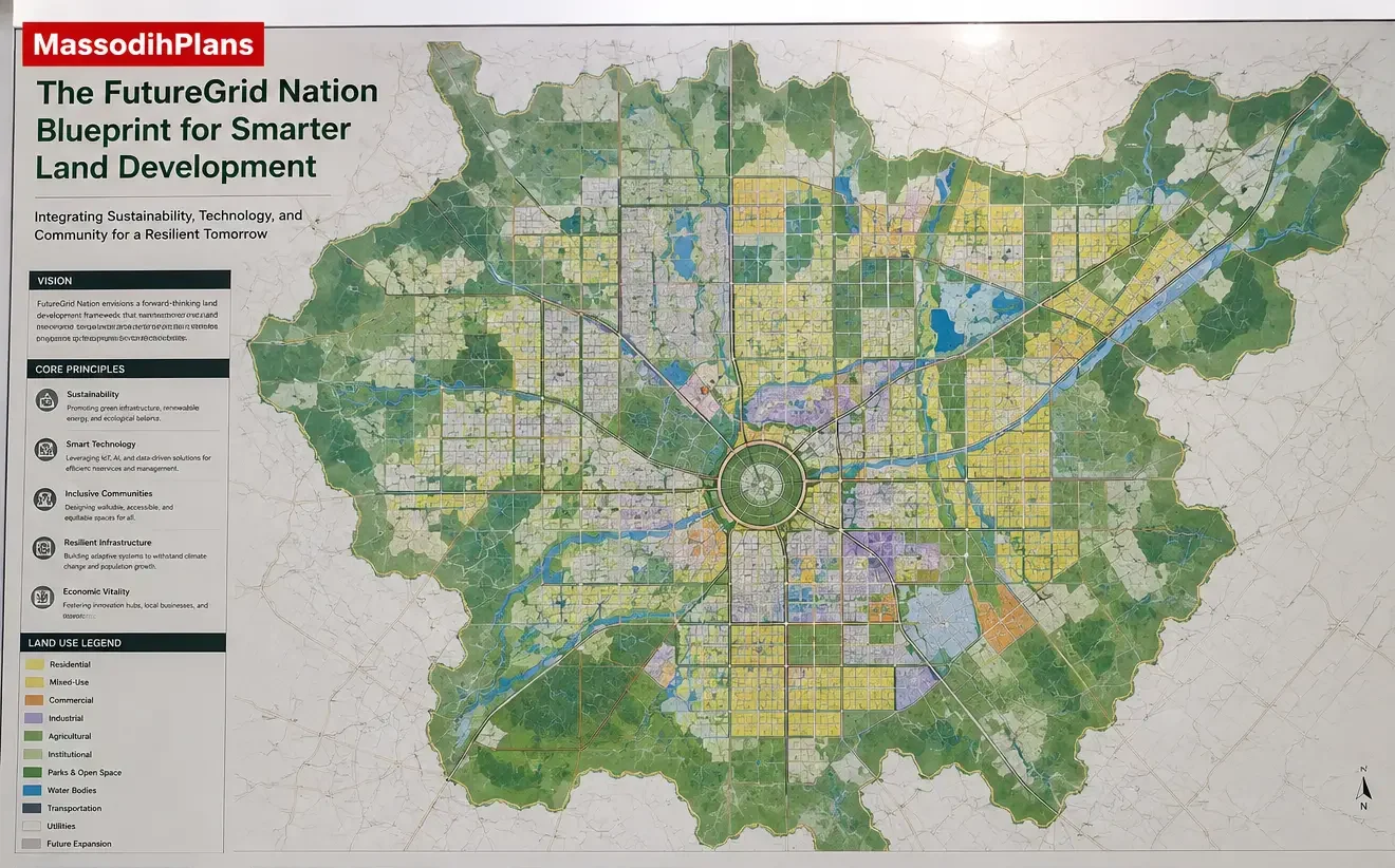
- The Proposed FutureGrid Nation Blueprint for Smarter Land Development
- The MegaRegion FlowPlan for Balanced Urban Expansion
- Why Local Development Plans Matter for Communities
- What Is a Structure Plan and Why Does It Matter for Nigerian Towns?
- 10 Problems Border Communities Face Without Proper Planning
- What Happens When a City Develops Without a Master Plan
- How to Build Cities That People Actually Want to Live In: The 2050 Urban Growth Blueprint
- How a State Master Plan Works: A Complete Guide to Modern Infrastructure Development
Authority Reference: Nigerian Institute of Town Planners (NITP): The statutory body governing town planning practice in Nigeria
About Author
Massodih Okon is a built environment professional with a background in architecture and urban planning. He specializes in practical Nigerian house design guidance through MassodihPlans.com.. He has a Master’s degree in Urban and Regional Planning, a first degree in Geography and Environmental Management, and professional certificates in Architectural Design, Landscape Design, and GIS. With over 15 years of hands‑on experience in architecture, town planning, GIS, and building economics across Nigerian residential and institutional projects, he understands the real challenges Nigerians face when planning and building homes.
At MassodihPlans, Massodih shares practical Nigerian building guides, modern bungalow and duplex house plans, and built environment resources created specifically for Nigerian homeowners, developers, and property investors. His work is based on real‑life conditions in Nigeria, climate‑responsive design, and cost‑effective planning, aimed at helping everyday Nigerians make smarter, more confident building decisions.