
A master plan presentation to community stakeholders, the starting point for every well-planned Nigerian settlement
The Document That Separates Organised Cities from Chaotic Ones and Why Your Community Needs It Now
Think about the street you grew up on, or the neighbourhood you live in right now. And think about whether the roads connect sensibly. Think about whether the drains actually drain, or whether they flood every July. Also think about whether there is a market in your neighbourhood, or whether you drive 40 minutes for bread. Think about whether you can walk from your house to anywhere without risking your life on a road with no pavement.
If your community struggles with some of these problems, nobody likely created a master plan for it. In some cases, planners created a master plan, but leaders, developers, or residents ignored it.
A master plan guides every stage of a community’s growth before builders construct a single building. It determines how people will use land, where roads will run, where water will flow, where schools, markets, and parks will stand, and how residents will live with dignity and safety for decades. Quite simply, no other document plays a more important role in shaping the future of a community.
This article will explain exactly what a master plan is, what it contains, and most importantly what happens to communities that grow without one.
The Honest Answer: What a Master Plan Actually Is
Many people have heard the phrase “master plan” but do not fully understand what it means in practice. It is one of those professional terms planners often use without clearly explaining it to the people who need to understand it most.
So let me explain it the way I would explain it to a community leader.
A master plan is a comprehensive, long-term planning document that guides the physical development and growth of a city, town, estate, or community over a defined period, usually 10, 15, or 20 years.
It serves as a plan for the land itself. It answers important questions such as:
- Where should housing go?
- Where should businesses and commercial activities operate?
- Where should industries locate, and how far should they be from homes?
- Where should schools, hospitals, markets, and parks sit?
- How should roads connect to support efficient movement?
- How should drainage systems reduce flooding?
- How should utilities such as water, electricity, and waste services reach residents?
- How much land should remain green and undeveloped?
- How many people can the area accommodate?
- How should growth occur in phases?
A master plan does not simply describe existing conditions. It defines a future vision and guides development decisions for years to come.
During my town planning studies at the University of Uyo, lecturers described a master plan as both a technical document and a social contract. It is technical because it relies on surveys, maps, engineering data, and planning standards. It is a social contract because it reflects a shared vision among government, professionals, and the community about how an area should grow and whom that growth should benefit.
That definition has remained relevant throughout the projects I have worked on since.
Why This Matters Right Now in Nigeria and the World
Before I go into the details of what a master plan contains, let me tell you why this conversation is urgent.
Nigeria is urbanising faster than almost any other country on earth. In 1960, approximately 15 percent of Nigerians lived in urban areas. Today, that figure exceeds 50 percent and continues to rise. Cities like Lagos, Kano, Port Harcourt, Ibadan, and Onitsha rank among the largest urban agglomerations in Africa. Secondary cities such as Uyo, Owerri, Warri, Asaba, and Calabar are growing faster than their infrastructure can support.
And this growth does not slow down. It accelerates. The United Nations projects that by 2050, Nigeria will become one of the most urbanised nations on the continent, with hundreds of millions of people concentrated in cities and towns.
If cities and towns grow without master plans, building by building, without coordination or vision, communities experience the consequences already visible across much of Nigeria: congestion that never clears, flooding that returns every rainy season, slums that expand while planned areas shrink, roads built for horse carts struggling to carry SUVs, electricity networks that cannot expand because buildings occupy every available corridor, and public health crises that arise as predictable consequences of poor planning.
I did not learn this from a textbook alone. I have walked those communities. And I have done field surveys in areas that grew without plans and seen what they become. I have reviewed master plan proposals for cities that are already in crisis, trying to impose order on chaos that would have cost a fraction of the price to prevent.
This is the cost of not planning. And every growing community in Nigeria and everywhere in the world experiencing rapid urbanisation faces this choice: plan now or pay much more later.
The 10 Things a Proper Master Plan Must Contain
Let me walk you through the core components of a master plan. I want you to understand each one, not just know it exists.
1. Land Use Plan
This is the heart of the master plan. The land use plan divides the entire planning area into zones and assigns a specific use to each zone:
- Residential zones: Areas where people live. Planners may further divide these areas into high-density developments (apartments and terrace houses), medium-density developments (semi-detached houses), and low-density developments (detached houses on larger plots).
- Commercial zones: Areas that accommodate shops, offices, banks, restaurants, and service businesses.
- Industrial zones: Areas that accommodate factories, workshops, and other industrial activities. Planners separate these areas from residential neighborhoods through appropriate buffer zones.
- Institutional zones: Areas that accommodate schools, hospitals, government offices, and places of worship.
- Open space zones: Areas that provide parks, recreation grounds, playgrounds, and green buffers.
- Agricultural zones: Areas that support farming activities in peri-urban and rural communities.
- Conservation zones: Areas that protect forests, wetlands, river corridors, and other natural resources from inappropriate development.
A well-designed land use plan separates incompatible uses while keeping compatible ones close together. Homes near schools. Shops near residential areas but not inside them. Factories far from homes but near transport routes.
The reality on the ground is often different from what many people expect. I have reviewed land use plans for communities where the zoning existed on paper but was never enforced so factories ended up next to primary schools, abattoirs sat beside residential areas, and heavy goods vehicle routes ran through the middle of housing estates. Once that happens, the cost of correcting it is enormous. The master plan’s land use map means nothing without the development control system to enforce it.
2. Population Projection
A master plan is not designed for today’s population alone. It must anticipate how many people will be living in the community at the end of the planning horizon.
Population projections in a master plan are based on:
- Current population (from census data or field survey)
- Historical growth rate
- Migration patterns (is the area gaining or losing people?)
- Economic trends (is the area a job-growth area, or is employment declining?)
Why does this matter? Because every infrastructure decision in the master plan is sized against the projected population. Roads are designed for the traffic volumes that population will generate. Water supply systems are sized for the daily consumption of that population. Schools are planned for the number of school-age children that population will include.
A master plan that underestimates population growth produces infrastructure that is overwhelmed within a decade. A master plan that overestimates it wastes resources on oversized facilities. Getting the projection right is a professional skill, and it is one of the first analytical exercises in any serious master planning process.
During my undergraduate studies in Town Planning, this principle formed a major part of our coursework. We were taught to never design for today. Design for the community you are building toward.
3. Transportation and Circulation Plan
How people move through a community is one of the most complex and consequential things a master plan must address.
The transportation plan within a master plan covers:
Road hierarchy: Not all roads are equal. A master plan defines a clear hierarchy of roads arterial roads that carry high volumes of traffic across the city, collector roads that distribute traffic within neighbourhoods, and local streets that give access to individual buildings. Each level has different standards for width, speed, pavement specification, and connection.
Public transportation corridors: Where will buses run? Where should BRT lanes be reserved? Where should bus stops and terminals be located? These must be planned as part of the master plan, not added as afterthoughts once buildings have taken over the right-of-way.
Pedestrian and cycling infrastructure: Walkways, cycle lanes, and pedestrian crossings must be planned into the road network. In Nigeria, this is sadly neglected in most developments, even though a majority of urban residents walk significant distances every day.
Parking provisions: For commercial areas, markets, and high-density residential zones, parking must be planned. The alternative buildings with no parking provision pushes parking onto public roads, contributing to congestion and road accidents.
One thing our lecturers constantly emphasized was that transportation shapes land use, and land use shapes transportation. You cannot plan one without the other. A commercial zone without adequate road access generates congestion. A road that runs through a residential zone with no traffic calming becomes a hazard.
4. Infrastructure Plan
A master plan must show how the following infrastructure systems will serve the community:
Water supply: Sources, treatment, storage, and distribution network. Where will water come from? How will it reach every household? What capacity is needed for the projected population?
Drainage: Primary drains, secondary drains, and tertiary drains. Where will stormwater flow? How will it be collected, conveyed, and discharged? Where are the natural drainage channels that must be protected?
Electricity: Transmission lines, substations, and distribution network. Where are the generation or transmission entry points? How will power be distributed to all zones?
Waste management: Where are waste collection points? What routes will waste trucks use? Where is the transfer station or disposal facility?
Sewage: For larger communities, a properly planned sewage collection and treatment system is essential for public health. For smaller communities, the master plan may define standards for on-site sanitation (septic tanks, soakaways) and setbacks from water sources.
In my experience, infrastructure planning is where the gap between Nigerian master plans and actual development is widest. Many communities have master plans that show infrastructure provision beautifully. What they lack is the implementation budget and the governance capacity to deliver that infrastructure. This is not a planning failure alone it is a governance failure. But it starts with having the plan.
5. Environmental Management Plan
This section of the master plan identifies environmental assets that must be protected and sets standards for managing environmental impacts of development.
It covers:
- Identification and protection of wetlands, river corridors, and forests
- Buffer zones around water bodies to prevent pollution and erosion
- Green corridors connecting open spaces across the urban area
- Air quality management in industrial zones
- Noise management for areas near major roads, markets, or industries
- Waste management systems to prevent land and water pollution
- Erosion control in areas with vulnerable soils
Over the years, I have noticed that communities which protect their natural environmental assets rivers, green spaces, tree cover tend to have better quality of life and higher property values than those that convert every available space to built development. This is not sentimentality. It is economics. Green space increases property values. Clean water sources reduce health costs. Tree cover reduces urban heat.
6. Open Space and Recreation Plan
Open spaces in a master plan are not decoration. They are essential infrastructure.
A proper master plan specifies:
- The total area of open space as a percentage of the planning area (typically 10 to 25 percent for residential areas)
- The location and size of parks, recreation grounds, children’s play areas, and sports facilities
- The distribution of open spaces so that every resident is within walking distance of one
- Design standards for open spaces to ensure they are usable and maintained
From what I have seen in practice, the communities that have the best quality of life are not necessarily the wealthiest. They are the ones with accessible, well-maintained open spaces. A well-designed neighbourhood park creates meeting points, reduces crime, provides children with safe play space, and gives adults a place to decompress. These social functions translate directly into community health and community cohesion.
7. Development Control Regulations
The master plan alone does not control development. What controls development is a set of regulations derived from the master plan that specify exactly what can be built in each zone, and how.
Development control regulations cover:
- Permitted land uses in each zone
- Minimum and maximum plot sizes
- Maximum building heights by zone
- Plot coverage (percentage of a plot that can be built on)
- Setbacks from road boundaries, side boundaries, and rear boundaries
- Parking requirements per building type
- Landscaping requirements
- Signage standards
Without these regulations, the master plan’s land use designations mean nothing in practice. A zone marked “residential” on the master plan but with no regulations to prevent commercial encroachment will become commercial within a few years if economic pressures push in that direction.
While assisting with development control activities during my internship, I witnessed firsthand how even well-designed plans become ineffective when development control is weak or poorly enforced. Buildings go up in the wrong zones. Setbacks are ignored. Roads are encroached. Each individual violation seems small. Cumulatively, they destroy the integrity of the plan.
8. Phased Development Plan
A master plan is not a one-time implementation project. It is a 10 to 20-year programme of development, and it must be divided into phases that are achievable with realistic budgets and governance capacity.
A typical phased development plan divides the master plan’s implementation into:
Phase 1 (Years 1 to 5): Priority infrastructure the primary road network, main drainage channels, the water supply backbone, and the electricity distribution framework. Regularisation of existing informal development where possible.
Phase 2 (Years 5 to 10): Secondary infrastructure extension, social facilities development (schools, health facilities, markets), and active land use regulation enforcement in developed areas.
Phase 3 (Years 10 to 20): Expansion into planned growth zones, upgrading of infrastructure to match population growth, and revision of the master plan if growth has varied significantly from projections.
This approach spreads investment over time, matches development to available resources, and ensures that early-phase infrastructure can support later-phase growth without requiring complete reconstruction.
9. GIS and Mapping Integration
Modern master plans in Nigeria and across the world increasingly use Geographic Information Systems (GIS) to produce, analyse, and present their spatial data.
GIS integration in a master plan means:
- All maps are georeferenced to the national coordinate system, allowing accurate measurement and spatial analysis
- Land use maps, road networks, drainage networks, and infrastructure plans are stored as digital layers that can be updated and analysed
- Flood risk analysis uses digital elevation models to identify vulnerable areas before planning decisions are made
- Population data is spatially distributed to identify service gaps
- The master plan can be monitored over time against satellite imagery to track compliance and identify deviations
A practical lesson from my internship experience was that master plans prepared without GIS are much harder to update, monitor, and enforce. When every map exists only as paper, changes require entirely new drawings. When maps are digital, updates are made to the relevant layer and the plan remains current.
This is one area where Nigerian planning practice must continue to advance. The tools are available and increasingly affordable. The question is whether planning authorities and developers are willing to invest in them.
10. Implementation and Monitoring Framework
A master plan that has no implementation framework is just a set of beautiful drawings.
The implementation framework specifies:
- Who is responsible for implementing each component (national government, state government, local government, private sector, community organisations)
- What the budget requirement is for each phase
- What the funding sources are (government budget, private investment, donor funding, land value capture)
- What the timeline is for each action
- What indicators will be used to monitor progress
- How the plan will be reviewed and updated
The monitoring framework is particularly important because no 20-year master plan survives contact with reality without adjustment. Economies change. Populations grow faster or slower than projected. New technologies emerge. Natural disasters alter the physical landscape.
A good master plan builds in review mechanisms typically at 5-year intervals that allow the plan to be updated in response to what is actually happening on the ground, rather than rigidly following projections that may no longer reflect reality.
What Happens When a Community Has No Master Plan
This is the part of the article that matters most. Not the theory. The reality.
Let me tell you what I have seen happen to Nigerian communities that grew without master plans. I am not describing hypothetical worst cases. I am describing what happens repeatedly, predictably, and expensively when communities grow without guidance.
Uncontrolled Urban Growth
Without a master plan, there is no designated path for growth. Development goes wherever someone happens to buy land and gets permission or does not bother getting permission. Buildings go up in floodplains. Commercial activities invade residential streets. Workshops appear next to primary schools.
This is not just aesthetically unpleasant. It is dangerous, expensive to reverse, and it permanently reduces the quality of life in that community.
During field inspections in peri-urban communities in Akwa Ibom State, I discovered settlements where residential buildings were surrounded on three sides by commercial activities that had encroached over two decades. The residents could not sleep without noise from generators and market activities until midnight. The streets were impassable for emergency vehicles. The drainage was completely blocked. These people were not poor because they were lazy or unlucky. They were poor in quality of life because nobody planned the community they lived in.
Traffic and Transportation Failure
Without a planned road hierarchy, roads in growing communities typically start as footpaths, become cart tracks, and end up as narrow strips of tarmac that cannot accommodate the vehicle volumes generated by a growing population.
Road widening in an already developed area means demolishing buildings. Buildings on road reserves were constructed by real people, often with their life savings. Demolishing them is traumatic, expensive, legally complex, and politically contentious.
I have worked on road planning studies for communities where the minimum required road width was 9 metres, and the existing road was 3 metres wide, with buildings on both sides constructed right to the carriageway edge. Widening that road required acquiring land from dozens of individual landowners, demolishing structures, and paying compensation at a cost 8 to 15 times higher than what proper road planning at the outset would have cost.
This is not just a Nigerian problem. It is a universal consequence of unplanned urban growth.
Slum Formation and Housing Problems
Without designated housing zones, density limits, and quality standards, housing in unplanned areas typically becomes overcrowded and substandard over time.
Slums do not form because people want to live badly. They form when there is no planning framework to ensure that housing development meets minimum standards, that infrastructure serves each household, and that density is controlled to levels that utilities and roads can support.
The evidence from projects I have worked on points to a consistent pattern: communities that began with a master plan and enforced it produced housing that held its value and quality over decades. Communities that grew without one required slum upgrading interventions within one or two generations at enormous cost.
Flooding and Drainage Crisis
This is perhaps the most visible and immediate consequence of unplanned urban growth in Nigeria.
Natural drainage channels are the land’s own way of managing rainfall. Every site has them low-lying pathways that water has always followed to rivers, streams, or the sea. A master plan identifies these channels and protects them from development.
Without a master plan, buildings go up on floodplains. Roads are constructed across natural drainage paths. Channels are blocked or narrowed. The result is that rainfall events which the land once managed comfortably now cause flooding, erosion, and destruction.
This is not just theory. I have seen it happen. I have walked sites where buildings constructed on old drainage channels were flooded every rainy season. The owners came back every year rebuilding damaged walls, replacing floors, treating waterborne diseases spending far more annually than it would have cost to never have built there in the first place.
A master plan would have said: do not build here. Nothing was built here because this land drains water. The absence of that plan cost those families enormously.
Environmental Degradation
Unplanned communities degrade their own environment in ways that compound over time.
Trees are cleared for buildings with no plan to replace them. Wetlands are filled for construction without understanding their role in the drainage system. Rivers are used as waste dumps because no formal waste management system exists. Industrial activities pollute air and water in residential areas because no buffer zones were ever defined.
The cost of environmental degradation is not always visible in naira. It appears in hospital bills for respiratory illness. In agricultural losses from polluted water. And in flood damage from destroyed drainage. In the gradual, quiet exodus of residents who can afford to leave to better-planned areas.
The Nigerian Reality: Why Our Communities Urgently Need Master Plans
I want to talk directly about Nigeria here, because the urgency is real and specific.
Nigeria has a functioning legal framework for physical planning. The Nigerian Urban and Regional Planning Act provides the national framework. Every state has its own physical planning law. There are planning authorities in every state. The Nigerian Institute of Town Planners has thousands of registered members. The professional knowledge and legal structure to plan well exists.
The gap is not knowledge or law. The gap is implementation.
Master plans exist for many Nigerian cities but are not effectively enforced. Development control is inconsistently applied. Land use conflicts are often resolved in courts rather than prevented through zoning. Infrastructure plans exist on paper but are not funded.
Based on my experience, this gap between plan and implementation is the central challenge of Nigerian urban planning today. It is not sufficient to produce a master plan and file it. Someone must implement it, enforce it, and update it. That requires political will, professional capacity, and adequate funding.
This does not mean master planning is pointless. A community with a master plan that is partially implemented is significantly better off than a community with no plan at all. The plan gives a framework for negotiation, a basis for infrastructure investment decisions, and a legal foundation for development control.
The communities I have seen that function best in Nigeria are those where a master plan exists, key infrastructure provisions have been implemented, and some measure of development control is consistently applied. They are not perfect. But they are measurably better places to live than comparable communities that grew without any plan.
How a Master Plan Affects Property Values and Investment
I want to address this because it is the language property developers, investors, and governments understand most clearly.
Properties in planned, well-serviced communities consistently achieve higher values than similar properties in unplanned areas. This pattern exists in Nigeria and around the world.
The reason is simple: buyers and investors pay for certainty. In a planned estate or community with an active master plan and effective development control, people know what can be built around them. Roads remain roads, drainage systems function properly, and planners control incompatible land uses.
In unplanned areas, that certainty disappears. A residential neighbour may sell to a business that generates noise and traffic. A fuel station may emerge beside homes or schools. Such developments reduce confidence and increase investment risk.
Because of this uncertainty, buyers often pay less for property in poorly planned areas. That reduction in value represents a real financial cost of planning failure.
From an investment perspective, master-planned communities attract more capital, attract it faster, and retain it longer than unplanned communities. The same principle applies to cities and countries.
Businesses prefer locations with reliable infrastructure, organized land use, and predictable development patterns. In contrast, areas with chaotic growth, inadequate roads, and weak infrastructure often struggle to attract the long-term investment needed for economic growth and job creation.
Nigeria’s ability to attract major investments, especially in manufacturing and industrial development, depends partly on the quality of its urban infrastructure. When investors compare locations across Africa, they often consider transportation networks, infrastructure reliability, and the efficiency of the urban environment. While these factors do not determine every investment decision, they remain important indicators of a country’s readiness for sustainable economic development.
Smart Growth and the Modern Master Plan
The master plan concept is not static. It has evolved significantly over the past two decades, incorporating concepts that were not part of traditional planning practice.
Smart Growth Principles
Smart growth is an approach to planning that focuses on making communities more liveable, sustainable, and economically efficient. Its core principles include:
Compact development: Building at sufficient density to support public transportation, walkable retail, and community facilities rather than sprawling at low density across large areas.
Mixed uses: Placing housing, work, and services close together so residents have more choices about how they move through their daily lives reducing car dependence and travel times.
Transportation options: Designing communities so residents can walk, cycle, or take public transport, not just drive.
Preservation of green spaces and natural areas: Protecting farmland, forests, wetlands, and open spaces from development pressure.
Infill development: Prioritising development on already-serviced land within existing urban areas rather than extending into undeveloped areas that require new infrastructure.
Community engagement: Involving residents in planning decisions that affect their communities.
These principles are as relevant to Nigerian cities as they are to European or American ones. In fact, the compact, mixed-use neighbourhoods that characterise many traditional Nigerian town centres where shops occupy ground floors of residential buildings, markets are accessible on foot, and community life happens at street level embody many smart growth principles intuitively.
The challenge is carrying those principles forward as Nigerian cities grow and modernise, rather than abandoning them for low-density, car-dependent sprawl that is neither affordable for the majority of residents nor sustainable in the long run.
Climate Responsiveness
Modern master plans must address climate change because climate change directly affects the physical planning challenges of every community.
In Nigeria, climate change means:
- More intense and less predictable rainfall events, increasing flood risk in low-lying and drainage-constrained areas
- Higher temperatures in urban areas due to the urban heat island effect, exacerbated by loss of vegetation
- More frequent and severe coastal flooding in Lagos, Port Harcourt, Calabar, and other coastal cities
- More severe erosion in the Middle Belt and Southeast due to more intense rainfall on exposed soils
A climate-responsive master plan:
- Identifies climate risk zones and restricts development in high-risk areas
- Designs drainage infrastructure to handle higher peak rainfall events than historical data alone would suggest
- Mandates green infrastructure (tree planting, green roofs, permeable surfaces) to reduce urban heat and manage stormwater
- Plans for sea-level rise in coastal areas by establishing coastal setback zones
- Protects natural drainage systems as the first line of defence against flooding
This is not future planning for a future problem. It is present planning for a problem that is already causing billions of naira in damage to Nigerian communities every rainy season.
Common Mistakes in Nigerian Master Planning
Based on projects I have worked on and plans I have reviewed, these are the most consistent failures in Nigerian master planning practice:
Mistake 1: Planning without genuine community consultation Master plans prepared entirely in offices by professionals, without meaningful input from the communities they will govern, consistently fail in implementation because residents do not understand or support them.
Mistake 2: Projecting unrealistically high population growth Overstating expected population to justify large infrastructure projects inflates costs and produces white-elephant facilities. Realistic projections, even if conservative, produce implementable plans.
Mistake 3: Ignoring natural drainage systems Every master plan for a Nigerian community must begin with a thorough mapping of natural drainage channels. Building across these channels is the primary cause of urban flooding in unplanned areas.
Mistake 4: Producing a plan without an implementation budget A beautiful master plan that has no funding attached to it will not be implemented. Every master plan must be accompanied by a phased implementation programme with realistic cost estimates and identified funding sources.
Mistake 5: Not creating an enforcement mechanism The master plan is only as effective as the development control system that enforces it. Planning authorities must have trained staff, legal authority, and political support to enforce the plan’s provisions.
Mistake 6: Never reviewing the plan A master plan for a rapidly growing community that is not reviewed for 20 years will be irrelevant long before its time horizon expires. Regular review at least every 5 years is essential.
FAQs: Master Plans in Nigeria and the World
Q: Who prepares a master plan in Nigeria?
A master plan is prepared by a team of professionals led by a registered Town Planner (registered with the Nigerian Institute of Town Planners). The team typically includes urban designers, civil engineers, environmental consultants, economists, and GIS specialists. For government-commissioned master plans, a multidisciplinary consultancy firm with demonstrated expertise in urban planning is typically engaged through a public tender process.
Q: Is a master plan the same as a structure plan?
They are related but not identical. A structure plan operates at a broader regional scale and sets the strategic framework for land use and infrastructure across a large area (a state or region). A master plan is more detailed and specific, covering a defined town, city, or district and providing detailed land use, road, and infrastructure guidance for that area. A structure plan typically provides the framework within which master plans for individual settlements are prepared.
Q: Does every Nigerian community legally require a master plan?
The Nigerian Urban and Regional Planning Act requires that all state and local planning authorities prepare and maintain planning schemes (which include master plans and structure plans) for their jurisdictions. In practice, many communities are not covered by current, enforced master plans. The legal requirement exists; the universal compliance does not.
Q: How long does it take to prepare a master plan?
A comprehensive master plan for a medium-sized Nigerian city typically takes 12 to 24 months to prepare, covering data collection, analysis, community consultation, design, drafting, review, and adoption. For smaller communities or estates, the process can be completed in 3 to 9 months depending on complexity and available data.
Q: How often should a master plan be reviewed?
Planning best practice recommends formal review every 5 years, with minor updates annually as development conditions change. A full revision is typically prepared at the end of the plan’s design horizon (10 to 20 years) or earlier if major changes have occurred such as the discovery of oil, a major new highway, a rapid population surge, or a significant natural disaster.
Q: What is the difference between a master plan and a general development plan?
In Nigerian planning terminology, a master plan and a general development plan are sometimes used interchangeably. In strict usage, a master plan is the more comprehensive document that covers all land use, infrastructure, and development control provisions for an area. A general development plan may be less detailed and focus more on broad land use designations and major infrastructure corridors without the full detail of a master plan.
Conclusion: The Plan You Cannot Afford to Skip
Let me end this article with a simple question:
Does your community have a master plan? And if it does, is it being implemented?
From more than 15 years of experience in the Nigerian built environment, I have seen a clear pattern. Communities with well-prepared master plans and consistent implementation are better places to live and invest. They have better roads, improved drainage systems, fewer flooding problems, higher property values, stronger business environments, and safer neighbourhoods.
On the other hand, communities that grow without proper planning or ignore existing plans often face serious challenges. Every year, they spend huge amounts on flood control, road repairs, slum upgrading, and other problems that proper planning could have prevented from the start.
This is not just a planning issue; it is an economic one. A master plan is not an unnecessary expense. It is one of the most cost-effective investments a community can make because it guides growth and prevents costly mistakes in the future.
If you are a developer, invest in proper layout plans and master planning for your projects. Do not overlook this critical stage.
If you are a government official, prioritise the preparation and implementation of master plans. The people you serve deserve functional, organised, and sustainable communities.
If you are a community resident or leader, ask questions. Find out whether a master plan exists for your area and how it is being implemented. Ask about provisions for roads, schools, drainage systems, public facilities, and open spaces.
And if you need professional guidance whether for an estate development, a new community project, planning approval, or master plan preparation, the team at MassodihPlans is ready to assist.
Explore Further on MassodihPlans:
- Browse our Nigerian House Plans Library find residential plans designed for Nigerian plot sizes and planning standards
- Visit Plan School learn Nigerian planning fundamentals from a practitioner
- Request Professional Planning Services master plan preparation, estate layout design, and planning approval processing
- Read: How to Design an Estate Layout Plan That Works in Nigeria the practical companion guide to this article
- Read: How Much Does It Cost to Develop an Estate in Nigeria, real cost breakdown from a registered town planner
- Why Local Development Plans Matter for Communities
- What Is a Structure Plan and Why Does It Matter for Nigerian Towns?
- 10 Problems Border Communities Face Without Proper Planning
- What Happens When a City Develops Without a Master Plan
- How to Build Cities That People Actually Want to Live In: The 2050 Urban Growth Blueprint
- How a State Master Plan Works: A Complete Guide to Modern Infrastructure Development
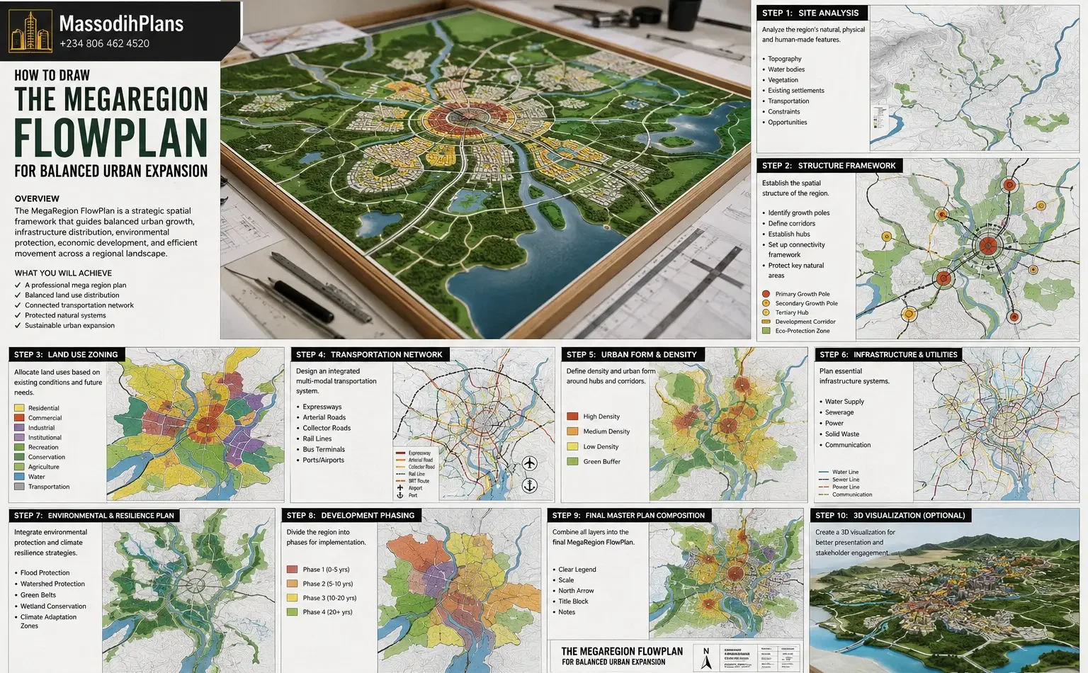
- The MegaRegion FlowPlan for Balanced Urban Expansion
- The Proposed FutureGrid Nation Blueprint for Smarter Land Development
- Industrial Estate Layout Design in Nigeria: Smart Master Plan for Small Industrial Plots
- Small Residential Estate Layout Design in Nigeria: Smart Master Plan Ideas for Limited Land
- Nigerian Estate Master Plan for Small Plots: Modern Residential Layout Strategies That Maximize Space
- Current Cost of Building a House in Port Harcourt (Professional Analysis)
Reference: UN-Habitat: Urban Planning: The United Nations agency for human settlements on the role of planning in sustainable urban development
About Author
Massodih Okon is a built environment professional with a background in architecture and urban planning. He specializes in practical Nigerian house design guidance through MassodihPlans.com.. He has a Master’s degree in Urban and Regional Planning, a first degree in Geography and Environmental Management, and professional certificates in Architectural Design, Landscape Design, and GIS. With over 15 years of hands‑on experience in architecture, town planning, GIS, and building economics across Nigerian residential and institutional projects, he understands the real challenges Nigerians face when planning and building homes.
At MassodihPlans, Massodih shares practical Nigerian building guides, modern bungalow and duplex house plans, and built environment resources created specifically for Nigerian homeowners, developers, and property investors. His work is based on real‑life conditions in Nigeria, climate‑responsive design, and cost‑effective planning, aimed at helping everyday Nigerians make smarter, more confident building decisions.