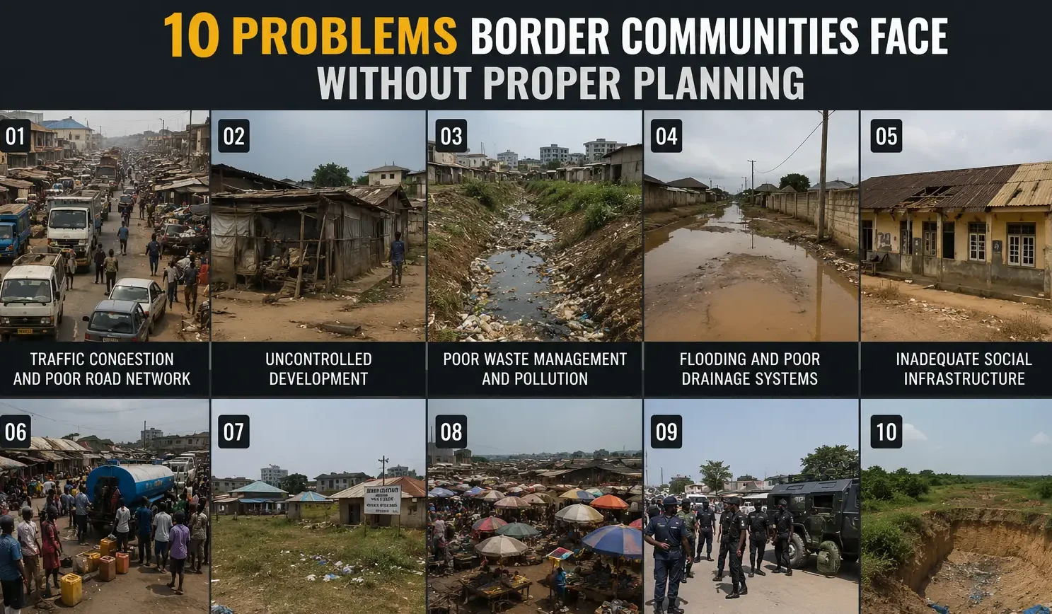

When cities grow without a master plan, drainage channels are blocked and buildings encroach on
If you have ever driven through a Nigerian city and asked yourself, “Who approved this?” you already know the answer. Nobody did. Or if they did, there was no plan.
That market sitting right beside a primary school. That filling station wedged between two residential compounds. That road that becomes a river every time it rains. That neighbourhood where ambulances cannot enter. None of these things happened by accident. They happened because the city grew without a master plan.
I have walked development sites in Uyo, studied layouts in Port Harcourt, and reviewed land allocations in cities where planning happened only on paper. I want to talk to you directly. If you are a student planner , a developer, a government official, or an everyday Nigerian trying to understand why their city feels chaotic. Please pay attention very carefully and read this line by line. Because you deserve a real explanation, not textbook language.
First, Let Me Tell You What a Master Plan Actually Is
A master plan is not a drawing. Not exactly.
Yes, it involves maps, land use diagrams, and zoning layouts. But more than anything else, a master plan decides in advance how a city should grow, where people should live, where businesses should operate, where roads should go, where drainage should flow, and where your children should play.
It answers one question before the problem arrives: “What do we do with this land?”
Think of it like building a house. Before you pour the foundation, you ask the architect to design the plan. You decide where the bedrooms go, where the kitchen sits, where the drainage exits. You do not just start building and figure it out as you go. But that is exactly what most Nigerian cities and many cities in Africa and the developing world have done. They started building and figured it out later. And the cost of that decision is still being paid today.
A master plan typically covers:
- Land use zoning: what activity goes where
- Road hierarchy and circulation: primary, secondary, and local roads
- Infrastructure corridors: water, drainage, electricity, sewage
- Population projections: how many people will live here in 10, 20, 50 years
- Open spaces and green areas: parks, buffers, recreation
- Development control regulations: setbacks, plot coverage, building heights
- Environmental management: floodplains, wetlands, tree lines
- Public facility distribution: schools, clinics, markets, government offices
When a city has all of this planned and coordinated from the beginning, it tends to function. When it does not, you get what you see across so many of our cities today.
What Actually Happens When There Is No Master Plan
Let me take you through this systematically, the way a town planner would when doing a post-development audit of a settlement. These are not theoretical possibilities. These are documented realities, many of which I have observed personally on Nigerian soil.
1. Uncontrolled Urban Growth
When there is no master plan, growth happens in whatever direction land is cheapest and least regulated. Developers buy land on the city fringe and start building without reference to any layout. Before long, settlement extends into areas that were never meant to carry development.
You see haphazard building development everywhere, houses facing different directions, setbacks ignored, compounds sharing walls with neighbouring land uses that have nothing to do with housing. This is not a matter of poverty. Wealthy neighbourhoods in unplanned cities suffer the same spatial disorder. The buildings may be expensive, but the layout is still chaotic.
Urban sprawl follows quickly. The city expands horizontally, eating up farmland, forest, and water catchment areas. Infrastructure cannot keep up with this expansion because nobody planned where it should go in the first place.
Then come the informal and illegal settlements. People who cannot afford land in even the sprawling areas begin to occupy government land, road setbacks, riverbanks, and drainage reserves. These settlements grow fast because enforcement is weak or absent. And once they are established, removing them becomes a political and human rights minefield.
In many Nigerian cities, buildings are constructed literally on road setbacks, the space legally reserved for road widening. When the government eventually tries to expand the road, it has to demolish private structures. The cost of demolition, compensation, and controversy all trace back to one thing: no master plan enforced at the beginning.
2. Traffic and Transportation Problems
A properly planned city has a road hierarchy. This means there are express roads carrying long-distance traffic, arterial roads distributing that traffic across zones, collector roads gathering traffic from neighbourhoods, and local streets giving access to individual plots. Each level of road has a standard width, right-of-way, and design speed.
In an unplanned city, none of this hierarchy exists. Roads grow organically, following paths that people walked before vehicles were invented. They are narrow, poorly connected, and unable to carry the volume of traffic that follows urban growth.
The result is the kind of traffic congestion that Nigerians know all too well. Not just inconvenient, economically destructive. Goods do not move. Workers arrive late. Petrol burns in stationary traffic. Emergency vehicles cannot navigate. The average Nigerian city dweller loses hours every day to traffic that better road planning could have prevented or significantly reduced.
Parking is another casualty of unplanned cities. Because no space was reserved for parking facilities when development was first approved, vehicles park on roads, reducing already-narrow carriageways by half. This compounds the congestion problem.
Pedestrian facilities walkways, crossings, shade trees are almost nonexistent in most unplanned Nigerian urban areas. People walk on roads because there is nowhere else to walk. This directly contributes to road accidents.
And when you try to introduce public transportation BRT systems, rail, organised minibus routes you find that the road network does not support it. The corridors needed for high-capacity transport do not exist because nobody planned for them.
3. Slums and Housing Problems
Slums do not appear randomly. They are the predictable outcome of unplanned growth. When a city expands without housing policy, without planned low-cost residential zones, without serviced plots for ordinary people, what you get is self-help housing in the worst possible locations.
In Nigerian cities, you will find dense, overcrowded neighbourhoods where multiple families share facilities designed for one. You will find residential buildings sandwiched between auto-repair workshops, welding sheds, and food-processing units. The noise, fumes, and hazards from these incompatible land uses affect the health and quality of life of every resident in the area.
Poor housing quality is not only about income. It is also about planning. Even low-income residents build better when they have access to properly surveyed plots, approved layouts, and clear development standards. When none of that exists, they build whatever they can afford, wherever they can find space, without any reference to safety, drainage, or future services.
Slums also make it nearly impossible to extend basic services. Water supply networks, sewage lines, and electricity connections are designed to follow planned road grids. In unplanned settlements, the density and irregular layout make infrastructure extension extremely costly and sometimes technically impossible.
4. Land Use Conflicts
One of the clearest signs that a city has grown without a master plan is the presence of incompatible land uses side by side. These conflicts generate enormous social and economic costs.
I have seen a church with a loud PA system sitting between two residential compounds, conducting all-night programmes three times a week. The neighbours cannot sleep. The church cannot relocate. There is no buffer, no noise management, no zoning standard that was applied when that land was developed.
I have seen a sawmill operating beside a school. A slaughterhouse beside a borehole. A mechanic workshop sharing a boundary wall with a maternity clinic. Every one of these situations represents a land use conflict that proper zoning would have prevented.
Zoning is simply the practice of grouping compatible land uses together and separating incompatible ones. Residential areas need to be near shops and schools but away from heavy industries. Markets need to be accessible but not right on major road intersections. Industrial zones need buffers from residential areas. When zoning is applied consistently and enforced through development control, these conflicts do not arise. When there is no zoning, they multiply year after year.
5. Infrastructure Deficiencies
Infrastructure water supply, electricity distribution, sewage, telecommunications is not just about technology or funding. It is about layout. The physical arrangement of streets, plots, and buildings determines where pipes go, where cables run, where pumping stations can be located.
In a planned city, infrastructure corridors are reserved during the layout stage. The water treatment plant is sited upstream. The sewage system flows downhill by gravity. The electricity substation is positioned to serve equal radii. All of this is coordinated before a single structure is built.
In an unplanned city, infrastructure arrives after people are already there. And by then, the layout makes efficient provision nearly impossible. Pipes have to follow roads that were never designed for underground services. Electricity cables have to navigate irregular plot arrangements. Sewage cannot flow by gravity because drainage levels were never surveyed or coordinated.
The result is the infrastructure we know in many Nigerian cities: boreholes in every compound because there is no network water supply, generators running 24 hours because the electricity grid cannot serve the sprawling density, open drains choking with waste because there is no sewage system, and telecommunications infrastructure installed piecemeal without any coordination.
6. Flooding and Drainage Problems
This is arguably the most visible consequence of unplanned urban growth in Nigeria, and it affects the greatest number of people directly.
Every urban area has a natural drainage system. Rain falls, collects on surfaces, flows into channels, and eventually reaches rivers or the sea. This system follows a logic defined by topography, soil type, catchment areas, and flow rates. A good master plan maps this system, respects it, and builds the urban layout around it.
Without a master plan, people build on floodplains. They block natural drainage channels with structures. And they pave surfaces that once absorbed rainfall, increasing runoff. They fill wetlands that served as natural retention basins. Then, when the rains come, they find water in their living rooms.
I once reviewed a layout in a Nigerian city where an entire residential estate had been developed on a depression that functioned as a natural flood storage area. Every rainy season, the estate flooded. The developer had not carried out a drainage survey. The town planning authority had not required one. Residents moved in and discovered the problem after the first major rainfall.
Erosion often follows flooding. Unprotected slopes, disturbed soil, and poorly designed drainage channels accelerate erosion. In the Southeast and South-South of Nigeria, the consequences are severe. Gullies consume entire plots, roads collapse into trenches, and communities lose land permanently each year.
Proper master planning includes a drainage master plan. It defines the hierarchy of drainage channels, from individual plot drains to tertiary, secondary, and primary drains leading to outfalls. It specifies setbacks from drainage channels and identifies flood-prone areas where development should be restricted. Without these measures, flooding is not simply a weather problem. It is a planning failure.
7. Environmental Degradation
A city without a master plan is a city at war with its own environment.
Green spaces; parks, urban forests, buffer zones, roadside trees are the first victims of unplanned growth. Every available piece of land gets built on because no land was legally reserved and protected for open space. The result is dense, treeless urban fabric that absorbs heat, generates dust, and offers no relief to residents.
Wetlands are filled in for development. In many coastal cities and riverine communities in Nigeria, mangroves and freshwater wetlands that once served as flood buffers, breeding grounds for fish, and carbon sinks have been reclaimed and built on. Once a wetland is gone, it is gone. And the ecological services it provided the flood control, the water filtration, the biodiversity are gone with it.
Air pollution, water pollution, and noise pollution all intensify in unplanned cities because there are no buffers between polluting activities and residential areas, no waste management systems, no sewage treatment, and no organised waste collection and disposal infrastructure.
8. Public Health Problems
Unplanned cities make people sick. This is not rhetoric, it is established public health science.
Dense, overcrowded housing with inadequate ventilation and poor sanitation accelerates the spread of communicable diseases. TB, typhoid, cholera, malaria all of these diseases thrive in the conditions that unplanned urban growth creates.
Poor solid waste management means garbage accumulates in open spaces, on road medians, and in drainage channels. This creates breeding grounds for mosquitoes, rats, and other disease vectors. It also contaminates groundwater, the source of drinking water for most unplanned Nigerian urban settlements.
Contaminated water sources are one of the most direct health consequences. In planned cities with centralised water supply, water quality can be monitored and treated. In unplanned settlements dependent on shallow boreholes and hand-dug wells, contamination from nearby septic tanks, leaking sewers, and surface waste is a constant risk.
9. Economic Consequences
The economic cost of unplanned urban growth is enormous and largely invisible because nobody writes a bill. But the costs are real.
Property values in unplanned areas are lower than they should be because investors are uncertain about the security of their investment. Is the road in front of my building going to be widened next year? And is my plot on a government easement? Is this neighbourhood going to flood? These uncertainties reduce what buyers are willing to pay.
Infrastructure provision in unplanned areas costs far more than in planned ones. Trying to lay water pipes through an irregular settlement costs more per kilometre because the alignment is difficult. Trying to construct a road where buildings are already on the setback requires compensation and demolition. All of this comes from the government’s budget or does not come at all.
Businesses in unplanned cities operate at reduced efficiency. Traffic congestion increases transport and logistics costs. Poor power supply forces every business to invest in private generation. Inadequate water supply requires private storage. All of these increase the cost of doing business and reduce competitiveness.
Investors; both domestic and foreign: look at infrastructure quality, land title security, and spatial organisation when deciding where to establish operations. A city that cannot demonstrate it is planned and managed struggles to attract serious investment.
10. Social Problems
Cities are social spaces. They are where communities form, where children grow, where people meet, gather, and build shared lives. A well-planned city creates the conditions for social cohesion. An unplanned city fragments communities and increases vulnerability.
When there are no parks, playgrounds, or public gathering spaces, children play on roads. Teenagers have nowhere to go that is not dangerous or commercially driven. Communities lose the shared spaces that make them communities.
Crime is not caused by poor planning, but poor planning creates the conditions in which crime is harder to prevent. Areas inaccessible to security agencies, poor street lighting, narrow unlit alleys, buildings packed so closely together that surveillance is impossible all of these are products of unplanned development. And all of them make it easier for criminal activity to hide and harder for security to respond.
Social segregation intensifies in unplanned cities as wealth determines access to better-serviced areas while low-income groups are pushed into progressively worse environments with no plan to upgrade them.
11. Disaster Risks
When a fire breaks out in an unplanned settlement, the fire service cannot reach it. The roads are too narrow, the layout too irregular, the addresses too unclear. By the time help arrives, entire blocks have burned.
This is not hypothetical. It is a documented reality in dense informal settlements across Nigeria and many developing cities worldwide.
Floods travel faster and further in unplanned cities because natural drainage paths are blocked, retention areas are built on, and buildings are constructed on vulnerable ground. Earthquake risk less common in Nigeria but significant in many global cities is dramatically higher in unplanned urban areas where building standards are not enforced.
Emergency access, the ability of ambulances, fire trucks, police vehicles, and rescue teams to reach any point in the city quickly is a function of road planning. In a properly planned city, emergency response times are designed into the road network. In an unplanned city, response time is largely determined by luck.
12. Governance and Administrative Challenges
Town planning authorities in unplanned cities face an almost impossible task. Development control the process of reviewing building plans, approving layouts, enforcing standards, and managing land use change requires a plan to enforce against. If there is no master plan, there is no baseline.
Without a master plan, boundary disputes multiply. Where does one plot end and another begin? Who approved this road? Is this land government or private? These questions generate years of litigation, community conflict, and dead investment.
Revenue generation from land administration, through planning fees, land charges, and property rates requires a functional land information system. That system requires a master plan as its foundation. Without it, land administration is informal, incomplete, and easily corrupted.
13. Inadequate Public Facilities
Planning standards specify how many public facilities a given population requires and how those facilities should be distributed across the urban area. A neighbourhood of 5,000 people needs a certain number of primary schools within walking distance. A ward of 15,000 needs a primary health care centre. A zone of 50,000 needs a market, a park, and secondary infrastructure.
Without a master plan, these calculations are never done. Schools are built where land is available, not where children are concentrated. Clinics are established where there is political will, not where health need is highest. Markets develop wherever traders congregate, regardless of traffic, drainage, or spatial logic.
The result is chronic maldistribution of public services abundance in some areas, complete absence in others compounding spatial inequality across the city.
14. Security Problems
Security is a function of both social and spatial organisation. The spatial dimension the one that town planning can influence includes street lighting, road accessibility, the visibility of public spaces, the ratio of active frontages to blank walls, and the ease with which surveillance can be maintained.
In unplanned cities, dark alleys, dead-end streets, derelict buildings, and areas inaccessible to vehicles create environments that are difficult to police. The “eyes on the street” effect, the natural surveillance that comes from well-designed public spaces with active frontages cannot function in irregular, poorly lit, disconnected urban fabric.
Emergency response time is also compromised. When a street has no name, when a building has no address, when the road grid is non-navigable, the average response time for police, ambulance, and fire services increases dramatically. In some Nigerian urban areas, the response time makes emergency services functionally irrelevant.
15. Future Development Constraints
The most painful consequence of unplanned growth is that it forecloses future options. Every structure built without reference to a plan is a constraint on what the city can do later.
Urban renewal, the process of upgrading or redeveloping deteriorated urban areas is enormously expensive in unplanned cities. It requires compensation for displaced residents and businesses, demolition of existing structures, and complete reconstruction of infrastructure. World Bank and African Development Bank data consistently shows that the cost of retrofitting infrastructure into an unplanned settlement is three to five times higher than providing it in a planned one.
Road expansion in unplanned cities requires demolition. Property owners resist, courts intervene, projects stall. The ring roads, bypasses, and expressways that a growing city desperately needs cannot be built because the setbacks where they should go are already occupied.
Land acquisition for public projects: schools, hospitals, government offices becomes prohibitively expensive and politically contentious when unplanned private development has already occupied every available parcel.
And sustainable growth, the integration of energy efficiency, green infrastructure, transit-oriented development, and climate resilience is structurally impossible in cities that were never planned in the first place.
The Nigerian Reality Layer: What I Have Seen on the Ground
I want to pause here and be honest with you about the Nigerian urban planning context, because this is not just theory.
Most Nigerian towns and cities have master plans. The problem is that these plans are:
- Outdated — many are decades old and bear no relationship to current population or development patterns
- Underfunded — plans exist on paper but there is no budget to implement them
- Ignored — political pressure, corruption, and weak institutions mean that approved plans are routinely violated
- Uncoordinated — multiple agencies — town planning, surveying, housing development, FCDA equivalent bodies — work in silos without reference to a shared plan
- Inaccessible — the public does not know what the plan says, so community pressure to enforce it does not exist
The cities that manage to maintain some planning order in Nigeria tend to be those with strong town planning authority leadership, consistent political will, and importantly, a recent and up-to-date master plan that is publicly accessible and consistently enforced.
States like Akwa Ibom, Lagos, and Abuja FCT have periods of better planning performance. But even in these places, the pressure of rapid urbanisation and political land allocation constantly pushes against proper development control.
What this means practically is that even where a plan exists, the consequences of inadequate enforcement look almost identical to the consequences of having no plan at all.
The Human Lifestyle Layer: What Residents Actually Experience
Let me bring this down from policy to person.
Imagine you are a mother in a fast-growing Nigerian city. Your house is in a residential area that was not planned. The road outside your gate is unpaved and floods every rainy season. The primary school for your children is three kilometres away because no school was planned for your neighbourhood. The nearest clinic is on the other side of a market that generates traffic congestion from 7am to 9pm. There is no park, no playground, no green space anywhere within walking distance.
Your neighbour runs a generator 18 hours a day because there is no stable power. The noise and fumes come through your windows. A mechanic moved into the compound next door last year. The smell of oil, the noise of metal work, and the traffic of vehicles coming for repair starts at 7am.
This is not a description of poverty. This is a description of unplanned development. Many of the residents in this scenario earn reasonable incomes and own decent buildings. The problem is not their resources. The problem is the absence of a plan that would have separated incompatible uses, provided public facilities, and maintained standards.
Planning is not just for government or developers. Planning is for you, the resident, who deserves to live in an environment designed to support human life not one that happened by accident.
The Construction Experience Layer: What Developers and Builders Face
If you are a developer, a building contractor, or an architect working in unplanned areas, you already know the challenges.
You apply for building approval, but the layout plan the approval office needs does not exist or no longer reflects current conditions. The approval process stalls, becomes informal, or remains unavailable. You proceed without approval, which means authorities may later earmark your building for demolition during urban renewal or road expansion.
And you want to connect your development to the public water main, but the water main does not reach your location because planners never included infrastructure provision in that area. You sink a borehole. It works until your neighbour’s septic tank starts leaking into the water table.
You design beautiful drainage for your development, but the drainage has nowhere to go because structures now block the natural channel it should connect to. Those structures appeared after other developers ignored the same drainage setbacks you are now trying to observe.
The construction experience in unplanned areas involves constant negotiation with a landscape that no one designed for what you are trying to build. Good planning provides the platform for good construction. Without it, even the best builders work against the grain.
The Investment Layer: What Unplanned Cities Cost Investors
Every serious investor whether building a house, developing an estate, or establishing a commercial enterprise — needs to assess location risk. In unplanned cities, this risk is structurally elevated.
Title security is uncertain. If a plot sits on an undeclared easement, government land, or within a future road setback, the investment could be wiped out during urban renewal without full compensation.
Infrastructure costs are higher. Private provision of electricity, water, and security in unplanned areas adds significantly to operating costs costs that would not exist in a properly serviced, planned city.
Exit value is lower. Buyers willing to pay premium prices want premium locations. Premium locations are, in almost every market in the world, planned ones with good roads, services, green space, and clear land use zones.
The irony is that developers who choose to build on planned, approved layouts even at higher initial cost typically achieve higher returns than those who cut corners by buying cheaper land in unplanned areas. Planning is not just good governance. It is good business.
What Good Master Planning Looks Like: A Practical Framework
Let me describe what a functioning master plan does not in academic language, but in the language of practical application.
Land Use Distribution and Zoning Hierarchy
A master plan divides the planning area into zones. The most basic zoning categories are: residential, commercial, industrial, institutional, recreational, and agricultural. Each zone has regulations governing what can be built there, how densely, and to what height.
Within residential zoning, there is usually a hierarchy low density (large plots, detached houses, significant open space), medium density (smaller plots, semi-detached and terrace housing), and high density (apartments, mixed-use, higher plot coverage). The density allocated to any zone depends on its location relative to infrastructure and services.
Commercial zones are similarly graded into local commercial areas serving immediate neighbourhoods, district commercial areas serving larger catchments, and central business districts serving entire urban areas. Each level has different development standards.
Industrial zones remain separated from residential areas through buffer green spaces, physical barriers, or compatible uses such as warehousing and logistics facilities that serve as transition zones.
Circulation Systems and Road Hierarchy
The circulation system is the skeleton of the city. Every movement vehicular, pedestrian, cycling, public transport depends on it.
A properly planned road hierarchy moves from expressways (the major corridors carrying long-distance traffic at high speeds) down through arterial roads (distributing traffic across urban zones), collector roads (gathering traffic from neighbourhoods), and local streets (providing access to individual plots).
Each road level has a defined right-of-way the total land width reserved for the road, including carriageway, service strips, and footpaths. Expressways in Nigerian cities typically require a minimum 60-metre right-of-way. Primary arterials need 40 to 50 metres. Secondary roads need 20 to 30 metres. Local streets need at least 9 to 12 metres.
These rights-of-way must be protected from the moment land is surveyed and allocated. Once they are built over, recovery becomes extremely expensive.
Plot Arrangements and Development Standards
A master plan does not just define zones, it also guides how individual plots are arranged, what setbacks are required, and what development standards apply.
Setbacks are the minimum distances between a building and the boundaries of its plot. Front setbacks keep buildings away from roads, providing space for landscaping, pedestrian movement, and future road widening. Side and rear setbacks ensure ventilation, fire safety distance, and access for maintenance.
Nigerian planning standards typically specify front setbacks of 3 to 9 metres depending on the road class, side setbacks of 1.5 to 3 metres, and rear setbacks of 3 to 6 metres. These standards exist for good reasons light, air, fire access, and the future integrity of the road network.
Plot coverage the percentage of a plot that can be built on is usually 50 to 60 percent for residential plots, leaving the rest for open space, drainage, and landscaping. Floor area ratio, which controls the total building area across all floors relative to plot area, manages the density of development.
Infrastructure Planning and Drainage Systems
Infrastructure planning in a master plan coordinates the provision of water supply, sewage, stormwater drainage, electricity, telecommunications, and solid waste systems across the entire planning area.
For drainage specifically, the master plan identifies the primary drainage outfalls the main rivers, channels, or outfalls to which all city drainage ultimately connects. From these, the plan works backward to design a hierarchy of drainage channels: primary channels carrying the largest volumes, secondary channels collecting from multiple catchments, tertiary channels serving individual blocks, and plot drains managing runoff from individual development sites.
Each channel is sized using rainfall data, catchment area calculations, and run-off coefficients that account for surface type and slope. This is hydrological engineering, and it requires a master plan to coordinate it across the city.
Flood control considerations go further identifying floodplains through topographic survey and historical flood data, restricting development within defined flood lines, and designing retention basins and detention ponds that absorb peak rainfall events before releasing water gradually to downstream channels.
Environmental Management and Green Infrastructure
A serious master plan treats the natural environment not as an obstacle to development but as infrastructure that requires continuous maintenance.
Planners identify and protect green corridors, networks of parks, greenways, riparian buffers along watercourses, and urban forests during the master planning stage. These corridors provide multiple services simultaneously: temperature regulation, stormwater management, biodiversity support, recreational space, and air quality improvement.
Planning authorities specify tree planting requirements for roads, public spaces, and private developments. They map wetland areas with GIS and protect them from reclamation. Authorities also embed environmental impact assessment requirements into the development approval process, preventing significant development from proceeding before developers evaluate its effects on the surrounding environment.
Urban Growth Strategy and Development Phasing
A master plan does not try to build the whole city at once. It defines phases of development typically over a 20 to 25-year horizon that coordinate population growth, infrastructure provision, and land release.
Phase 1 concentrates development around existing infrastructure and services, densifying before expanding. And phase 2 extends infrastructure into prepared new growth areas with serviced plots and reserved corridors. Phase 3 develops long-term expansion areas as population demand justifies the investment.
This phasing strategy avoids the most common Nigerian planning failure: releasing land for development before infrastructure is ready. When infrastructure lags behind population, the gap is filled by private, informal, and substandard provision that becomes almost impossible to replace later.
Population Projections and Planning Standards
Good master planning starts with evidence. Population data current census figures, growth rate analysis, in-migration projections drives all subsequent planning decisions.
How many primary schools does the planning area need? And how many health centres? How much market space? How wide should the road network be? All of these depend on how many people will live there over the plan period.
Nigerian planning standards developed by the Federal Ministry of Works and Housing and adapted by state town planning authorities specify the ratios of facilities to population. These include school catchment areas, minimum open space provision per capita, healthcare facility spacing, and fire station response radii.
A master plan applies these standards to the projected population across the planning area, then allocates land for each facility type accordingly. When this is done correctly, the city that grows according to the plan has the facilities it needs in the right places.
GIS and Mapping Integration
Modern master planning uses Geographic Information Systems — GIS — as its core technical platform. GIS integrates spatial data: topographic surveys, land ownership records, existing land use, road networks, drainage channels, vegetation cover, flood risk areas, and population distribution.
By layering this information on a common digital platform, planners can make decisions based on comprehensive spatial analysis rather than partial information. Where is the land suitable for development? And where are the flood risks? Where is the existing road network most deficient? GIS provides evidence-based answers to all of these questions.
The resulting master plan exists not just as a paper document but as a digital data platform that planning authorities can update as conditions change, share with all planning agencies, and use to make building approval decisions consistently.
This planning standard increasingly guides Nigerian cities, and communities should demand it from their state and local government planning authorities.
How to Tell If Your City Is Paying the Price of No Planning
Here is a quick checklist. If you recognise more than five of these in your city, you are looking at the consequences of unplanned or poorly planned urban growth:
- Roads flood during every significant rainfall
- Traffic gridlocks every major intersection during peak hours
- Markets spill onto road medians and drainage channels
- Mechanics, welding workshops, and small industries operate throughout residential neighbourhoods
- Developers construct buildings right to the property boundary with no setbacks
- Most residents rely on boreholes as their primary source of water supply
- Residents cannot access a park or public green space within reasonable walking distance
- Solid waste and vegetation choke drainage channels
- Developers continue new developments on the city fringe without road access or services
- Emergency vehicles cannot reach significant portions of the urban area
- Land disputes occur frequently and authorities resolve them slowly
This is not just a Nigerian problem. You will find these same symptoms in Lagos and in Lima, in Port Harcourt and in Jakarta, in Kano and in Nairobi. Unplanned urban growth is a global challenge. But planners already know the solutions, and every solution starts with a master plan.
Common Mistakes to Avoid (For Developers, Government, and Communities)
Mistake 1: Assuming that a master plan means rigid, unchangeable rules
A good master plan serves as a framework, not a prison. Planning authorities periodically review and update it. It accommodates variance and special use permits for situations that do not fit standard zones. Flexibility within a plan differs from having no plan at all.
Mistake 2: Approving development before infrastructure is ready
This is perhaps the single most common planning failure in Nigeria. Authorities release land, developers sell plots, and builders construct buildings then government attempts to provide roads and drainage. The sequence should always be: plan, provide infrastructure, then allow development.
Mistake 3: Treating town planning as a revenue collection exercise
When planning authorities focus primarily on collecting fees rather than managing development quality, the planning system loses its effectiveness. The true value of planning lies in the long-term development quality it maintains, not the fees it collects.
Mistake 4: Planning without community engagement
A master plan that communities do not understand and do not help create will not earn respect. Community engagement explaining why certain areas are zoned for certain uses, why setbacks matter, and why people cannot block drainage channels is not optional. It transforms a plan from a document into a shared commitment.
Mistake 5: Ignoring climate responsiveness
Many older Nigerian master plans reflected climate conditions that no longer exist. Rainfall patterns have changed. Flood frequencies have increased. New master plans must incorporate climate projections and account for the weather conditions of the next 30 years, not the past 30 years.
Quick Summary: What You Need to Remember
- A master plan is a coordinated framework for how a city should grow covering land use, roads, infrastructure, green space, and development standards
- Without a master plan, cities develop chaotically, generating flooding, traffic gridlock, slums, land use conflicts, and environmental degradation
- The cost of fixing an unplanned city is always higher than the cost of planning it properly from the start
- Good master planning uses GIS, population projections, engineering standards, and community engagement to produce a plan that is both technically sound and socially grounded
- Nigeria and many developing cities have plans the challenge is enforcement, funding, and political will
- As a developer, homeowner, student, or government official, understanding master planning helps you make better decisions and advocate for better cities
Expert Note from a Town Planner
I have worked in this field long enough to know that the problem is rarely ignorance. Most Nigerian state governments know what a master plan is. And most developers understand setbacks. Most town planners can explain land use zoning in their sleep.
The problem is implementation. And implementation requires political will, consistent enforcement, adequate funding, and a public that understands enough about planning to demand it.
This is why I write and why MassodihPlans exists not to rank on Google, but to build the knowledge base that makes planning advocacy possible. When you understand why your city floods, why your road is too narrow, why your neighbourhood has no park, you are equipped to ask the right questions and demand better answers.
That is how cities change. Not from the top down, but from an informed public holding government accountable to the plans that already exist.
Frequently Asked Questions
What is the main purpose of an urban master plan?
A master plan provides a coordinated, long-term framework for how a city should grow. It allocates land to appropriate uses, reserves corridors for roads and infrastructure, protects environmental features, and sets development standards. Its main purpose is to guide growth in a way that serves residents efficiently, safely, and sustainably.
Why do so many Nigerian cities still have planning problems despite having master plans?
Most Nigerian cities have outdated master plans often decades old that do not reflect current population, land use, or infrastructure realities. Even where newer plans exist, enforcement is inconsistent, institutional capacity is limited, and political pressure often overrides planning decisions. Having a plan is the first step; implementing and enforcing it is the harder challenge.
How does a master plan prevent flooding?
A master plan incorporates drainage engineering that maps the natural drainage system, reserves setbacks along drainage channels, restricts development within flood-prone areas, and designs a hierarchy of storm drains to manage rainfall runoff. When these provisions are enforced, buildings are not constructed on floodplains and drainage channels are not blocked.
Can an unplanned area be upgraded to meet planning standards?
Yes, but it is costly and complex. Urban renewal or upgrading projects can improve roads, drainage, utilities, and public facilities in unplanned areas. However, the cost is typically three to five times higher than providing planned infrastructure from the beginning, and the process is socially disruptive. Prevention through proper planning is always preferable to cure through urban renewal.
What is the difference between zoning and a master plan?
A master plan is the comprehensive framework covering land use, infrastructure, transport, environment, and development strategy for an entire urban area. Zoning is a component of a master plan that specifies permitted activities in different areas and establishes the development standards for each area. You cannot have effective zoning without a master plan to define the overall spatial strategy it supports.
How does GIS improve the master planning process?
GIS allows planners to integrate multiple layers of spatial data topography, existing land use, road networks, drainage systems, population distribution, flood risk on a single digital platform. This enables analysis-based decision making rather than guesswork, allows the plan to be updated as conditions change, and supports consistent development approval decisions across all planning authorities.
What role does community engagement play in master planning?
Communities that participate in developing a master plan are more likely to understand, respect, and advocate for it. Engagement also improves the quality of the plan by incorporating local knowledge about drainage patterns, land use conflicts, and community needs that technical surveys alone cannot capture.
Conclusion: Your City Does Not Have to Be This Way
Every city you have ever admired, the cities with wide roads, effective flood management systems, parks and schools in every neighbourhood, and businesses and homes that coexist without conflict, did not emerge by accident. Planners designed those cities. Leaders made decisions in advance, established standards, and built institutions that enforced them
The cities that frustrate you where driving is a daily ordeal, where the rainy season brings anxiety about flooding, where your children have nowhere safe to play, where development control seems to mean nothing are not inevitable. They are the product of planning failures that can be understood, diagnosed, and corrected.
This is not primarily a conversation for architects or town planners. It is a conversation for everyone who lives in a city and wants it to be better. Understanding what a master plan does and what the absence of one costs is the beginning of constructive advocacy for better urban governance.
If you are a student studying urban and regional planning, a civil servant in a state ministry, a developer evaluating a location, a community leader frustrated by flooding and poor roads, or simply someone who wants to understand why Nigerian cities are the way they are you now have a framework.
Use it.
Want to explore how professional estate layouts, subdivision plans, and physical development frameworks are applied in Nigerian practice? Browse the Plans Library on MassodihPlans to see real examples of planned residential and commercial layouts developed to Nigerian planning standards. If you need estate master planning, subdivision layout design, or physical development plan preparation for your project, explore our professional planning services or visit Plan School to deepen your understanding of Nigerian urban and regional planning practice.
Related Post
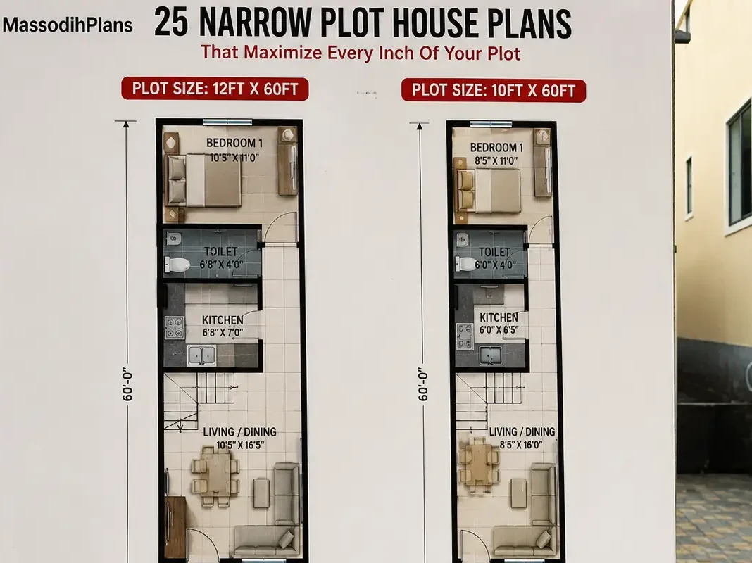
- Small Residential Estate Layout Design in Nigeria: Smart Master Plan Ideas for Limited Land
- Industrial Estate Layout Design in Nigeria: Smart Master Plan for Small Industrial Plots
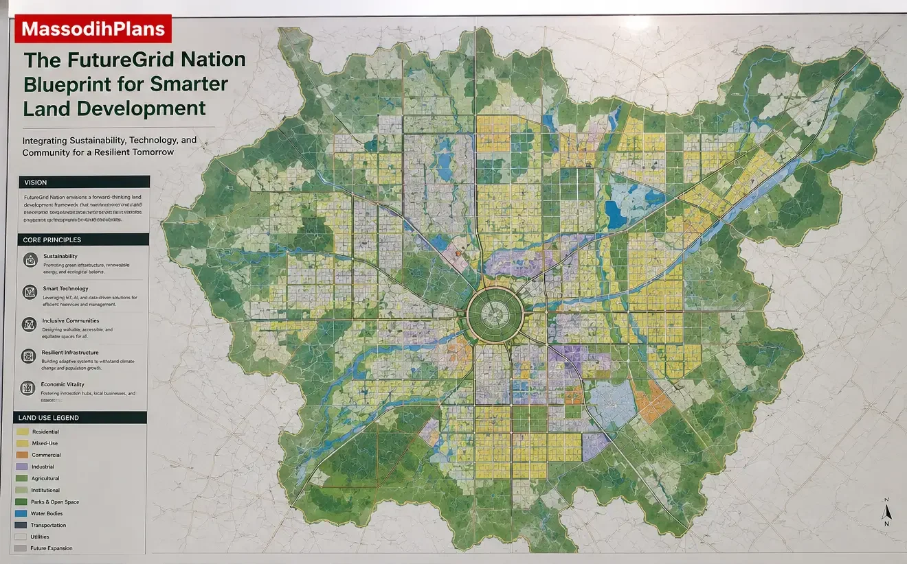
- The Proposed FutureGrid Nation Blueprint for Smarter Land Development
- The MegaRegion FlowPlan for Balanced Urban Expansion
- How a State Master Plan Works: A Complete Guide to Modern Infrastructure Development
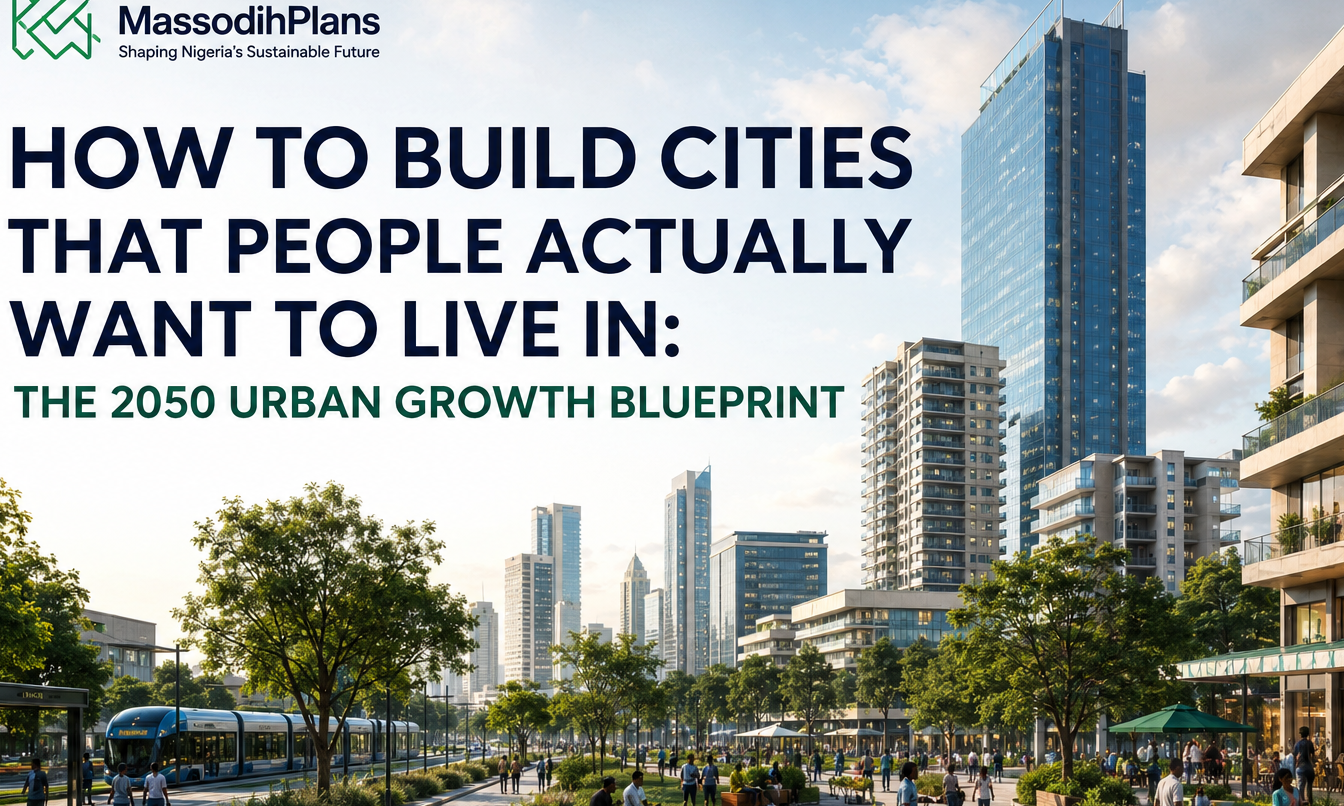
- How to Build Cities That People Actually Want to Live In: The 2050 Urban Growth Blueprint
- United Nations Habitat
About Author
Massodih Okon is a built environment professional with a background in architecture and urban planning. He specializes in practical Nigerian house design guidance through MassodihPlans.com.. He has a Master’s degree in Urban and Regional Planning, a first degree in Geography and Environmental Management, and professional certificates in Architectural Design, Landscape Design, and GIS. With over 15 years of hands‑on experience in architecture, town planning, GIS, and building economics across Nigerian residential and institutional projects, he understands the real challenges Nigerians face when planning and building homes.
At MassodihPlans, Massodih shares practical Nigerian building guides, modern bungalow and duplex house plans, and built environment resources created specifically for Nigerian homeowners, developers, and property investors. His work is based on real‑life conditions in Nigeria, climate‑responsive design, and cost‑effective planning, aimed at helping everyday Nigerians make smarter, more confident building decisions.