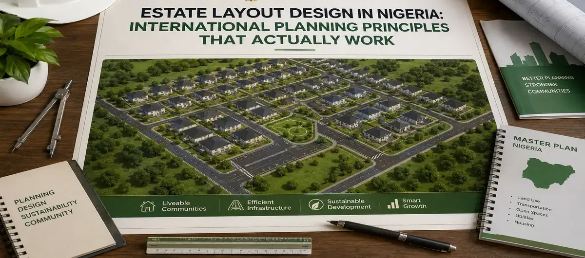
Estate Layout Design in Nigeria: International Planning Principles That Actually Work
The Nigerian Town That Never Floods: What Proper Master Planning Looks Like
Picture two towns. Both started the same size, thirty years ago, on flat land near a river. Town A grew house by house, plot by plot, with no plan guiding where roads should go or where water should drain. Today, Town A floods every rainy season, its narrow streets cannot fit two cars passing each other, and a market has somehow grown right beside a primary school. Town B, thirty minutes away, grew with a master plan in place from the start. Its roads connect properly, its drainage channels were built before the houses, and its land uses, residential, commercial, and recreational, sit where they should. Same starting point. Same country. Completely different outcomes. The difference was never money. It was planning. This is what estate layout design and master planning, done properly, can do for any community in Nigeria, or anywhere in the world.
I have watched Town A happen far too many times, and I have also seen what it takes to build Town B. This article is written for the homeowner trying to understand why their estate keeps flooding, the developer trying to do things right, and the government official trying to prevent the next disaster before it happens.
What a Master Plan Actually Is (In Plain Language)
In my experience, most people hear “master plan” and imagine a complicated government document nobody reads. This is one of the most common misconceptions I encounter. A master plan is simply a long-term guide that shows how land in a specific area should be used, where roads should run, where drainage should flow, where schools and markets belong, and how the area should grow over the next 15 to 25 years, before the actual building starts.
Quick Truth Box:
A master plan does not slow development down. It prevents the far more expensive problem of fixing bad development after the fact, demolishing buildings for road expansion, digging up existing streets for drainage, or resettling communities built on flood-prone land.
The Real Cost of Growing Without a Plan
Over the years, I have noticed that Nigerian cities without proper master plans tend to suffer the same recurring problems, regardless of which state they are in. This is not just a Nigerian issue either. Rapid, unplanned urbanization is a global challenge affecting rapidly growing cities everywhere. In Ibadan, for example, weak land use planning has driven urban sprawl and pushed informal settlements into flood-prone areas, contributing to devastating floods, including one in 2011 that killed more than 100 people and caused major damage to property and infrastructure. That single example captures almost every problem uncontrolled growth creates: flooding, informal settlement, infrastructure strain, and preventable loss of life.
What Happens Without a Master Plan
- Haphazard building development and urban sprawl, with houses built without proper setbacks
- Narrow, poorly connected roads that cause daily traffic congestion and frequent accidents
- Slums and overcrowding, with residential buildings mixed dangerously close to industrial or commercial uses
- Blocked natural drainage channels leading to recurring flooding and erosion
- Loss of green spaces, wetland destruction, and rising pollution
- Difficulty extending water, electricity, and sewage systems across an already unplanned layout
- Increased crime opportunities due to poor street lighting and inaccessible corners
- Expensive, disruptive urban renewal projects later, because fixing a mistake always costs more than preventing it
Land Use Distribution: The Foundation of Every Good Master Plan
During my undergraduate studies in Town Planning, one thing our lecturers constantly emphasized was that land use distribution is the single most important decision in any master plan. Get this wrong, and every other planning decision becomes harder to fix later.
A Realistic Land Use Distribution Example
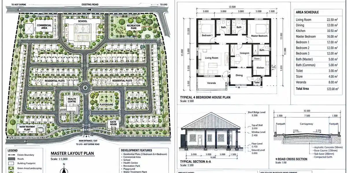
Here is a land use breakdown I have used in planning studio projects and real layout assignments for a medium-sized residential development area:
Land Use Category = Typical Allocation = Purpose
Residential = 50 – 60% = Housing for the projected population
Roads and Circulation = 15 – 20% = Main roads, feeder roads, pedestrian paths
Commercial and Mixed-Use = 8 – 12% = Markets, shops, offices, integrated with residential zones
Public Facilities = 5 – 8% = Schools, healthcare centers, civic buildings
Open Space and Recreation = 5 – 10% = Parks, playgrounds, environmental buffers
Utilities and Infrastructure = 3 – 5% = Water treatment, electrical substations, waste facilities
Notice that commercial and residential zones are described as integrated rather than completely separated. In practical terms, what usually happens in poorly planned Nigerian towns is those two uses collide chaotically, a market growing directly beside a residential street, or industrial activity next to family homes. A good master plan allows mixed-use development in designated corridors while protecting quiet residential zones from incompatible land uses like heavy industry or large-scale commercial noise.
Zoning Hierarchy: Organizing Land Use With Intention
One of our lecturers described zoning as “giving every piece of land a job to do.” A proper zoning hierarchy typically includes:
- Primary residential zones: quiet, low-traffic areas dedicated mainly to housing
- Mixed-use corridors: along major roads, combining ground-floor commercial with residential above
- Institutional zones: schools, healthcare facilities, religious buildings, positioned to minimize conflict with neighboring uses
- Industrial or light commercial zones: deliberately separated from residential areas with buffer distance and green screening
- Conservation and open space zones: wetlands, natural drainage paths, and green corridors protected from development entirely
I once reviewed a plan where a religious building was approved right in the middle of a quiet residential zone with no buffer consideration, and it eventually became a source of ongoing conflict between the congregation and neighboring families over noise and parking. Zoning hierarchy exists precisely to prevent situations like this before they happen.
Road Hierarchy and Circulation Systems
My academic training exposed me to circulation planning as one of the most technical, yet most impactful, parts of any master plan. A proper road hierarchy moves traffic efficiently while keeping residential streets calm and safe.
Road Type = Typical Width = Function
Primary/Arterial Road = 12 – 15 meters = Connects the settlement to the wider region, handles heaviest traffic
Secondary/Collector Road = 9 – 12 meters = Distributes traffic from arterial roads into neighborhoods
Local/Residential Street = 6 – 9 meters = Serves individual houses, low-speed, pedestrian-friendly
Pedestrian and Cycle Paths = 1.5 – 2.5 meters = Dedicated non-motorized circulation, often overlooked in Nigerian layouts
This is something I have encountered many times: layouts with roads, but no dedicated pedestrian paths at all, forcing people to walk on the same narrow road as vehicles. Transportation integration means planning for how people actually move, not just how vehicles move.
Plot Arrangement and Physical Planning Standards
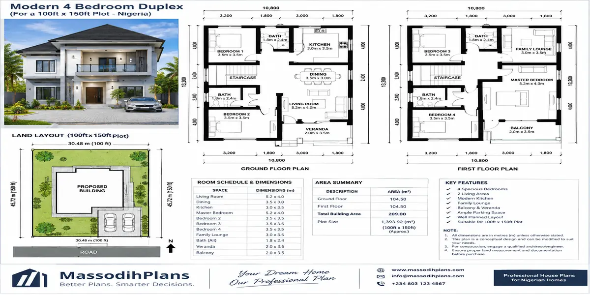
During site analysis assignments in school, we were taught that plot arrangement affects everything from natural light access to emergency vehicle response time. A well-planned layout typically follows these standards:
Consistent minimum plot sizes within each zone to maintain fair land distribution and predictable infrastructure loads
Setbacks respected on all sides, typically a minimum of 3 meters front, 1.5 meters sides, and 3 meters rear for standard residential plots, though this varies by state regulation
Corner plots slightly larger to accommodate additional road frontage exposure
Orientation planned collectively, so that as many plots as possible benefit from favorable sun orientation and natural ventilation, not just individually designed houses fighting the site conditions
Infrastructure Planning: Water, Electricity, and Sewage
In one of our planning studio projects, we learned that infrastructure planning must happen at the same time as land use planning, not after. A common and costly mistake I have witnessed firsthand is infrastructure retrofitting, digging up already-built roads to lay water pipes or electrical cables that should have been planned from the start.
Utilities Planning Checklist
- Water supply source and reticulation network mapped before plot sales begin
- Electrical distribution routes planned alongside road corridors to avoid conflicts
- Sewage and waste management systems designed for the full projected population, not just initial phase occupants
- Utility easements clearly marked on the master plan to prevent future encroachment disputes
Drainage Systems and Flood Control
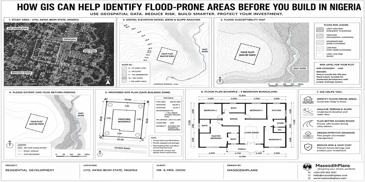
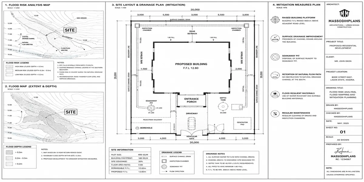
The reality on the ground is often different from what a paper layout suggests. I have reviewed drainage designs that looked perfect on a drawing but completely ignored the natural slope of the land. Before any master plan is finalized, a proper topographical and hydrological study must determine how water naturally moves across the entire site.
Flood Control Principle:
Never build on natural floodplains or block existing drainage channels, even when the land looks dry for most of the year. This single principle, if respected consistently, would prevent the majority of urban flooding disasters seen across Nigerian cities today.
Environmental Management and Climate Responsiveness
A master plan that ignores environmental management is not a master plan at all, it is just a land subdivision exercise. Proper environmental management within a master plan includes:
- Protecting existing wetlands and natural drainage corridors rather than filling them for development
- Preserving green spaces and tree cover to manage heat and improve air quality
- Planning waste management systems that prevent solid waste accumulation and water contamination
- Designing with Nigeria’s climate in mind, orienting road networks and open spaces to support natural ventilation across the settlement, not just individual buildings
Population Projections and Urban Growth Strategy
This principle formed a major part of our coursework: planners must design a master plan for the population the area will have in 15 to 25 years, not just the population it has today. In practical terms, skipping this step usually overwhelms infrastructure within a few years of completion. Roads that adequately served the community at launch quickly become congested, while schools that accommodated the initial population can no longer meet the needs of the growing community.
Smart Growth Concepts Worth Adopting
Phased development: building infrastructure in stages that match actual population growth, rather than committing all resources to a single phase
Compact, mixed-use design: reducing the distance between homes, workplaces, and daily needs, which also reduces transportation costs for residents
Reserved land for future expansion: setting aside a percentage of land specifically for future public facilities before demand forces reactive, poorly planned expansion
GIS and Mapping Integration
My internship experience reinforced the importance of accurate data in planning. Modern master planning increasingly relies on Geographic Information Systems (GIS) to map topography, existing land use, flood risk zones, and infrastructure networks before any layout decisions are finalized. While assisting with development control activities, I saw firsthand how layouts approved without proper GIS-based site analysis often ran into conflicts with existing drainage paths or utility corridors that were not visible on a simple hand-drawn plan.
Development Control and the Planning Approval Process
One challenge I repeatedly encountered during my internship was helping developers understand that development control is not bureaucratic obstruction, it is the mechanism that keeps an entire community’s master plan intact over time. Without consistent enforcement, even the best master plan on paper eventually degrades into the same haphazard growth it was designed to prevent.
A Realistic Approval Process Overview
- Site survey and feasibility study, including soil, topography, and drainage assessment
- Preparation of a draft layout showing land use distribution, zoning, and circulation
- Submission to the relevant state Development Control Department for review
- Public and stakeholder input, where required, to align the plan with community needs
- Approval, followed by phased implementation and ongoing compliance monitoring
You can learn more about how development control and layout approvals actually work in practice in our Plan School section.
Nigerian Reality Layer: What International Textbooks Often Miss
Power Supply Realities
Any Nigerian master plan must account for unreliable grid power from the start, reserving space for shared transformers, generator zones, or future renewable energy infrastructure within the layout itself.
Unstable Material and Infrastructure Costs
From what I have seen in practice, master plans that assume fixed infrastructure costs over a 15-20 year implementation period often fail to secure adequate funding partway through, as material and construction costs shift significantly in Nigeria’s economic environment. Build cost contingencies into every phase.
Compound and Community Security
Gatehouses, clear sightlines at entrances, and adequate street lighting should be built into the master plan itself, not left to individual property owners to figure out later.
Human Lifestyle Layer: Planning for Real Community Life
Based on projects I have worked on, a master plan succeeds or fails based on whether real people can live comfortably within it:
Children’s safety: residential streets designed to discourage high-speed through-traffic near schools and playgrounds
Community cohesion: public gathering spaces and parks that encourage neighbors to interact, reducing social segregation
Elderly accessibility: gentle road gradients and accessible public facility design where the natural topography allows it
Future family growth: a mix of plot and housing sizes within residential zones, so families are not forced to relocate as their needs change
Construction Experience Layer: Where Master Plans Fail on the Ground
While working on site plans, I noticed that even well-designed master plans can collapse during implementation if certain mistakes are made:
- Selling or allocating plots before infrastructure funding and construction sequencing are secured
- Weak enforcement allowing individual developers to bypass approved setbacks or land use designations
- Ignoring phased development sequencing, trying to build everything at once instead of matching growth
- Failing to update the master plan as actual population growth and land use patterns evolve
If there is one thing I would encourage government agencies and private developers to do, it is to treat the master plan as a living document that gets reviewed periodically, not a one-time drawing that gets filed away and forgotten.
Expert Note:
A master plan is only as strong as its enforcement. Consistent development control, backed by accurate GIS data and periodic review, is what separates thriving planned communities from estates that slowly decay into the same problems they were designed to prevent. Our master planning and layout design services can support both private developers and government agencies through this entire process.
Investment Layer: Why Proper Master Planning Pays Off
Many people assume that master planning slows down investment returns, but my experience suggests otherwise. Well-planned areas consistently attract more serious investment, both from private developers and public infrastructure funding, because they reduce risk and demonstrate long-term viability.
Reduced infrastructure costs: planned growth is significantly cheaper to service than retrofitting infrastructure into unplanned sprawl
Higher property values: areas with functioning roads, drainage, and public facilities consistently command better resale and rental value
Investment attractiveness: government agencies and private investors both favor areas with clear, enforced master plans, since this reduces uncertainty and future dispute risk
Long-term urban investment value: as cities expand, properly planned corridors appreciate more predictably than informal, unplanned growth areas
Mixed-Use Integration and Community Functionality
A situation I encountered illustrates this perfectly: a residential layout with beautiful houses but no nearby market, school, or clinic, forcing residents into long daily commutes for basic needs. A functional community integrates residential, commercial, and institutional uses within reasonable walking or short driving distance, without allowing incompatible uses to conflict with each other. This principle, borrowed from internationally recognized planning practice, applies just as well in a Nigerian context as anywhere else in the world.
Future Expansion: Planning Beyond the First Phase
Having seen the consequences of poor planning, I advise every government agency or developer preparing a master plan to reserve land specifically for future expansion, additional schools, healthcare facilities, and green space, before current demand forces reactive, poorly considered decisions. A master plan designed only for today’s population will fail the community within a decade.
If you are exploring house plans or estate layouts designed to fit properly within a well-planned residential zone, browse our Plans Library for realistic, dimensioned options.
Frequently Asked Questions
What is the difference between a master plan and a layout plan?
A master plan covers the long-term vision for an entire area, including land use, zoning, infrastructure, and growth strategy over 15-25 years. A layout plan is typically a more detailed subdivision of a specific site within that broader master plan framework.
Why do so many Nigerian towns lack a proper master plan?
Weak institutional capacity, inconsistent enforcement, rapid uncoordinated urban growth, and limited land administration coverage have all contributed to many Nigerian settlements developing without adequate master planning.
Can an existing unplanned area still benefit from a master plan?
Yes, though it requires more careful phased intervention, focusing first on critical issues like drainage and road access, since retrofitting infrastructure into existing unplanned areas is more complex than planning undeveloped land from scratch.
How does GIS help in master planning?
GIS mapping provides accurate data on topography, flood risk, existing land use, and infrastructure networks, allowing planners to make evidence-based decisions rather than relying on incomplete manual surveys.
Who enforces master plans and zoning regulations in Nigeria?
Enforcement primarily rests with state government Development Control Departments and physical planning authorities, since urban and regional planning responsibilities in Nigeria are largely administered at the state level.
Final Word From Me to You
Every flooded street, every overcrowded neighborhood, and every conflict between a market and a school that I have encountered in my career traces back to the same root cause: growth without a plan. The good news is that this is entirely preventable. What has worked consistently, both in my own projects and in every properly planned community I have studied, is simple: plan land use and infrastructure together, respect zoning and setbacks, and treat the master plan as a living guide that gets reviewed as the community grows.
If you are a developer, government agency, or community leader ready to plan responsibly, explore dimensioned, realistic house designs suited to properly planned residential zones in our house plans library, or visit our Plan School to understand planning standards and approval processes in more depth. For direct support with master planning, layout design, or development control guidance, our services page outlines how we can help. You can also start from our homepage to see everything we offer.
Town A and Town B started the same. The only difference was a plan. Whichever one your community becomes is still, even now, a choice. Take the time to plan properly, and reach out before the next flood, the next dispute, or the next avoidable mistake happens on the ground. Best Nigerian House Plans for Nigerians Living in the UK, USA and Canada How Much Money Do You Need to Build a House in Nigeria from the UK, USA or Canada? World bank urban development. Modern Nigerian House Plans That Meet International Building Standards.