Land Development Permit Process: Step-by-Step Guide
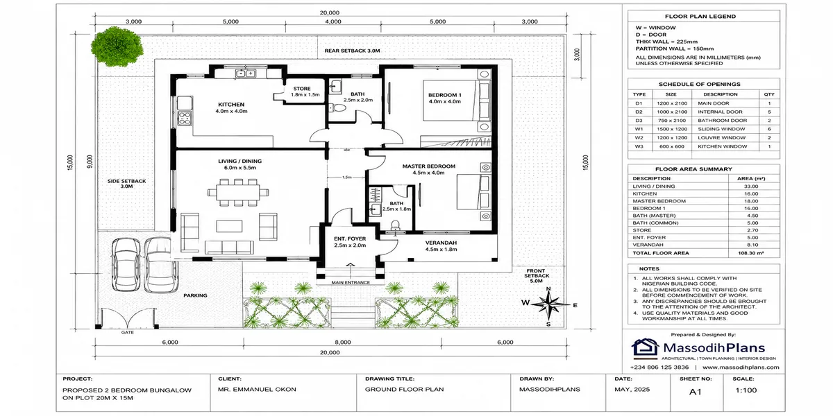
Land Development Guide Permits, Planning, Zoning, Costs and Approval Process Explained
Introduction to Land Development Guide: Permits, Planning, Zoning, Costs and Approval Process Explained
Land development looks straightforward on paper: acquire land, prepare a plan, obtain approvals, develop the site, and eventually build. In practice, that sequence can become complicated very quickly. A developer may have a valid title, an attractive site plan and enough money to start construction, yet still be unable to obtain an individual building permit because a more fundamental land development or subdivision approval has not been completed. Understanding that distinction can save you from costly delays, redesigns, rejected applications and infrastructure problems that may not become obvious until buyers have already taken possession.
Much of what you will find online explains land development through a generic five-stage model: feasibility, design, permitting, construction and closeout. While that framework is useful, it often reflects a US commercial real estate context and does not explain what actually happens between those stages, particularly when land is being subdivided into an estate, residential plots or multiple development parcels. The process can also change considerably from one country, state or planning authority to another.
Having worked with land development and planning matters across Nigerian States, including estate-level subdivisions where individual homeowners later discovered that required infrastructure approvals had not been completed, I approach this guide from the sequencing problem rather than from a generic list of development phases. The key question is not simply “What permits do I need?” but “Which approval has to come first, who grants it, what does it unlock, and what happens if I skip it?”
That is the part many land development guides fail to explain.
In this guide, I will take you through land development from the initial site investigation to planning, zoning, subdivision, infrastructure, permits, costs, approvals and eventual construction, explaining how the pieces fit together and where developers commonly make expensive mistakes. I will also compare the general international development framework with the practical realities you may encounter in Nigeria and other planning systems, so you can understand which principles are universal and which requirements depend on your location.
If you are buying land, subdividing a large parcel, developing an estate, preparing plots for sale or planning to construct on land that has already been divided, don’t skip the approval sequence. The most expensive mistake may not be paying too much for the land. It may be assuming that because you can legally own a parcel, you are automatically free to develop it.
By the end of this guide, you should be able to understand what comes first, what comes next, which approvals are normally required, how zoning affects what you can build, where development costs arise, and why obtaining a building permit may not be the first approval you need.
What Land Development Approval Actually Covers
Before the steps, it’s worth being precise about what this process governs, since it’s often confused with the building permit process covered elsewhere in this guide. A land development permit addresses what happens to the land itself, before any individual structure goes up on it:
- Site clearing, grading, and drainage pattern alterations
- Subdivision of a larger parcel into smaller, separately titled plots
- Road and access infrastructure construction or extension
- Stormwater management systems channels, culverts, retention basins
- Utility infrastructure water, electrical, and sewage lines laid ahead of individual building work
This distinction matters practically: in many jurisdictions, individual building permits for plots within a larger development cannot be approved until the broader land development approval particularly drainage and road infrastructure sign-off is complete.
Step 1: Feasibility Study and Site Assessment
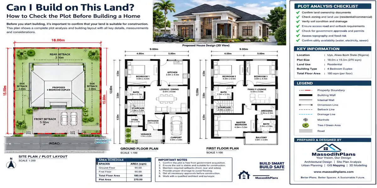
Before committing capital, assess the site’s actual development potential: current zoning classification, topography, soil conditions, existing drainage patterns, flood risk, and access to utility infrastructure. This step should answer one core question honestly does this land, as currently classified and configured, support the development you intend, or will it require rezoning, environmental mitigation, or significant infrastructure investment first?
Step 2: Title and Land Verification
Confirm clean legal title before proceeding further. This means verifying ownership documentation, checking for existing encumbrances, liens, or competing claims, and in jurisdictions like Nigeria where land use rights sit with state governors under frameworks like the Land Use Act confirming the specific consents required to develop or transfer the land legally. Skipping thorough title verification at this stage is one of the most expensive mistakes a developer can make, since problems discovered later can halt a project after significant capital has already been committed.
Step 3: Pre-Application Consultation
Contact the relevant planning or land development authority before submitting anything formally. Most authorities from a US county planning department to a Nigerian state Ministry of Lands and Physical Planning to a UK local planning authority offer some form of pre-application discussion. Use this conversation to confirm zoning compatibility, likely conditions, required studies, and a realistic (not official) processing timeline for a project of your specific scale.
Step 4: Site Surveys and Technical Studies
Commission the technical studies your project will need to support its application:
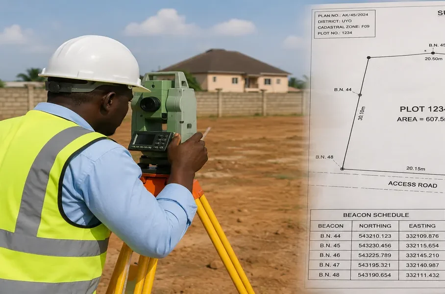
- A registered topographic and boundary survey
- Geotechnical or soil investigation report
- Drainage and stormwater impact assessment
- Environmental impact assessment, where project size or sensitivity triggers this requirement
- Traffic impact assessment, for larger developments affecting surrounding road capacity
These studies inform your engineering design and form part of your eventual submission package commissioning them early avoids redesigning your site plan around findings discovered too late in the process.
Step 5: Engineering and Site Design
With survey and study data in hand, your engineering team designs the actual infrastructure: road layout and access points, drainage and stormwater systems, utility routing, and where the project involves subdivision the specific boundaries and access arrangement for each resulting plot.
Step 6: Subdivision Approval, Where Applicable
If your project involves splitting a larger parcel into multiple separately titled plots, this typically requires its own approval track, distinct from general development approval. Each resulting parcel generally needs its own registered survey and title process before individual buyers or building permit applicants can proceed on it. This step is frequently underestimated in timeline planning subdivision approval can take as long as the rest of the development approval combined.
Step 7: Formal Application Submission
Submit your complete development plan package to the relevant authority: engineering drawings, survey data, technical study reports, and the formal application form. Pay applicable fees, which are typically calculated based on land area, project scale, or estimated infrastructure cost rather than the residential-scale fee schedules covered elsewhere in this guide.
Step 8: Technical and Environmental Review
Your application undergoes review against zoning compliance, drainage and environmental standards, road and infrastructure adequacy, and for larger projects potential impact on surrounding properties and public infrastructure. Expect queries at this stage; respond completely and promptly, since partial or delayed responses are the most common cause of extended review timelines at this step specifically.
Step 9: Public Notification or Consultation, Where Required
Many jurisdictions require some form of public notice or consultation period for land development applications, particularly for larger projects a published notice, direct notification to adjoining landowners, or in some systems, a formal public hearing. Build this period into your project timeline rather than treating it as an unexpected delay.
Step 10: Infrastructure Sign-Off
Before final approval, authorities typically require confirmation that proposed roads, drainage, and utility infrastructure meet minimum development standards sometimes involving separate sign-off from utility providers, road authorities, or environmental agencies distinct from the primary planning body.
Step 11: Approval and Permit Issuance
Once approved, you receive formal land development approval, sometimes bundled with specific conditions a phased construction schedule, a requirement to complete drainage infrastructure before building permits for individual plots are considered, or bonding requirements guaranteeing infrastructure completion.
Step 12: Individual Building Permit Applications Can Now Proceed
This is the step every competing guide I reviewed treats as an afterthought, and it’s often the most consequential for anyone buying into a development rather than leading it: individual building permit applications for plots within your development typically cannot be approved until this entire land development sequence is complete. If you’re a developer selling plots before infrastructure sign-off is finished, be transparent with buyers about this sequencing and if you’re a buyer, confirm this status before purchasing.
Where Land Development Applications Most Commonly Stall
- Step 2 (Title): Undiscovered encumbrances or unclear ownership history surfacing mid-process
- Step 4 (Studies): Commissioning technical studies too late, forcing redesign around findings that should have shaped the original site plan
- Step 6 (Subdivision): Underestimating how long individual parcel titling takes relative to the broader development approval
- Step 8 (Review): Slow or incomplete responses to technical queries, extending review timelines significantly
- Step 10 (Infrastructure sign-off): Treating this as a formality rather than a genuine gate incomplete drainage or road infrastructure is a common reason final approval stalls even after design review clears
How This Process Shifts Internationally
United States: Often runs through a dedicated Environmental Resource Permit (ERP) or equivalent process alongside standard zoning and subdivision review, varying significantly by state and county.
Nigeria: State-level Ministries of Lands and Physical Planning typically require land development or estate layout approval before individual plot building permits are considered, with drainage compliance particularly strictly enforced in flood-prone areas like Akwa Ibom and Rivers States.
United Kingdom: Larger developments typically require outline planning permission before detailed reserved matters applications for individual phases or plots.
Germany: A Bebauungsplan (detailed development plan) may need to be created or amended by the municipality itself before individual building permits within a new development area can be issued sometimes placing the municipality, not just the developer, in the approval sequence.
If you’re purchasing a plot within a larger estate or subdivision rather than leading the development yourself, always confirm in writing, from the relevant planning authority that land development and infrastructure approval for the broader estate is fully complete before assuming your individual building permit application will proceed smoothly.
A Practical Checklist for Developers
☐ Verified clean legal title before committing significant capital
☐ Confirmed zoning compatibility through pre-application consultation
☐ Commissioned survey, geotechnical, drainage, and environmental studies early
☐ Designed infrastructure around actual site data, not assumptions
☐ Confirmed whether subdivision requires a separate approval track and timeline
☐ Submitted a complete application package with all supporting technical studies
☐ Responded to every technical review query completely and promptly
☐ Confirmed infrastructure sign-off status before marketing or selling individual plots
☐ Communicated infrastructure approval status transparently to buyers, where applicable
A Note From Practice
I have handled cases across States in Nigeria where estate developers sold plots to homeowners before completing drainage infrastructure approval, leaving individual buyers unable to secure their own building permits until the broader estate-level issues were resolved in some cases, years after purchase. The lesson for developers is straightforward: sequence your infrastructure approval as the gate it actually is, not a formality to complete alongside sales. The lesson for buyers is equally direct: before purchasing into any development, confirm land development and infrastructure sign-off status in writing, not on a developer’s assurance alone. See plan school, plans library, services and homepage for more insight.
Other Guides to assist you cover everything:
- Building Permit Documents: Complete Checklist of Requirements for Building Approval
- Zoning Laws and Regulations for Property Development: Complete Guide
- Planning Permission and Building Permits for Residential Construction: Complete Guide
- How to Apply for a Building Permit: Requirements, Documents, Costs & Process
- Building Permit Requirements by Country: Complete Global Guide
- House Plans: Complete Guide to Floor Plans, Building Drawings, Home Designs & How to Design a House
- House Plan Selection Guide: How to Choose the Right House Plan for Your Land, Budget and Lifestyle
- Land-Buying Checklist: 100+ Things to Check Before Buying Land in Nigeria
- Building Project Budget Template: Complete House Construction Cost Planner
- Homeowner’s Construction Checklist: 150+ Things to Check Before and During Building
- Building Materials Checklist: 100+ Materials You May Need When Building a House
- Site Analysis Checklist: 50+ Things to Check Before Building on Your Land
- House Planning Checklist: 50+ Essential Things to Check Before Building a House (Complete Guide)
- Building Cost Calculator Nigeria: Estimate Your House Cost in 60 Seconds
Related Guides
- I Don’t Know Which Location to Buy In: How to Choose the Best Location
- I Don’t Know What Type of Property I Should Buy: Here’s How to Actually Decide
- Can’t Find a Property Within Your Budget? Here’s the Part Nobody’s Telling You
- I Don’t Know Where to Find the Right Property in Nigeria | Buyer Guide
- I Need a Real Estate Agent to Help Me Buy a Property in Nigeria Safely
- Property for Sale in Nigeria: The Buyer’s Guide Nobody Publishes Today
- How Do I Get Natural Ventilation? Best Ways to Improve Airflow at Home
- Where Should My House Face? Best Direction for Sun, Wind and Comfort
- I Can’t Understand or Visualize My Floor Plan — Let’s Fix That Right Now
- My Floor Plan Has Poor Circulation: How to Fix It and Improve Flow
- I Don’t Know How to Arrange My Rooms: Here’s How to Actually Figure It Out
- My Rooms Are Too Small: How Big Should Each Room Be in a House?
- I Don’t Know How Big Each Room Should Be: Standard Room Size Guide
- How Much Building Can I Put on My Plot? Building Coverage and Setbacks
- My House Plan Doesn’t Fit My Land: What to Do Before You Build
- I Need a House Plan That Fits My Plot with Exact Dimensions and Layout
- I Don’t Know What House Plan to Build? Here’s How to Decide
Author
Massodih Okon is a Nigerian built-environment professional with academic and professional experience in urban and regional planning, geography, architectural design, Landscape Design, GIS and land development.
He holds a Master’s degree in Urban and Regional Planning from the University of Uyo and a first degree in Geography and Regional Planning.
Through MassodihPlans, he publishes practical guides on Nigerian house plans, building design, physical planning, site planning, development approval and residential construction. Read the full author profile →