How Do I Download GIS Data for Land Use Analysis and Property Planning?
A student sent me a message last month that I want to quote almost exactly, because it’s the question behind everything in this article: “I have QGIS installed, I know how to use it, but I don’t actually have any data to put into it. Where do people even get this stuff from?”
That’s the real problem. Nobody struggles to open QGIS or ArcGIS anymore tutorials for the software itself are everywhere. What almost nobody explains properly is where the actual data comes from, which source is right for which job, which format you’ll be handed, and how to tell if what you downloaded is even trustworthy enough to build a planning decision on. That’s what this article is for not another list of ten random links, but the actual decision-making behind sourcing GIS data for real land use analysis and property planning work, the way I’d walk a student or a client through it directly.
First: Know What You’re Actually Looking For
Before opening a browser, answer three questions, because they determine everything else:
What is the analysis for? a feasibility study for one plot needs very different data from a regional land use plan covering an entire local government area.
What scale do you need? a parcel-level cadastral question and a national land cover question are not solved by the same dataset, even when both are technically “GIS data.”
What format does your software expect? QGIS and ArcGIS both handle Shapefile, GeoJSON, and GeoTIFF, but knowing which one you need before downloading saves you a repeat trip back to the source.
Skipping this step is the single biggest reason people download the wrong dataset, or three overlapping datasets that don’t agree with each other, and then blame “GIS” for being confusing.
Always write down your exact area of interest country, state, LGA, or even just plot coordinates before you start searching. Vague searches return vague, often outdated national-level data; specific searches lead you to the right regional or local source faster.
Understanding GIS Data Formats Before You Download Anything
Every download you’ll do in this guide comes in one of a handful of formats, and knowing what they actually are stops you from downloading something you can’t open.
Shapefile (.shp) the oldest and still most common vector format. Technically a bundle of files (.shp, .shx, .dbf, and others) that must all stay together in the same folder, or the file won’t open properly. This trips up more beginners than any other single issue.
GeoJSON (.geojson) a single, lightweight text-based vector format, popular for web mapping and increasingly for data sharing because it’s easy to preview and edit without specialized software.
GeoTIFF (.tif) the standard raster format, used for satellite imagery, elevation models, and land cover rasters. Each pixel carries a real-world coordinate, which is what makes it “geo.”
KML/KMZ Google Earth’s native format. Useful for quick visual sharing, but generally weaker than Shapefile or GeoJSON for serious analysis.
File Geodatabase (.gdb) Esri’s own format, common on US government portals, and openable in QGIS with the right driver, though slightly less universally convenient than Shapefile or GeoJSON.
For most land use and property planning work, you’ll be handling a mix of vector data (Shapefile or GeoJSON for boundaries, roads, parcels, water bodies) and raster data (GeoTIFF for elevation, satellite imagery, land cover). Knowing this distinction before you download tells you immediately what kind of analysis a dataset can actually support.
How to Download a Shapefile: The General Process
Regardless of which specific source you use later in this guide, downloading a shapefile almost always follows the same pattern:
Identify the exact dataset and geographic extent you need (don’t download an entire country’s data if you only need one state)
Look for a “Download” or “Export” button on the data portal most modern portals let you draw or select your area of interest before downloading, rather than forcing a full dataset
Choose the format select Shapefile specifically if that’s what your software needs, rather than defaulting to whatever format is listed first
Download the file it usually arrives as a .zip folder
Extract the .zip fully into its own folder before trying to open it never try to load a shapefile straight out of a zipped folder
Open it in QGIS or ArcGIS by adding it as a vector layer, and check the coordinate reference system (CRS) immediately a shapefile in the wrong CRS will either fail to align with your other layers or silently misplace everything by a significant distance
Always check a new shapefile’s CRS before combining it with anything else. Nigerian data commonly arrives in either WGS 84 (EPSG:4326) or one of the Nigeria-specific UTM zones (31N/32N/33N) mixing these without reprojecting is the most common reason two correct datasets appear to be in the wrong place relative to each other.
Free GIS Data Download: Where to Actually Start
“Free GIS data” isn’t one place it’s a small set of trustworthy hubs that different specialists rely on for different layers. Below, I’ve organized this by exactly what you’re trying to get, because that’s how the search actually works in practice.
Administrative Boundaries
For country, state, and local government area (LGA) boundaries:
GADM (gadm.org) probably the most widely used free global administrative boundary dataset, covering national, state/provincial, and in many countries, LGA-level boundaries, downloadable directly as Shapefile or GeoPackage
geoBoundaries (geoboundaries.org) an open, academically maintained alternative to GADM, useful when you want boundaries with clearer open licensing for publication or client work
Humanitarian Data Exchange / HDX (data.humdata.org) hosts Nigeria-specific administrative boundary sets, often maintained in coordination with OCHA and national statistical bodies, and generally more current for Nigerian LGA boundaries than global-only sources
Nigeria’s National Bureau of Statistics (NBS) publishes administrative shapefiles tied to census enumeration areas, useful when your analysis needs to connect spatial boundaries to population or socioeconomic data
Roads and Transportation Networks
OpenStreetMap, via Geofabrik (download.geofabrik.de) downloadable regional extracts (Nigeria is available as its own extract) containing road networks, already tagged by road class, which is genuinely useful for transportation and accessibility analysis
HOTOSM Export Tool (export.hotosm.org) lets you draw a custom area of interest and export just roads (or buildings, or waterways) for that exact area, rather than downloading an entire country’s OSM extract when you only need one town
Nigeria’s Federal Ministry of Works and state Ministries of Transportation occasionally publish official road network data for specific projects, though availability and currency vary significantly by state, so OSM-based sources are usually more reliably current for day-to-day planning work
Land Use and Land Cover Data
ESA WorldCover (esa-worldcover.org) a genuinely excellent, free, high-resolution (10m) global land cover dataset, current and regularly cited in academic and professional work
Copernicus Global Land Cover Layers annual global land cover classification, useful for tracking land use change over time rather than a single snapshot
Dynamic World (via Google Earth Engine) a near-real-time land cover classification that updates frequently, useful when you need the most current picture available rather than an annual composite
NASRDA (Nigeria’s National Space Research and Development Agency) has produced Nigeria-specific land use/land cover mapping products over the years, though access and currency vary; worth checking directly for project-specific needs before defaulting to global datasets
Elevation and DEM Data
SRTM (Shuttle Radar Topography Mission), available through USGS EarthExplorer or the simplified download tool at dwtkns.com/srtm the most widely used free global elevation dataset, 30m resolution, genuinely sufficient for most drainage, slope, and site suitability analysis at the property or neighbourhood scale
Copernicus DEM (via OpenTopography or Copernicus Data Space) a newer, generally more accurate global elevation dataset than SRTM in many regions, worth comparing against SRTM if your analysis is elevation-sensitive
OpenTopography (opentopography.org) a genuinely useful portal that lets you clip elevation data to a custom area rather than downloading oversized global tiles
Drainage and Water Bodies
HydroSHEDS (hydrosheds.org) free global river networks, watershed boundaries, and drainage direction data derived from elevation models, essential for any flood or drainage-related analysis
OpenStreetMap water layers waterways and water bodies are tagged within standard OSM extracts, and are often more current at the local scale than global hydrology datasets for smaller streams and drainage channels
NIHSA (Nigeria Hydrological Services Agency) Nigeria’s official body for hydrological data, worth contacting directly for project-specific flood and river-level data that isn’t available through open global portals
Flood-Risk Data
This is one of the most requested and least well-organized categories, so here’s exactly what exists:
JRC Global Flood Hazard Maps (European Commission’s Joint Research Centre) free, global flood hazard layers at different return periods (1-in-100-year, 1-in-500-year, etc.), a genuinely strong starting point for site-level flood risk screening
Global Flood Database (Cloud to Street / Google Earth Engine) maps actual historical flood extents from satellite imagery, useful for validating modeled flood risk against what has actually happened on the ground
NEMA (National Emergency Management Agency) and state emergency management agencies hold historical flood incident records for Nigeria, which, while not always in ready-to-use GIS format, are worth requesting directly when a project’s flood risk assessment needs local historical grounding rather than only modeled global data
Never rely on a single flood-risk dataset for a real property decision. Cross-check a modeled hazard map (like JRC) against actual historical flood extent (like Global Flood Database) and, where possible, local resident or community knowledge of past flooding the combination is far more reliable than any one source alone.
Cadastral and Property-Related Data
This is the category with the biggest honest gap in Nigeria, and I’d rather tell you that plainly than pretend otherwise. Open, downloadable cadastral (parcel-level property) data is not freely and comprehensively available for most of Nigeria the way it is in, say, the US or parts of Europe. What actually exists:
OSGoF (Office of the Surveyor General of the Federation) the national custodian of cadastral and geodetic data; access to specific parcel data typically requires a formal request rather than open download
State Geographic Information Systems agencies (Lagos State’s LASGIS, for example, and similar agencies in other states) hold state-level cadastral and land registry data, generally accessible through direct application rather than open portals
OpenStreetMap building footprints not true cadastral data, but a genuinely useful free proxy for building footprint and plot outline analysis when official cadastral data isn’t accessible for your area
Overture Maps Foundation (overturemaps.org) a newer, genuinely promising open building footprint dataset with growing global coverage, worth checking for property-adjacent analysis where formal cadastral access isn’t feasible
Be honest with clients about this limitation upfront promising parcel-perfect open cadastral data for a Nigerian LGA when it doesn’t exist openly is how planning credibility gets damaged.
Satellite Imagery
Copernicus Data Space Ecosystem (dataspace.copernicus.eu) free access to Sentinel-2 imagery (10m resolution, revisited every 5 days), genuinely strong for land use monitoring and change detection
USGS EarthExplorer (earthexplorer.usgs.gov) the primary free source for Landsat imagery (30m resolution, decades of historical archive) and also hosts SRTM elevation data in the same portal
Google Earth Engine not a simple download portal, but a genuinely powerful free platform for anyone comfortable with basic scripting, giving access to a huge catalog of satellite imagery and pre-built analysis tools without needing to store the raw imagery yourself
NASA Earthdata (earthdata.nasa.gov) a broader catalog beyond Landsat, including MODIS and other sensors useful for environmental and land cover monitoring at different resolutions
For high-resolution imagery beyond what these free sources offer (sub-metre resolution), commercial providers like Maxar or Planet are the realistic option free sources top out around 10m resolution, which is genuinely sufficient for most land use and regional planning work, but not for parcel-level visual detail.
Planning and Development Datasets
GRID3 (grid3.org) produces genuinely excellent, Nigeria-focused population, settlement, and infrastructure datasets, developed specifically for planning and development use cases across Nigeria and other countries; this is one of the strongest and most under-used sources for Nigerian planning work
WorldPop (worldpop.org) free gridded population estimates at fine spatial resolution, useful for density analysis that official census boundaries alone can’t give you
Humanitarian Data Exchange (data.humdata.org) beyond boundaries, hosts a wide range of Nigeria-specific development, infrastructure, and demographic datasets contributed by NGOs, UN agencies, and government partners
Nigeria-Specific GIS Data Sources: A Consolidated List
Pulling together everything above, plus a few additional Nigeria-specific resources worth knowing:
- NASRDA — national land use, land cover, and remote sensing products
- OSGoF — national cadastral and geodetic data (request-based access)
- NBS — administrative and census-linked boundary data
- NIHSA — hydrological and river data
- GRID3 — population, settlement, and infrastructure data purpose-built for Nigerian planning
- State GIS agencies (LASGIS in Lagos and equivalents in other states) state-level cadastral, land use, and planning data
- HDX Nigeria country page a genuinely useful single hub aggregating many of the above, contributed by multiple agencies and NGOs
Nigerian government data portals vary significantly in how current they keep their published datasets. Always check a dataset’s stated publication or last-update date before relying on it for a live planning decision a land use map from 2015 tells you very little about ground conditions on a rapidly urbanizing plot today.
Global GIS Data Sources: A Consolidated List
For projects outside Nigeria, or for the global layers (elevation, imagery, boundaries) that underpin most analysis regardless of country:
- GADM and geoBoundaries global administrative boundaries
- Natural Earth (naturalearthdata.com) simplified global boundaries, coastlines, and physical features, particularly good for cartographic/reference maps rather than detailed analysis
- USGS EarthExplorer Landsat imagery and SRTM elevation
- Copernicus Data Space Ecosystem Sentinel satellite imagery
- OpenTopography clipped elevation data downloads
- HydroSHEDS global rivers and watersheds
- ESA WorldCover and Copernicus Global Land Cover global land cover
- Geofabrik and HOTOSM Export Tool OpenStreetMap extracts (roads, buildings, waterways) for any country
- WorldPop global gridded population
- Overture Maps Foundation open global building footprints
QGIS-Compatible Downloads: What to Actually Check Before You Download
QGIS opens Shapefile, GeoJSON, GeoTIFF, GeoPackage, and File Geodatabase natively, so compatibility is rarely the real issue currency and completeness usually are. A few habits that save real time:
Prefer GeoPackage (.gpkg) over Shapefile when a source offers both it’s a single file (no risk of losing a companion .dbf or .shx), handles larger datasets better, and avoids Shapefile’s old 2GB size limit and 10-character field name restriction
Use the QuickMapServices QGIS plugin to add basemaps (satellite, OSM) directly inside QGIS without a separate download, useful for visual reference while you work with your downloaded analytical layers
Use the QuickOSM QGIS plugin to pull specific OpenStreetMap features (roads, buildings, water) directly into QGIS by tag, without needing to download and clip a full regional extract first genuinely one of the most time-saving tools for property-scale work
How to Check Whether GIS Data Is Accurate and Current
This is the step almost every “where to download GIS data” article skips entirely, and it’s the one that actually protects your professional credibility.
1. Check the Metadata, Not Just the Map
Every legitimate dataset should come with metadata stating its source, date of creation or last update, coordinate system, and intended scale of use. If a download has no metadata at all, treat it as a red flag rather than a convenience.
2. Check the Publication Date Against Your Need
A land use dataset from five years ago is not “current” for a rapidly urbanizing area, even if it was excellent when published. Always match the dataset’s age to how fast conditions actually change in your specific area of interest.
3. Check the Stated Resolution or Scale
A 30m-resolution global land cover dataset cannot answer a question that needs parcel-level accuracy this isn’t a flaw in the dataset, it’s a mismatch between the data’s intended use and your question. Always confirm resolution against the scale of decision you’re actually making.
4. Cross-Check Against a Second, Independent Source
Where a decision genuinely matters (site suitability, flood risk, boundary disputes), never rely on a single dataset alone. Overlay it against at least one independent source a different agency’s boundary file, a more recent satellite image, or ground-truth knowledge from someone who actually knows the site before treating it as fact.
5. Ground-Truth Where the Stakes Are High
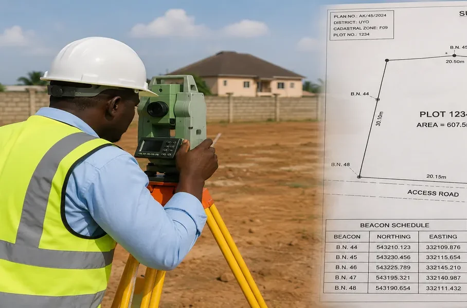
For property and land use decisions with real financial or legal consequences, a site visit, a local surveyor’s confirmation, or direct verification against a recent satellite image is not optional extra diligence it’s the step that separates defensible professional analysis from a pretty map that turns out to be wrong.
Before presenting any GIS-based analysis to a client, be able to answer three questions yourself: where did each layer come from, how old is it, and what happens to my conclusion if that layer turns out to be slightly wrong. If you can’t answer all three, the analysis isn’t ready to present yet.
Extra Layers Worth Knowing About (That Most Guides Never Mention)
A few additional data categories genuinely relevant to land use and property planning that rarely make it into standard “download GIS data” articles:
Soil data — via FAO’s Harmonized World Soil Database, relevant for foundation suitability and agricultural land use decisions
Night-time lights data — via NASA’s VIIRS/Black Marble products, a genuinely useful proxy for informal urban growth and settlement density where official data lags behind actual development
Protected areas and conservation zones — via the World Database on Protected Areas (protectedplanet.net), essential to check before any land use change near forest reserves or conservation land
Geology data — Nigeria’s Geological Survey Agency data, relevant for foundation and construction suitability studies alongside standard soil tests
Climate and rainfall data — via WorldClim or Nigeria’s NiMet, relevant for drainage design and flood risk beyond just topography
Coastal erosion and shoreline change data — increasingly relevant for Nigeria’s coastal states, available through some academic and NASRDA-linked research datasets, worth actively seeking out for coastal property planning rather than assuming standard elevation data covers this adequately
A Practical Walkthrough: Using This for Real Property Planning
Say you’re assessing a plot for residential development. A realistic data-gathering sequence looks like this:
Pull the administrative boundary (GADM or HDX) to confirm the LGA and any relevant planning jurisdiction
Download an SRTM or Copernicus DEM clipped to the site and immediate surroundings to check slope and drainage direction
Pull HydroSHEDS or OSM water layers to identify nearby watercourses and drainage paths
Check JRC flood hazard data and cross-reference against Global Flood Database historical extents for flood risk screening
Pull the latest available Sentinel-2 imagery (Copernicus Data Space) to visually confirm current ground conditions against any older land use dataset
Check OSM or Geofabrik road data to assess access and connectivity
Attempt to access state GIS agency or OSGoF cadastral data for formal boundary confirmation, and fall back to OSM building footprints or a site survey if that access isn’t available
Ground-truth everything with an actual site visit before finalizing any recommendation
This sequence not any single dataset is what a genuinely defensible land use or property planning analysis actually looks like.
Frequently Asked Questions
Is GIS data really free, or is there always a hidden cost?
Much of the data covered here GADM, OSM extracts, SRTM, Sentinel imagery, ESA WorldCover is genuinely free with no licensing cost, though some require free account registration (USGS EarthExplorer and Copernicus Data Space, for example) before download.
Why does my downloaded shapefile fail to open in QGIS?
Almost always because the .zip wasn’t fully extracted, or one of the companion files (.shx, .dbf) got separated from the .shp file. Extract everything into one folder and load the .shp from there.
What’s the best format for property and cadastral analysis specifically?
GeoPackage or Shapefile for parcel boundaries, since these preserve precise vector geometry; GeoTIFF only becomes relevant if you’re overlaying imagery or elevation context behind the parcel data.
Is free satellite imagery good enough for real property planning work?
For land use, regional planning, and site context, yes Sentinel-2’s 10m resolution is genuinely sufficient. For fine visual detail on an individual building or plot, you’ll need commercial high-resolution imagery instead.
Where do I get cadastral (parcel-level) data for a specific Nigerian state?
Start with that state’s GIS or land bureau agency directly, since open, comprehensive cadastral downloads are not yet widely available for most Nigerian states OSM building footprints are a reasonable free proxy where official access isn’t possible.
Finally
Knowing GIS software was never the hard part knowing where the right data actually lives, in the right format, at a resolution that matches your actual question, is. Treat every download the way you’d treat a site report from a colleague you don’t know yet: check its date, check its source, and confirm it against something else before you build a real decision on it. That habit matters more than any single source on this list.
If you’re working on a specific site plan or land use question and want direct support pulling this together properly, our Services page outlines how we assist with planning and GIS-informed site analysis. Browse our Plans Library for building plans developed with real site-context data in mind, or visit Plan School to build your foundation in reading plans, layouts, and planning data together. You can also explore more planning and GIS guides on our Homepage.
- Where Can I Get GIS Data for Land Use, Property Mapping and Urban Planning?
- How Do I Use QGIS for Site Planning and Land Analysis in Urban Development?
- How Do I Use ArcGIS? A Practical Guide for Urban Planning and Site Analysis
- How Do I Use GIS? A Real Guide to Urban Planning, Property and Site Mapping
- How Do I Make a Map? Step-by-Step GIS Mapping for Urban Planning and Design
- How Do I Create a Shapefile for GIS Land Use Planning and Property Mapping?
Author
Massodih Okon is a Nigerian built-environment professional with academic and professional experience in urban and regional planning, geography, architectural design, Landscape Design, GIS and land development.
He holds a Master’s degree in Urban and Regional Planning from the University of Uyo and a first degree in Geography and Regional Planning.
Through MassodihPlans, he publishes practical guides on Nigerian house plans, building design, physical planning, site planning, development approval and residential construction. Read the full author profile →