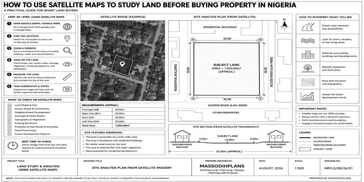
Can’t Read Your Survey Plan? Here’s What Every Symbol and Number Really Means
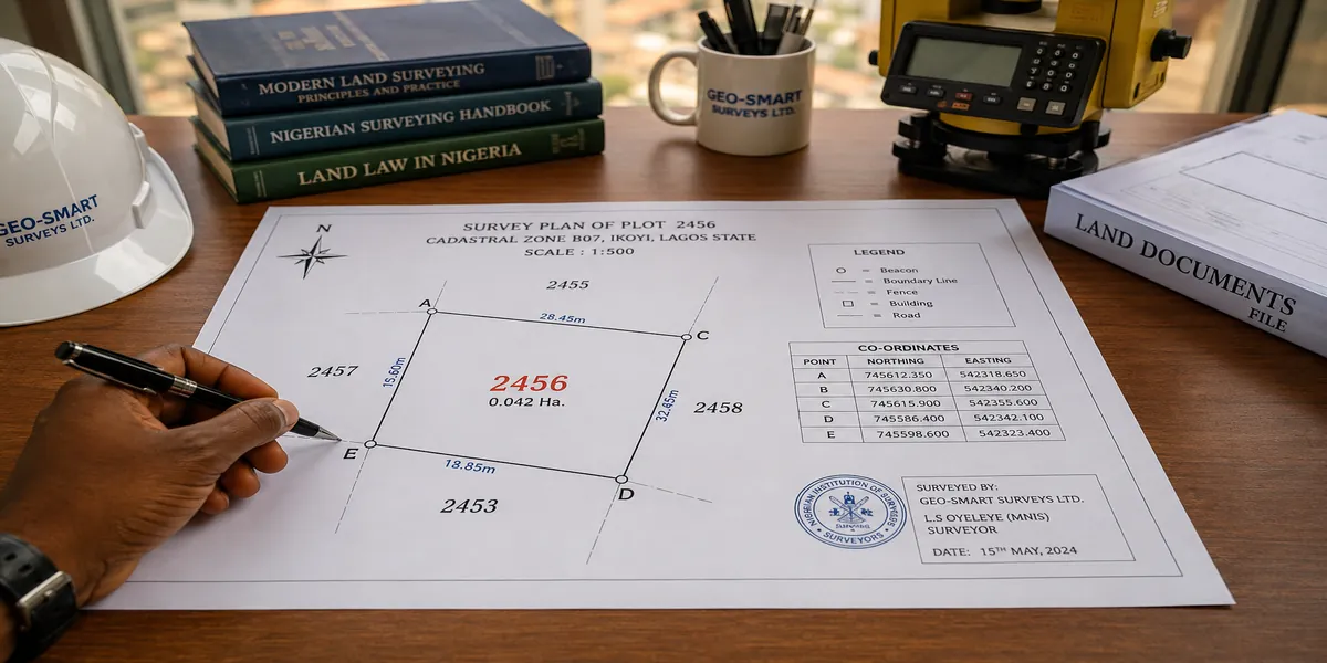
Survey Plan Symbols and Numbers Explained in Nigeria: A Complete Guide for Land Buyers
Every symbol, number, and code on a Nigerian survey plan has a specific meaning, and understanding them is what separates a buyer who can genuinely verify their land from one who is simply trusting a piece of paper. In short: the survey number identifies and registers the plan, the coordinates fix each corner’s exact position on earth, the bearings and distances describe each boundary line, and the beacon symbols mark where those lines physically meet on the ground. Read together, these elements tell you precisely what you are buying — and just as importantly, they let you catch inconsistencies before you pay. I have seen this mistake repeatedly: buyers who hold a survey plan in their hands for months without ever understanding what half of it actually says.
This guide breaks down every major symbol and number you’ll encounter on a Nigerian survey plan, explains what each one is protecting you from, and shows you how to use that knowledge to catch fraud, boundary errors, or acquisition problems before they cost you.
Why Understanding Survey Plan Symbols Matters
During my internship, I observed that most land disputes don’t start with dramatic fraud — they start with buyers who never learned to read the basic information already sitting in front of them. A survey plan is not decoration; it is a technical record that, once understood, lets an ordinary buyer independently confirm whether a plot matches what’s being sold.
The Survey Number: Your Plan’s Fingerprint
Every registered survey plan carries a unique survey number, assigned and recorded by the state Surveyor-General’s office. This number is what allows independent verification you can present it at the Surveyor-General’s office and confirm that the plan genuinely exists in official records, matches the land in question, and hasn’t been altered or duplicated.
Coordinates: Fixing Your Land on the Map
Coordinates are numerical values (usually Easting and Northing figures, or GPS latitude/longitude in modern surveys) that pinpoint the exact position of each corner beacon on the earth’s surface. Unlike a rough sketch or verbal description, coordinates cannot be casually altered without the change being detectable when checked against physical beacon positions.
How to Use Coordinates as a Buyer
- Request that a licensed surveyor confirm coordinates match physical beacons on-site
- Compare coordinates against neighbouring plans to check for overlaps
- Be suspicious of round, oddly convenient-looking coordinate figures with no clear derivation
Bearings and Distances: Reading the Boundary Lines
Bearings describe the compass direction of each boundary line (often written in degrees, minutes, and seconds), while distances describe the length of that line, usually in metres. Together, moving from one beacon to the next, bearings and distances let a surveyor “walk” the boundary of a plot purely from the paper record and let you confirm that the actual shape of the land on the ground matches the shape described on the plan.
| Symbol/Term | What It Means | Why It Matters to You |
|---|---|---|
| Survey Number | Unique registered plan reference | Confirms the plan is genuine and registered |
| Coordinates (E, N) | Exact position of each beacon | Lets you verify beacons match the plan |
| Bearing | Compass direction of a boundary line | Confirms the correct shape/orientation of the plot |
| Distance | Length of a boundary line | Confirms plot size matches what’s claimed |
| Beacon symbol (usually a small circle or triangle) | Physical marker position | Shows where corners should be found on-site |
| Scale | Ratio of drawing size to real size | Lets you calculate real-world dimensions from the drawing |
| North arrow | Orientation reference | Confirms correct alignment of the plan |
| Parcel/Plot number | Identifies the specific plot within a layout | Matches the plan to the correct plot in a larger estate |
Beacon Symbols and Placement
Beacon symbols on a survey plan (typically small circles, triangles, or dots at each corner) represent the physical concrete or metal markers placed on the land itself. While working on site plans, I noticed that buyers who never cross-check beacon symbols against actual markers on the ground are the ones most likely to discover after building has started that a boundary sits in a different place than they assumed.
Verification Steps for Beacons
- Request a copy of the survey plan showing beacon numbers
- Walk the site with a licensed surveyor to physically locate each beacon
- Confirm beacon numbers on the ground match the numbers on the plan
- Flag any missing, shifted, or unmarked beacons immediately
Parcel Identification and Layout Numbers
Where land forms part of a larger estate or layout, the survey plan will include a parcel or plot number identifying the specific plot within that broader development. This is essential in estate purchases, where multiple plots share similar-looking documentation confirming your specific parcel number prevents confusion with a neighbouring plot.
How These Symbols Connect to Ownership Verification
One lesson I learned early is that a technically accurate survey plan still does not, by itself, prove ownership. Understanding the symbols helps you verify that the land matches the document but you still need to separately confirm the seller’s legal title through a deed of assignment, C of O, or other title document, and check the land’s registration status at the relevant land registry.
Government Acquisition Clues Hidden in a Survey Plan
In my experience, updated survey plans sometimes carry annotations or references indicating that a plot falls within a government acquisition, committed acquisition, or global acquisition area, or that it has been excised and gazetted for private allocation. Older plans, however, may not reflect acquisition changes that happened after the plan was first drawn.
| Term | What to Check |
|---|---|
| Government Acquisition | Confirm current status at the Ministry of Lands, not just the plan |
| Excision | Verify a gazette has been published releasing the land for private allocation |
| Free Area | Request written confirmation from the relevant land authority |
Fraud Warning Signs Hidden in Symbols and Numbers
This is not just theory. I have seen it happen: fraudulent plans with survey numbers that don’t exist in any official register, coordinates copied from a different, legitimate plan, or beacon symbols added to match a description that has no physical counterpart on-site.
Red Flags to Watch For
- Survey number that returns no match at the Surveyor-General’s office
- Coordinates identical to another plan you’ve seen for a different plot
- Missing north arrow, scale, or parcel number signs of a rushed or fabricated document
- Beacon symbols with no corresponding markers found during a site visit
- Photocopied plans with no verifiable original on file
How Survey Plan Details Feed Into Building Approval
During field inspections, I discovered that planning authorities rely heavily on the accuracy of coordinates, bearings, and distances when reviewing building approval applications. Errors or mismatches in these figures even minor ones can delay setback compliance checks and site plan approval for architectural drawings.
Modern Tools That Make Symbols Easier to Verify
GPS surveying, GIS mapping, and increasingly drone-based digital surveys have made it far easier for buyers and surveyors to independently confirm coordinates and beacon positions without relying purely on paper documents. Based on projects I have worked on, digital verification tools significantly reduce the room for manipulated coordinates to go unnoticed.
Practical Checklist: Reading Your Survey Plan Before You Buy
- ✔ Confirm the survey number at the Surveyor-General’s office
- ✔ Match coordinates to physical beacon positions on-site
- ✔ Check bearings and distances form a closed, logical boundary shape
- ✔ Confirm the parcel/plot number matches the specific plot you’re buying
- ✔ Verify the scale and calculate real dimensions independently
- ✔ Check for acquisition annotations, and confirm current status separately with the Ministry of Lands
Frequently Asked Questions
What is the most important number on a survey plan?
The survey number, since it’s the reference used to verify the plan’s authenticity and registration at the Surveyor-General’s office.
Can I verify coordinates without a surveyor?
You can review the figures yourself, but physically confirming that coordinates match real beacon positions on the ground requires a licensed surveyor with proper equipment.
What does it mean if a survey plan has no north arrow or scale?
It may indicate an incomplete, outdated, or improperly prepared document. Genuine registered plans typically include both.
Do symbols differ between states in Nigeria?
Core elements (coordinates, bearings, beacon symbols) follow the same general surveying standards nationally, though formatting and specific annotations can vary slightly by state Surveyor-General practice.
Common Mistakes Buyers Make
- Never learning to read basic symbols before signing a purchase agreement
- Trusting a survey plan without verifying the survey number officially
- Ignoring mismatches between coordinates and physical beacon positions
- Overlooking missing scale, north arrow, or parcel number details
- Assuming acquisition status hasn’t changed since the plan was drawn
Quick Summary
A survey plan’s symbols and numbers survey number, coordinates, bearings, distances, beacon marks, scale, and parcel identification together describe exactly what land you’re buying and where it sits. Learning to read them, and independently verifying them at the Surveyor-General’s office and on-site, is one of the simplest ways to protect yourself from fraud, boundary disputes, and costly mistakes.
Conclusion: Read Before You Sign
A survey plan you can’t read is a document you’re trusting blindly. Take the time to understand the numbers and symbols in front of you, verify them independently, and involve a licensed surveyor for physical confirmation before any money changes hands. This is not just theory it is the practical habit that protects buyers who take land investment seriously.
For further guidance, explore our Plans Library for verified architectural designs, our Plan School for step-by-step land and building education, and our Services page for professional survey and verification support. Return to our homepage for more trusted guidance on Nigerian land and building matters.
External reference: LawNigeria — Land Use Act resources
- Lost Survey Beacon in Nigeria: What to Do, Replacement Cost, and Legal Process
- How to Verify Land Ownership Using GIS and Survey Records
- How to Read a Survey Plan in Nigeria Without Hiring an Expert
- Survey Plan Cost in Nigeria: Fees, Process and Hidden Expenses
- What Is a Survey Plan and Why Do Property Owners in Nigeria Need One?
- Town Planning Services: Plans, Permits and Land Development
- Modern Nigerian House Plans That Meet International Building Standards
- Modern Nigerian House Plans That Meet International Building Standards
- Survey Plan vs Deed of Assignment in Nigeria: The Complete Difference Explained
- Nigerian Building Approval Checklist for Overseas Property Owners
- Cost of Roofing a House in Uyo: Current Prices Explained
- 25 Narrow PLot House Plans That Maximize Every Inch of Your Plot
- Cost of Building a House in Uyo: Honest Budget Guide for Property Owners
- Current Cost of Building a House in Port Harcourt (Professional Analysis)
- Modern Nigerian House Plans That Meet International Building Standards
- Estate Layout Design in Nigeria: International Planning Principles That Actually Work
- How Many Blocks Are Needed to Build a 3-Bedroom House? Complete Block Calculator & Quantity Guide