“I Almost Bought Committed Land: Here Is What a Survey Plan Would Have Saved Me”
A SURCON-registered surveyor places a permanent beacon at a boundary corner, the physical marker that defines your land in law and in fact
Introduction
If you are asking what a survey plan costs in Nigeria, here is the direct answer: a residential plot survey typically costs between ₦80,000 and ₦300,000 depending on your state, the size of the land, and the licensed surveyor you engage. For larger parcels and estate surveys, costs run from ₦300,000 to several million naira. But the fee is not the real story.
The real story is what happens when you buy land without one.
Over more than 15 years of my professional work across Akwa Ibom, Rivers, Cross River, Lagos, and Abuja, I have worked alongside licensed surveyors on layouts, site plans, and development approvals. I have sat with clients who lost everything because they bought land with a fake survey plan. I have stood on plots where beacons were missing, boundaries were disputed, and families were fighting over land that was already committed to government acquisition decades before.
A survey plan is not just a document. It is your legal proof that a piece of land exists exactly where the seller says it does with the dimensions they claimed, within boundaries that can be physically verified, and free from the clouds that make Nigerian land transactions so dangerous.
This article will tell you exactly what a survey plan costs, what the process involves, what hidden expenses most buyers never see coming, and how to protect yourself from the land fraud that has swallowed the savings of thousands of Nigerians.
What Is a Survey Plan?
A survey plan is an official technical drawing prepared by a licensed surveyor that accurately shows the shape, size, location, and boundary of a piece of land. It is produced from physical measurements taken on the ground using surveying instruments and, in modern practice, GPS and GIS technology.
Every survey plan contains specific technical information:
Core Components of a Survey Plan:
- The plot number or parcel identification the unique reference that identifies that land within the government land registry
- Coordinates GPS or grid coordinates of each corner point of the land
- Bearings and distances the precise direction and length of each boundary line
- Beacon information the physical reference markers placed at boundary corners
- The survey number assigned when the plan is filed with the state surveyor-general’s office
- The surveyor’s details and seal the licensed surveyor’s name, registration number, and professional stamp
- The plan scale and north orientation showing how the drawing relates to actual dimensions on ground
- Adjacent landowners or roads showing what surrounds the plot on each side
- Total land area expressed in square metres, hectares, or square feet
One lesson I learned early is that many people confuse a survey plan with a title document. They are not the same thing. A survey plan defines the physical land. A title document Certificate of Occupancy (C of O), Deed of Assignment, Governor’s Consent establishes legal ownership. You need both. The survey plan without the title tells you where the land is. The title without a current survey plan tells you someone once owned something somewhere.
Why a Survey Plan Matters More Than Most Buyers Realize
During field inspections, I discovered something that still surprises me when I think about it: a significant number of land buyers in Nigeria have never seen the actual survey plan of the land they purchased. They received a receipt, perhaps a letter of allocation or a deed of assignment, and assumed that was enough.
It is not enough.
Here is why a survey plan matters at every stage of land ownership:
It Confirms the Land Is Where the Seller Says It Is
Land fraud in Nigeria frequently involves a seller showing you one piece of land and presenting documents for a different piece. Without a survey plan that you can independently verify by checking coordinates on the ground you cannot confirm the land described in the document is the land you are standing on.
It Reveals Government Acquisition
This is where I have seen the most heartbreaking losses. A family saves for years, buys a plot in what appears to be a developing area, and years later discovers the land was committed to government acquisition long before they purchased it. The acquisition whether global, partial, or committed should show up in a verification check with the state surveyor-general’s office. But if you never ask for the survey plan and never verify it, you will not know until it is too late.
It Establishes Boundaries Legally
Neighbours move beacons. Family members dispute inherited land. Developers try to encroach on adjacent plots. Without a survey plan showing the precise coordinates and dimensions of your land, you have no technical basis for any boundary dispute. The surveyor’s measured lines are what the court will rely on.
It Is Required for Building Approval
This is something I have encountered multiple times as a town planner: clients who approach me to prepare building plans but have no survey plan for their land. You cannot obtain building plan approval in Nigeria without a survey plan. Every state planning authority requires it. Without it, your building plan application is dead on arrival.
It Protects Mortgage and Finance Applications
Banks and mortgage institutions in Nigeria require an approved survey plan as part of property valuation and title verification. A land investment without a survey plan cannot be used as collateral for finance.
Types of Survey Plans in Nigeria
Not all survey plans are the same. Understanding the type you need and the type you have prevents expensive confusion.
Topographic Survey Plan
Shows the natural features of the land contours, vegetation, water bodies, existing structures. Used for site analysis before layout and building design.
Boundary Survey Plan
The most common type. Defines the exact boundary of a plot or parcel of land, placing beacons at corners and recording coordinates and dimensions.
Cadastral Survey Plan
A formal survey registered with the government cadastral system, assigning an official parcel number to the land and recording it in the state lands registry.
Engineering Survey Plan
Used for infrastructure projects roads, drainage, utilities. Provides the technical data for engineering design.
As-Built Survey Plan
Prepared after construction to document exactly where structures were built in relation to plot boundaries. Required for certificate of completion in many states.
For most Nigerians buying residential land, the boundary survey plan registered with the state surveyor-general is what you need.
Survey Plan Cost in Nigeria: State-by-State Reality
Let me give you the most honest breakdown I can, based on professional experience and information from colleagues across Nigerian states. These are professional surveyor fees only additional costs are discussed separately.
| State | Residential Plot Survey (approx.) | Notes |
|---|---|---|
| Lagos State | ₦150,000 – ₦400,000 | Higher due to demand and land values |
| FCT Abuja | ₦200,000 – ₦500,000 | Complex cadastral system, higher fees |
| Rivers State | ₦100,000 – ₦250,000 | Port Harcourt area typically higher |
| Akwa Ibom State | ₦80,000 – ₦200,000 | Varies by LGA and complexity |
| Cross River State | ₦80,000 – ₦180,000 | Lower demand, lower fee range |
| Delta State | ₦100,000 – ₦250,000 | Oil-region demand affects pricing |
| Ogun State | ₦120,000 – ₦300,000 | High demand near Lagos corridor |
| Enugu State | ₦80,000 – ₦200,000 | Active land market, competitive fees |
| Kano State | ₦70,000 – ₦180,000 | Generally lower fee range |
| Other states | ₦60,000 – ₦200,000 | Wide range by location and access |
Important: These figures are for simple residential plot surveys. Estate surveys, commercial surveys, and surveys in remote or inaccessible areas cost significantly more.
Also note that licensed surveyor fees are regulated by the Surveyors Council of Nigeria (SURCON) through a fee schedule. A surveyor charging far below the regulated scale is a warning sign not a bargain.
What Affects Survey Plan Cost in Nigeria
Many factors push the cost of a survey plan up or down. Understanding them helps you budget accurately and avoid surprises.
1. Size of the Land
Larger land takes more time to survey. More boundary points mean more instrument setups, more data collection, and more drawing work. A 500 square metre residential plot and a 2-hectare estate are completely different exercises.
2. Location and Accessibility
Surveying land in a dense urban area requires navigating tight spaces and confirming urban boundaries. Surveying rural or waterfront land requires more travel, more equipment, and sometimes boat access. Remote land costs more to survey simply because it costs more to reach.
3. Terrain Complexity
Flat, open land is straightforward to survey. Hilly, forested, or waterlogged land requires more work, more time, and sometimes specialized equipment. Coastal land in places like Bonny, Calabar waterfront, or Lagos Island require specific expertise and often higher fees.
4. Number of Beacons Required
Each corner of the land requires a beacon. A rectangular plot has four corners. An irregular plot may have eight, ten, or more corners. Each beacon placement adds to survey time and material cost.
5. State Government Processing Fees
Separate from the surveyor’s professional fee, the state surveyor-general’s office charges filing and processing fees to register the survey and assign an official survey number. These vary by state and are often not included in the surveyor’s quoted fee.
6. Whether the Land Has Been Previously Surveyed
Re-surveying land that already has an existing survey on file is sometimes simpler and cheaper. Surveying virgin land with no existing reference is more work.
7. Urgency
If you need a survey plan processed quickly say, to meet a transaction deadline surveyors typically charge urgency fees. This is not unreasonable. Survey plans require field work, data processing, drawing, and government submission. Compressing that timeline has a cost.
The Hidden Expenses Nobody Warns You About
This is the section I wish existed when I was just starting out. Because in my experience, the quoted surveyor fee is rarely the total cost. Here are the additional expenses that catch landowners off guard.
Government Filing and Registration Fees
After the surveyor prepares your plan, it must be submitted to the state surveyor-general’s office for examination, endorsement, and official filing. The fees for this process sometimes called charting fees, examination fees, or registration fees are charged separately.
In some states, these government charges actually exceed the surveyor’s professional fee. Budget an additional ₦30,000 to ₦200,000 depending on your state.
Transportation and Field Logistics
Getting the survey team to your site, especially for remote land or land requiring multiple visits, involves fuel, vehicle hire, and sometimes accommodation costs. Some surveyors include this in their quote. Many do not. Always ask explicitly.
Beacon Materials
Concrete beacons, iron pins, and survey pegs carry a cost. Most surveyors bundle this into their fee, but some charge separately, particularly if your plot has many corners or if the job requires constructing beacons rather than simply placing them.
Redoing Acquisition Search
Before you can properly rely on any survey plan, you must verify the land against government acquisition records at the state surveyor-general’s office. This process, commonly called an acquisition search, attracts its own fee, typically ₦20,000 to ₦80,000 depending on the state.
This step is not optional. Skipping it is how people end up with a perfectly prepared, professionally stamped survey plan for land that the government has already acquired and that no one can legally buy or sell.
Boundary Dispute Resolution
If the survey reveals a boundary conflict with a neighbouring land claim, resolution may require additional survey work, legal consultation, and sometimes formal arbitration. This can add ₦100,000 to ₦500,000 or more to your total cost.
Document Authentication
If your survey plan needs to be authenticated for mortgage, court, or external institutional purposes, notarization and authentication fees apply.
The Surveying Process: What Actually Happens on Ground
Understanding the process helps you know what you are paying for and what stages should actually happen before you receive a finished survey plan.
Stage 1: Engagement and Briefing
You engage a licensed surveyor registered with SURCON and provide them with available documents about the land: any existing deed, allocation letter, sketch, or previous survey. You agree on scope, fee, and timeline.
Stage 2: Site Reconnaissance
Before formal measurement begins, the surveyor visits the site to assess conditions, identify existing boundary markers, and plan the survey approach. During my internship, I observed that experienced surveyors spend considerable time at this stage and it shows in the quality of the final plan.
Stage 3: Field Measurement
The survey team visits the site with instruments. Modern surveys use Total Stations (electronic theodolites combined with distance measurement), GPS receivers, and in advanced cases, drone surveying for large areas. The team measures each boundary line its direction (bearing) and its length (distance) from every corner of the land.
Beacons are placed or confirmed at each corner. These are permanent physical markers typically concrete pillars with iron pins that define the boundary corners in the physical world.
Stage 4: Data Processing
The field measurements are processed using specialist survey software. The raw data is converted into coordinates, areas are calculated, and error checks are performed. A properly processed survey should close meaning the mathematical computation of the boundary lines should bring you back to the starting point within an acceptable tolerance.
Stage 5: Plan Drafting
The processed data is used to produce the formal survey plan drawing. This includes the boundary lines, coordinates, bearings, distances, beacon information, plot number, scale, north point, adjacent features, and the surveyor’s details and seal.
Stage 6: Government Submission and Registration
The completed survey plan is submitted to the state surveyor-general’s office for examination and official endorsement. The office checks the plan for compliance with standards, searches for conflicts with existing cadastral records, and assigns the official survey number. This is the stage where acquisition conflicts are typically identified.
Stage 7: Collection and Delivery
Once approved and registered, the stamped, sealed survey plan is collected and delivered to you. Always collect the original. Always make certified copies and keep them separately from the original.
Government Acquisition: The Risk That Destroys Investments
I want to spend real time on this because it is the issue I have seen cause the most catastrophic losses.
In Nigeria, government at the federal and state level has the power to acquire land compulsorily for public purposes roads, government buildings, infrastructure, public spaces. When land is acquired, compensation is paid (though this is often disputed in practice) and private ownership rights are extinguished.
The problem is that many acquisitions happened decades ago and the physical land was never taken. The area continued to be occupied, sold, and resold. Buyers had no idea. The acquisition existed only in government records.
There are several types of acquisition status you need to understand:
Global Acquisition
The entire area or community has been acquired by government. No private transaction in this area is legally valid. Yet people buy and sell in globally acquired areas all the time sometimes in complete ignorance, sometimes through deliberate fraud.
Committed Acquisition
The land is scheduled for a specific government project. The acquisition is intended and recorded, even if the physical project has not yet started.
Partial Acquisition
Government has acquired a portion of the land perhaps a strip for a road corridor leaving the remainder available for private use. The survey plan must reflect the acquired portion.
Excision
Land that has been formally released from government acquisition and returned to private or community ownership, as recorded in the official gazette. Excised land is generally safe to transact if the excision is properly documented and gazetted.
Free Area
Land that the government has not acquired. Confirmed free area status carries significant weight in any land due diligence.
This is not just theory. I have seen it happen: a client in Rivers State purchased four plots sitting inside a globally acquired government housing estate area. Community members sold the land without disclosing the acquisition status whether they knew or not. The survey plan looked legitimate. A licensed surveyor prepared it. It carried a survey number. But nobody ran an acquisition search. When the client attempted to process title documents, the acquisition appeared in the records. Years of savings. Gone.
Always do an acquisition search. Always.
Fraud Prevention: How to Spot a Fake Survey Plan
Land fraud in Nigeria is sophisticated. Fraudsters have access to design software. They can produce documents that look convincingly professional. Here is how to protect yourself.
Warning Signs of a Fake Survey Plan
- No survey number Every properly filed survey plan has a unique survey number assigned by the surveyor-general’s office. A plan without one has not been officially registered.
- Unsealed or unsigned A genuine survey plan bears the original seal and signature of the licensed surveyor who prepared it. Photocopied seals or signatures that do not match the registered surveyor’s details are red flags.
- Survey number that cannot be verified You can verify a survey plan by visiting the state surveyor-general’s office and requesting a search using the survey number. If the number does not exist in their records, the plan is fake.
- Coordinates that do not match the location If you have any GPS capability, check that the coordinates stated on the plan correspond to the physical location of the land. Fraudulent plans sometimes lift coordinates from different locations.
- Incorrect surveyor registration number Every licensed surveyor has a SURCON registration number. You can verify whether a surveyor is registered and in good standing by contacting SURCON or visiting their office.
- Beacons missing or recently disturbed On a properly surveyed plot, beacons should be present at each corner. Missing or freshly moved beacons suggest either negligence or deliberate manipulation of boundaries.
- Inconsistent dimensions If the area computed from the stated dimensions does not match the stated total area, something is wrong.
Multiple Sales: The Fraud Nobody Warns You About Loudly Enough
One of the most common forms of land fraud in Nigeria is multiple sales the same piece of land sold to two, three, or even more buyers. Each buyer receives documents that look legitimate. The fraudster collects money from everyone and disappears.
You detect and prevent this through a proper cadastral search at the surveyor-general’s office and an official title search at the lands registry. Run both searches before you pay for any land.
Survey Plans and Building Development: The Direct Connection
As a town planner, I work with survey plans at the building design stage on every project. The connection between your survey plan and your building project is direct and practical.
Building Plan Preparation: Your survey plan serves as the base drawing on which your architect or designer builds your architectural building plan. Your architect or designer lays the proposed building footprint over the exact plot dimensions from the survey. Without an accurate survey, your architect or designer will produce wrong building plan dimensions, and the planning authority will reject any building plan carrying wrong dimensions at the approval stage.
Setback Compliance: Every state’s planning regulations specify minimum setbacks how far your building must sit from each boundary line of your plot. Your surveyor computes these setbacks from the boundary lines shown on your survey plan. If your survey plan carries incorrect dimensions, your setback compliance calculations will produce wrong results.
Plot Utilization: The survey plan tells you exactly what land area you have to work with. Based on projects I have worked on, many clients discover their actual plot dimensions differ from what the seller told them sometimes by a metre or two, sometimes significantly more. An accurate survey protects you from building a structure only to discover it projects beyond your actual boundary.
Site Layout: For estate developers, the survey plan of the overall land parcel is the foundation of the estate layout plan. Layout plans cannot be professionally prepared without an accurate survey.
You can learn more about how survey plans connect to building design in our Plans Library and explore site planning education at Plan School.
GIS and Modern Surveying Technology
Nigerian land surveying is increasingly embracing modern technology, and this affects both cost and quality.
GPS Surveying
Global Positioning System receivers particularly high-accuracy differential GPS instruments allow surveyors to establish coordinates with centimetre-level precision. GPS surveying is faster than traditional traverse methods for large parcels and produces coordinates that are internationally compatible.
GIS Integration
Geographic Information System technology allows surveyors to integrate survey data with satellite imagery, existing cadastral maps, topographic data, and infrastructure databases. GIS-prepared survey plans show not just boundary lines but the full geographic context of the land nearby roads, drainage features, neighbouring parcels, and acquisition zones.
During my work on layout plans, I have found that GIS-integrated survey data dramatically improves the quality of planning outputs. The planner can see how the land sits in its broader context, not just as an isolated parcel.
Drone Surveying
For large estates, surveyors increasingly use drone (unmanned aerial vehicle) technology to capture aerial imagery and topographic data. Drone surveys cover large areas rapidly and produce highly accurate elevation models and orthophoto maps.
Drone survey costs run higher than traditional survey for small plots but offer significant cost and time advantages for large parcels typically above 5 hectares.
Digital Survey Plans
Some states are moving toward digital, GIS-linked survey plans that government databases store and make available electronically for verification. This dramatically reduces the scope for fraud because the government system holds a digital record that no one can easily forge.
Nigerian Reality Layer: What Buying Land Actually Looks Like
Let me tell you what the land-buying experience often looks like in practice, because the theory and the reality are not always the same.
A buyer finds land through a family member or agent. They visit the site. They like it. The seller shows them a bundle of papers perhaps a deed of assignment, perhaps an allocation letter, perhaps something that looks like a survey plan. The buyer, wanting to close the deal before someone else does, pays a deposit.
Then begins the scramble to verify.
This is backwards. Verification should happen before any money changes hands not after. I have encountered this situation multiple times, and what happens is predictable: some of those “survey plans” are photocopies of plans for different land. Some coordinates do not match the land being sold. Some land is in committed acquisition zones.
The correct sequence for buying land in Nigeria:
- Request all documents from the seller survey plan, title document, tax receipts
- Verify the survey plan at the state surveyor-general’s office (acquisition search)
- Verify the title document at the state lands registry
- Engage your own licensed surveyor to confirm boundary beacons on the ground
- Get a legal opinion from a lawyer experienced in land transactions
- Then pay your money
Every shortcut in this sequence is a risk you are taking with your money.
Surveyor’s Practical Layer: What Field Experience Teaches
Working alongside licensed surveyors on field projects has taught me things no textbook covers.
Beacons Get Moved: In dense urban areas especially, I have seen cases where neighbouring landowners or even the original seller move beacons either deliberately to expand their own plot or inadvertently during construction. When you buy land and the beacons no longer sit in their correct positions, you do not own the full land you paid for.
Urban Survey Conditions Are Challenging: In cities like Port Harcourt, Lagos, and Uyo, dense settlements complicate surveying through obstructions, existing structures that encroach on boundary lines, and access disputes. A surveyor who cannot demonstrate experience with urban conditions will produce inaccurate results.
Existing Survey Data May Be Outdated: Land that surveyors last measured twenty years ago may carry coordinate data that no longer aligns with current GPS systems or current cadastral records. Commission a resurvey particularly before any major transaction or development.
Soil Conditions Affect Beacon Stability: In waterlogged or sandy soil common in coastal Nigerian states, concrete beacons can shift over time. Regular verification of beacon positions is good practice for large land holdings.
Land Fraud Prevention Layer: Practical Checklist Before You Pay
Use this checklist on every land transaction. Share it with anyone buying land.
Before Paying:
- Obtain the survey plan from the seller
- Verify the survey number at the state surveyor-general’s office
- Request an official acquisition search on the land
- Confirm the surveyor’s name and registration number with SURCON
- Visit the land physically with a GPS device to check coordinates
- Confirm beacons are present at all stated corners
- Verify the title document at the lands registry
- Engage your own independent lawyer not one recommended by the seller
- Search for any existing court orders, injunctions, or disputes on the land
- Confirm the true identity of the seller personal, family land, or institutional
Red Flags That Should Stop the Transaction:
- Survey number cannot be found in government records
- Seller is unwilling to allow independent verification
- No original title document only photocopies
- Beacons cannot be physically located on the land
- Land dimensions on document do not match physical dimensions
- Seller is rushing you to pay before verification is complete
- Price is significantly below market rate for no clear reason
Investment Protection Layer: Why Survey Verification Multiplies Long-Term Value
A properly surveyed, verified, titled plot of land in Nigeria is a fundamentally different asset from an unverified one.
You can use the verified plot as collateral for mortgage finance. You can sell it without the buyer running into the due diligence problems you already solved. And you can develop it with full building plan approval. It retains value because it is legally clean.
In my experience, the cost of proper verification survey, acquisition search, title search, legal fees adds between ₦100,000 and ₦500,000 to a land purchase depending on state and land size. That is the cost of protection. The alternative discovering a problem after purchase can mean losing the entire purchase price.
If you are spending ₦5 million on land and trying to save ₦150,000 by skipping verification, you are protecting 97 percent of your money with a 3 percent risk reduction. That is not a saving. That is gambling.
Construction Reality Layer: How Survey Errors Cascade Into Building Problems
Based on projects I have worked on, survey errors are one of the leading causes of building plan rejection at the government approval stage and one of the most expensive problems to fix once construction has already started.
Here is what typically happens when a builder constructs on an inaccurate survey:
The architect uses the wrong plot dimensions. He draws the building footprint at the wrong scale relative to the actual boundaries. And he computes the setback calculations how far the building sits from each boundary on incorrect numbers. He submits the building plan for approval. The government reviewer then discovers the inconsistency between the survey dimensions and the architectural plan. He rejects the application.
Worse, sometimes the owner has already started construction when the surveyor’s error surfaces. The structure may have crossed the actual boundary line into neighbouring land, or the builder may have violated setback provisions. At that stage, the authorities order partial demolition.
This is not hypothetical. I have witnessed firsthand how a 0.5-metre error in a survey plan caused a building column to land in what turned out to be a road setback reserve requiring redesign and partial demolition of a structure already at lintel level.
Spend the money on an accurate survey from a competent, registered surveyor. It costs far less than fixing construction errors.
FAQs: Survey Plan Cost in Nigeria
Q: What is the minimum cost of a survey plan in Nigeria?
A: For a simple residential plot in a less urbanized state, a survey plan can cost from around ₦60,000 to ₦80,000 in professional fees. But with government filing charges, transportation, and beacon costs, the realistic minimum for a complete process is closer to ₦100,000 to ₦150,000.
Q: How long does it take to get a survey plan in Nigeria?
A: Field survey work typically takes one to three days for a residential plot. Data processing and drawing take another two to five days. Government submission and approval adds two to eight weeks depending on the state. Total from engagement to collection: three to ten weeks under normal conditions.
Q: Can I use a photocopy of a survey plan?
A: A photocopy can be used for preliminary reference and identity checks, but for legal transactions, building plan applications, and government submissions, you need the original stamped and sealed document. Always insist on the original.
Q: Who can legally prepare a survey plan in Nigeria?
A: Only a licensed surveyor registered with the Surveyors Council of Nigeria (SURCON) can legally prepare and seal a survey plan in Nigeria. Verify any surveyor’s registration number with SURCON before engagement.
Q: Does an old survey plan need to be redone?
A: Not necessarily redone, but it should be verified. Very old plans may reference coordinate systems or datums that have since changed. If you are proceeding with a major transaction or development on land with a decades-old survey, a resurvey or verification exercise is strongly advisable.
Q: What is the difference between a survey plan and a deed of assignment?
A: A survey plan is a technical document showing the physical boundaries and dimensions of the land. A deed of assignment is a legal document transferring ownership from one party to another. They serve different purposes. Both are necessary in a proper land transaction.
Q: Can I verify a survey plan without going to the government office myself?
A: Some states now offer partial online verification services. However, for a thorough acquisition search and cadastral verification, physical attendance or representation by your lawyer or surveyor at the government office remains the most reliable approach.
Q: What happens if I buy land and later discover the survey plan was fake?
A: This is a civil and potentially criminal matter. You may have a legal claim against the seller. But recovery in Nigerian courts is slow and uncertain. The most effective approach is to never reach this situation verify before you pay, every time.
Quick Summary: Survey Plan Cost in Nigeria
| Item | Typical Cost Range |
|---|---|
| Licensed surveyor professional fee | ₦80,000 – ₦400,000 |
| Government filing / charting fees | ₦30,000 – ₦200,000 |
| Acquisition search fee | ₦20,000 – ₦80,000 |
| Transportation and field logistics | ₦10,000 – ₦100,000 |
| Beacon materials | Included or ₦10,000 – ₦50,000 |
| Urgency premium (if applicable) | 20–50% of professional fee |
| Total Realistic Budget | ₦150,000 – ₦830,000+ |
Conclusion: Your Land Is Only as Safe as the Survey That Defines It
I want to be honest with you as I close this article, the same way I am honest with every client I work with.
Nigeria has one of the most complex and fraud-prone land markets in the world. Fraudsters produce sophisticated fake documents. Government agencies rarely publicize acquisition zones. Landowners and authorities dispute boundaries every day. People lose money sometimes life savings not because they were careless but because they did not know what they did not know.
Now you know.
A survey plan is not a luxury for the wealthy or a bureaucratic formality for large developers. It is the foundation of every land transaction, every building project, and every investment in property. It is what separates land you truly own from land you only think you own.
Before you buy any land:
- Demand the survey plan
- Verify it at the state surveyor-general’s office
- Do an acquisition search
- Engage a SURCON-registered surveyor for independent boundary confirmation
- Then and only then pay your money
If you need professional guidance on survey plan verification, land development, building plan preparation, or estate layout design anywhere in Nigeria, MassodihPlans is here to help. We work with clients across Akwa Ibom, Rivers, Cross River, Lagos, Abuja, and other Nigerian states.
Explore our Plans Library for professionally prepared building plans, and visit Plan School to deepen your understanding of the planning and development process before you build.
And if this article helped you share it with someone who is about to buy land. You may be saving them from the most expensive mistake of their life.
Related post, please read
- What Is a Survey Plan and Why Do Property Owners in Nigeria Need One?
- Layout Plan Cost in Nigeria and Abroad: What Every Landowner Must Budget Before Building
- Smart Ways to Reduce Building Costs in Nigeria Without Reducing Quality
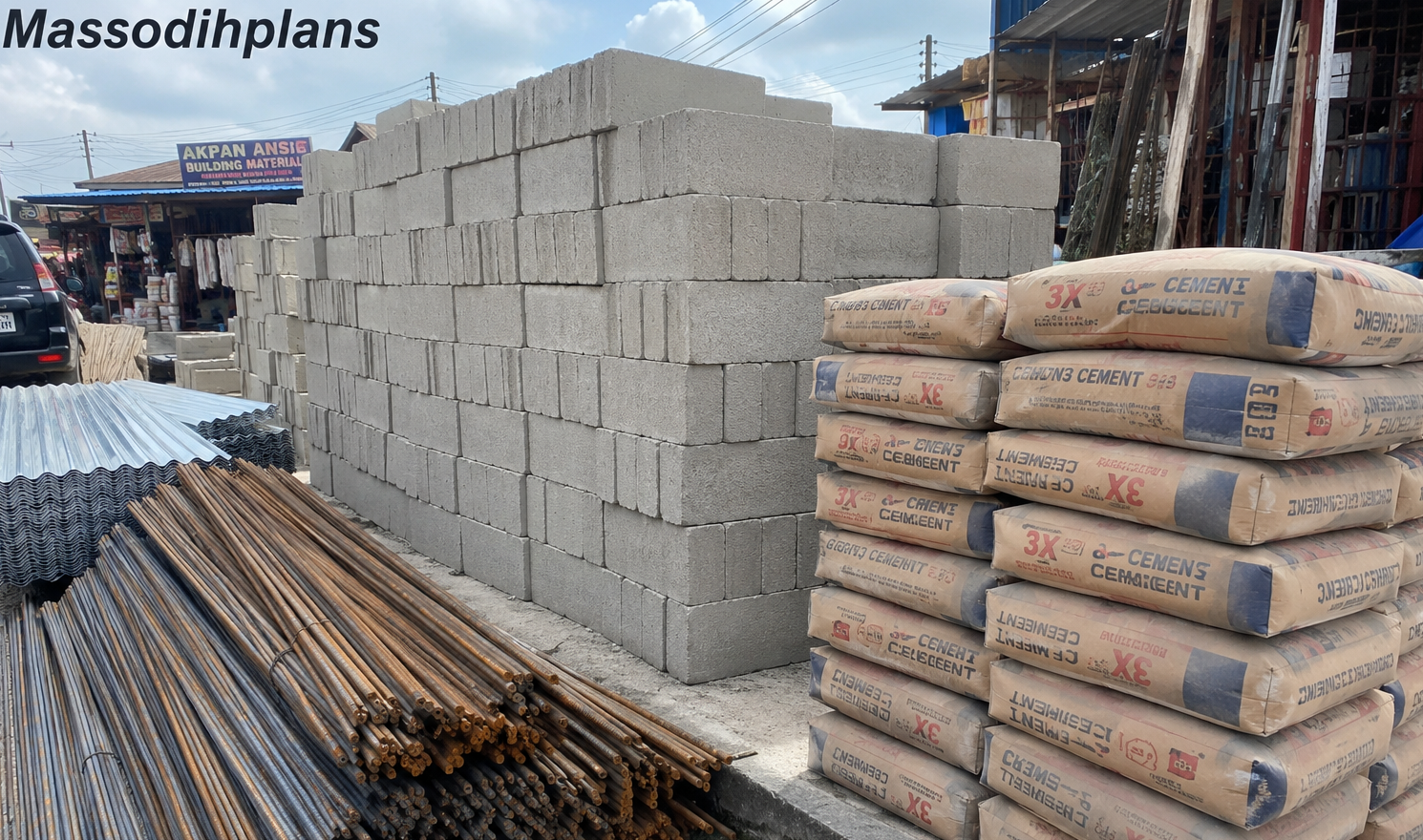
- Cost of Blocks, Cement, Iron Rod and Roofing Sheets in Uyo: Real Prices From the Field Now
- Estate Development Cost Breakdown: What Developers Should Budget For
- Estate Layout Design Services for Property Developers in Nigeria
- What Is a Master Plan and Why Does Every Growing Community Need One?
- How Much Does It Cost to Develop an Estate in Nigeria? A Town Planner’s Honest Breakdown
- Small Residential Estate Layout Design in Nigeria: Smart Master Plan Ideas for Limited Land
- Smart Duplex Design for Narrow Plots in Lekki, Nigeria: Complete Practical Guide
- Cost of Roofing a Bungalow and Duplex in Abuja Small Plot Now
- 25 Narrow PLot House Plans That Maximize Every Inch of Your Plot
- MassodihPlans Homepage
- Related articles: Layout Plan Cost in Nigeria, Building Plan Approval Process, How to Buy Land Safely in Nigeria, Estate Layout Standards
Authority Source
Surveyors Council of Nigeria (SURCON)
Article prepared by Massodih Okon Effiong, Planner and Architectural Designer, MassodihPlans.com
About Author
Massodih Okon is a built environment professional with a background in architecture and urban planning. He specializes in practical Nigerian house design guidance through MassodihPlans.com.. He has a Master’s degree in Urban and Regional Planning, a first degree in Geography and Environmental Management, and professional certificates in Architectural Design, Landscape Design, and GIS. With over 15 years of hands‑on experience in architecture, town planning, GIS, and building economics across Nigerian residential and institutional projects, he understands the real challenges Nigerians face when planning and building homes.
At MassodihPlans, Massodih shares practical Nigerian building guides, modern bungalow and duplex house plans, and built environment resources created specifically for Nigerian homeowners, developers, and property investors. His work is based on real‑life conditions in Nigeria, climate‑responsive design, and cost‑effective planning, aimed at helping everyday Nigerians make smarter, more confident building decisions.