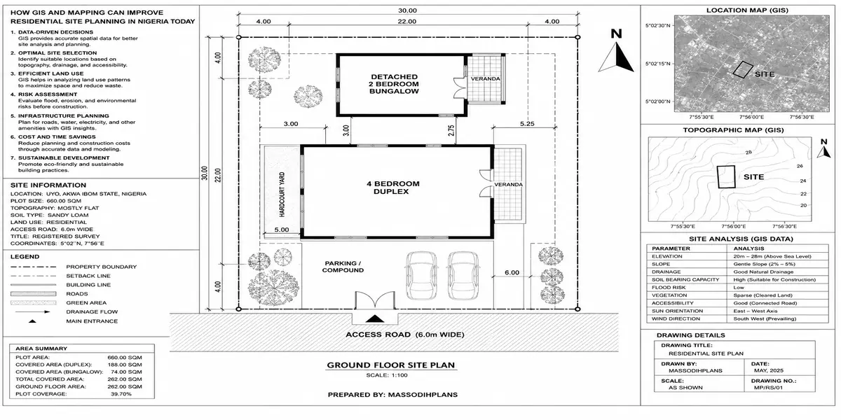
How GIS and Mapping Can Improve Residential Site Planning in Nigeria Today
Let me tell you the pattern I see over and over, because I think it explains why this topic matters more than most people realize.
A family buys a plot. The agent walks them round it on a dry afternoon, the ground looks fine, the price is good, papers look “clean” enough, and they pay. Eighteen months later, the compound floods every time it rains for more than an hour. Or the boundary they built up to turns out to overlap a neighbour’s plot by a metre and a half, and now there’s a fence dispute that drags on for two years. Or the government comes through with a road widening project and takes a chunk of what they thought was their front yard, because nobody checked whether the plot sat inside an existing right-of-way.
None of these are bad luck. Every single one of them is a question that had an answer before the plot was bought an answer that GIS and proper mapping could have surfaced in an afternoon, for far less money than what the mistake ends up costing. That’s what this article is actually about. Not “GIS is transforming Nigeria” in the abstract, but the specific, boring, unglamorous questions GIS answers that save ordinary people from expensive regret.
First, What I Actually Mean by “GIS” Here Not the Textbook Version
If you’ve read other articles on this, you’ve probably seen GIS described as “a system for gathering, managing, and analyzing geographic data.” True, but useless if you’re a homeowner or a small developer trying to decide whether to buy a specific plot in Uyo or Port Harcourt.
For residential site planning, GIS is really just this: overlaying different layers of information about a piece of land its elevation, its soil, its flood history, its legal boundaries, existing infrastructure nearby, and how it sits relative to government layout plans on top of each other, so you can see conflicts and risks that are invisible when you just look at the bare land with your eyes.
A satellite image alone won’t tell you a plot sits in a flood-prone depression. A survey plan alone won’t tell you the plot is inside a drainage easement. A soil map alone won’t tell you the access road is legally a footpath, not a vehicular right-of-way. GIS is the practice of putting all of these together before you commit money, not after.
If a land agent’s entire pitch is “come and see the land,” that’s a warning sign, not reassurance. Seeing land with your eyes tells you almost nothing about drainage history, soil bearing capacity, or legal encumbrances the things that actually determine whether your building stands and stays dry for the next thirty years.
The Real Problems GIS Solves in Residential Site Planning
I want to go through these one at a time, because each one is a specific failure I’ve either seen directly or been called in to help fix after the fact.
1. Buying Land That Floods Before You Build, Not After
Flooding isn’t random. It follows elevation and drainage patterns that are consistent year after year, and those patterns are mappable. A digital elevation model, cross-referenced with historical flood extent data (increasingly available for major Nigerian cities through satellite-based flood mapping) will show you, before you spend a naira, whether a plot sits in a natural water channel, a low-lying depression, or genuinely elevated, well-drained ground.
I have seen families discover this the hard way building a full house on a plot that looked completely dry in December, only to watch the compound become ankle-deep in water every August. The land wasn’t cursed. It was simply the low point where surrounding elevated plots naturally drain to, and nobody checked before building.
2. Boundary Disputes That Didn’t Need to Happen
A huge number of land disputes in Nigeria come down to one thing: two neighbouring plots, both with “genuine” survey documents, that overlap when you actually plot their coordinates on the ground. This happens more often than it should, partly because older surveys weren’t always tied to a consistent reference system, and partly because informal resurveys sometimes drift from the original beacon positions over time.
GIS-based boundary verification plotting your survey coordinates against satellite imagery and existing cadastral data catches this before you build a wall on a line that isn’t actually yours. It’s a few hours of work that can save you years of litigation.
3. Discovering a Road Reserve or Drainage Easement Cuts Through Your Plot
This is one of the most common and most painful surprises in Nigerian residential development. A plot looks whole and buildable, but a portion of it sometimes a significant portion is actually a road reserve, a power line easement, or a designated drainage channel reserved in the state’s layout plan. You don’t find out until you apply for building approval, or worse, until you’ve already built and the government marks your fence for demolition.
Overlaying your plot’s coordinates against the local planning authority’s approved layout plan is exactly the kind of check GIS makes fast and precise, instead of relying on word-of-mouth about “where the road is supposed to pass.”
4. Soil and Foundation Risk You Can Plan For Instead of Discovering Mid-Construction
Soil isn’t uniform even across small areas. Sandy, waterlogged, and firm clay soils can exist within a few hundred metres of each other, especially in coastal and riverine parts of Akwa Ibom and Rivers States. Combining existing geological and hydrological mapping with a site-specific soil test lets your structural engineer design the right foundation from day one, instead of your contractor discovering unexpectedly poor soil halfway through excavation at which point redesigning the foundation costs far more than it would have cost to know in advance.
5. Access Road Reality Versus What the Agent Told You
A plot can look perfectly positioned on a site plan and still be effectively landlocked in practice, if the “access road” shown on paper is actually an unmapped footpath, a private track through someone else’s land, or a road that exists on an old layout but was never actually opened. Cross-referencing current satellite imagery against the approved layout plan shows you the difference between a road that exists on paper and a road that exists on the ground a distinction that has trapped more than a few buyers into land they genuinely cannot get construction vehicles onto.
Never rely solely on a survey plan’s paper description of an access road. Cross-check it against current satellite imagery or a recent site visit. Layout plans can be decades old, and roads shown on them are sometimes never actually constructed.
6. Choosing the Right Orientation and Layout for the Actual Site, Not a Generic One
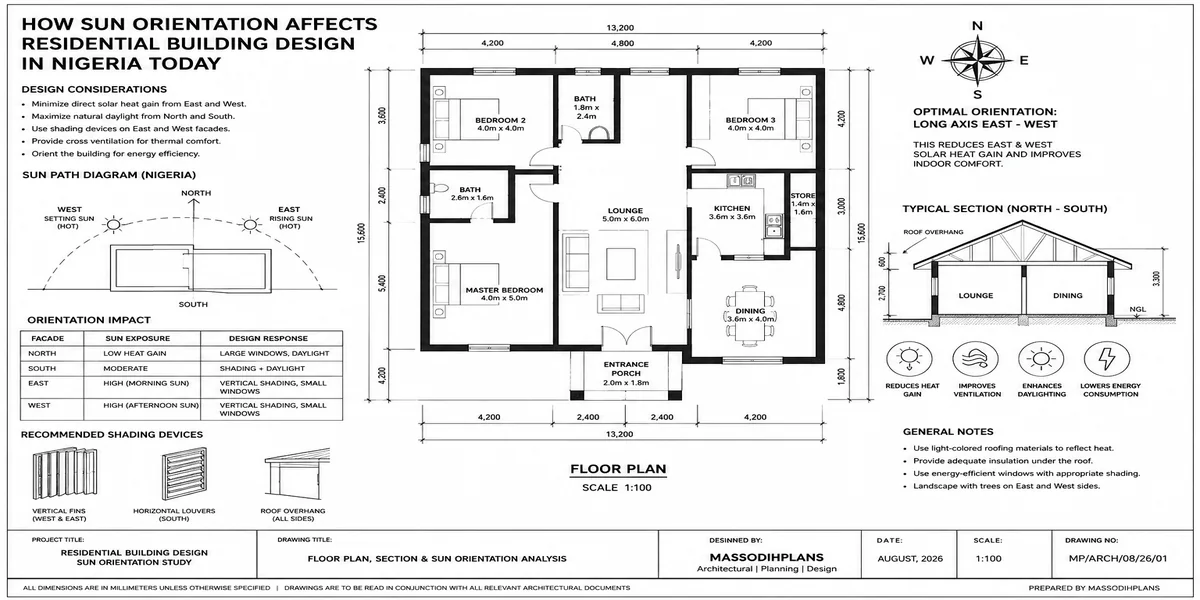
Even once a plot is confirmed safe and legally sound, GIS-derived data slope direction, prevailing wind, solar path relative to the specific site genuinely improves how a house should be laid out on that plot. A slightly sloped site might drain naturally away from the building if oriented correctly, or straight toward it if oriented carelessly. This is a site-planning decision that most self-builders never think to base on actual site data, and instead just copy whatever orientation the neighbouring house happened to use.
How This Actually Works in Practice A Simple Process, Not a Complicated One
I want to demystify this, because “GIS” sounds like something only a government agency or a big consulting firm can do. For an individual residential plot, the practical process is genuinely accessible:
Get your plot’s exact coordinates from your survey plan every legitimate survey plan carries this.
Check those coordinates against the state’s approved layout plan at the relevant Ministry of Lands or Physical Planning office, to confirm the plot isn’t inside a road reserve, drainage channel, or other reserved land.
Overlay the plot on current satellite imagery (freely accessible through tools like Google Earth) to compare what actually exists on the ground roads, drainage, neighbouring development against what the paper documents claim.
Check elevation and drainage direction for the specific plot and its immediate surroundings, either through a professional topographic survey or, at minimum, a careful physical inspection during the rainy season, not just the dry season.
Commission a soil test for the specific plot, not a generic assumption based on the general area.
Bring all of this to your architect and structural engineer before final design, so the building’s foundation, orientation, and drainage strategy are actually designed for the site you have, not a generic assumption about “typical” Nigerian soil and climate.
None of these steps require you personally to operate GIS software. What they require is knowing which questions to ask, and insisting that someone a town planner, a licensed surveyor, or a GIS-competent consultant actually answers them with real spatial data before you commit to buying or building.
If you’re buying land through an agent, ask directly whether the plot’s boundaries have been checked against the state’s approved layout plan, not just described by the seller. A confident “yes, it’s clean” without documentation to back it up is not the same as an actual check.
Why This Matters More in Nigeria Specifically, Not Less
Some of what I’ve described above applies anywhere in the world. But a few things make it genuinely more urgent here:
Layout plans and reality frequently disagree.
Many Nigerian states have approved layout plans that were drawn years or decades ago, while actual development on the ground has moved faster and less formally than the plan anticipated. That gap between “what the plan says” and “what’s actually built” is exactly where GIS-based verification earns its value it catches the disagreement before you’re the one caught in it.
Rapid, sometimes informal urbanization outpaces enforcement.
Plots get subdivided, resold, and built on faster than planning authorities can always verify and update records, which increases the odds of exactly the boundary and easement conflicts described above.
Climate patterns are shifting rainfall intensity.
Areas that historically drained adequately are increasingly experiencing flash flooding as rainfall patterns intensify, which means relying on “it’s never flooded before” as your only flood risk assessment is becoming less reliable over time, not more.
Land documentation history is uneven.
Older, informally surveyed plots are more common here than in markets with longer-established digital cadastral systems, which is precisely why an independent spatial check rather than trusting paper documents alone carries more weight in a Nigerian land transaction than it might elsewhere.
What I Tell Clients and Students Directly
If you take nothing else from this article, take these three things they are, honestly, the difference between the site-planning disasters I get called to help fix and the projects that go smoothly from the start.
Don’t buy land based on how it looks in the dry season. Visit it, or have someone credible check it, during or right after heavy rain. Drainage problems hide beautifully on a sunny day.
Never treat a survey plan as the final word on boundaries. A survey plan is a claim, not a guarantee. Verify it against the state’s approved layout and current ground reality before you build a wall based on it.
Budget the checking, not just the building. A proper site verification layout plan check, soil test, drainage assessment typically costs a small fraction of what a single flooding incident, boundary dispute, or foundation redesign costs later. Treat it as part of your build budget, not an optional extra you skip to save money upfront.
If you are a diaspora client buying land remotely, this matters even more, not less. You cannot personally walk the plot during a rainstorm or eyeball the neighbouring boundaries. Insist on a proper, documented site verification including layout plan cross-check and rainy-season drainage assessment carried out by someone you trust who is physically present, before you send money.
Frequently Asked Questions
Do I need to hire a GIS specialist to check a single residential plot?
Not necessarily a dedicated GIS firm a competent town planner, licensed surveyor, or architect with GIS literacy can carry out the core checks (layout plan cross-check, satellite imagery comparison, coordinate verification) for an individual plot without needing enterprise-level software or a large consulting engagement.
Is satellite imagery accurate enough to check land boundaries myself?
Freely available satellite imagery is useful for a first-pass sanity check comparing what’s actually built against what a survey plan claims but it should not replace a proper coordinate-based boundary verification against your actual survey beacons and the approved layout plan.
How do I know if my plot is inside a road reserve or drainage easement?
This has to be checked against your state’s approved layout plan at the relevant Ministry of Lands or Physical Planning office, cross-referenced with your survey plan’s coordinates. It is not something you can determine by looking at the land alone.
What’s the single most useful GIS-based check before buying land in Nigeria?
If you can only do one thing, verify the plot’s boundaries and access road against the state’s approved layout plan. This single check catches the majority of the boundary disputes, easement surprises, and landlocked-access problems described in this guide.
Can GIS help after I’ve already bought land, or only before?
Both. Before purchase, it prevents bad decisions. After purchase, the same layout-plan and elevation checks help your architect design the right foundation, drainage strategy, and building orientation for the specific site you now own, rather than a generic assumption.
Where This Leaves You
GIS and mapping aren’t a futuristic add-on to residential site planning in Nigeria they’re the difference between finding out your plot floods before you build, or after. Between confirming your boundaries before you fence, or during a dispute two years later. None of this requires you to become a technical expert. It requires you to ask the right questions, insist on documented answers, and treat site verification as a real line item in your building budget, not a step you skip because the land “looked fine.”
If you’re at the stage of choosing or verifying a plot, our Services page outlines how we support clients through proper site verification alongside architectural design. Browse our Plans Library for house designs that already account for site-specific drainage and orientation, or visit Plan School to understand the planning and approval process this kind of site verification feeds into. You can also explore more planning and land guides on our Homepage.
- How to Read a Satellite Image Before Buying Land in Nigeria: Full Guide
- How GIS Can Help Identify Flood-Prone Areas Before You Build in Nigeria
- How to Analyse Your Plot Using Satellite Imagery Before Building a House
- How to Use Satellite Maps to Study Land Before Buying Property in Nigeria
- How Wind Direction Can Influence House Planning and Natural Ventilation
- How Sun Orientation Affects Residential Building Design in Nigeria Today
Author
Massodih Okon is a Nigerian built-environment professional with academic and professional experience in urban and regional planning, geography, architectural design, Landscape Design, GIS and land development.
He holds a Master’s degree in Urban and Regional Planning from the University of Uyo and a first degree in Geography and Regional Planning.
Through MassodihPlans, he publishes practical guides on Nigerian house plans, building design, physical planning, site planning, development approval and residential construction. Read the full author profile →