How to Analyse a Property Location Before Buying Land in Nigeria Today
Let me tell you the part almost nobody warns you about: you can do everything right on paper clean title, genuine C of O, verified family, registered surveyor, lawyer sign-off and still end up with land that floods every August, or land you can’t get a truck into during rainy season, or land sitting quietly inside a government road-widening corridor that nobody mentioned. The documents were real. The location was the problem. And documentation is the one thing every single article on this subject already drills into you.
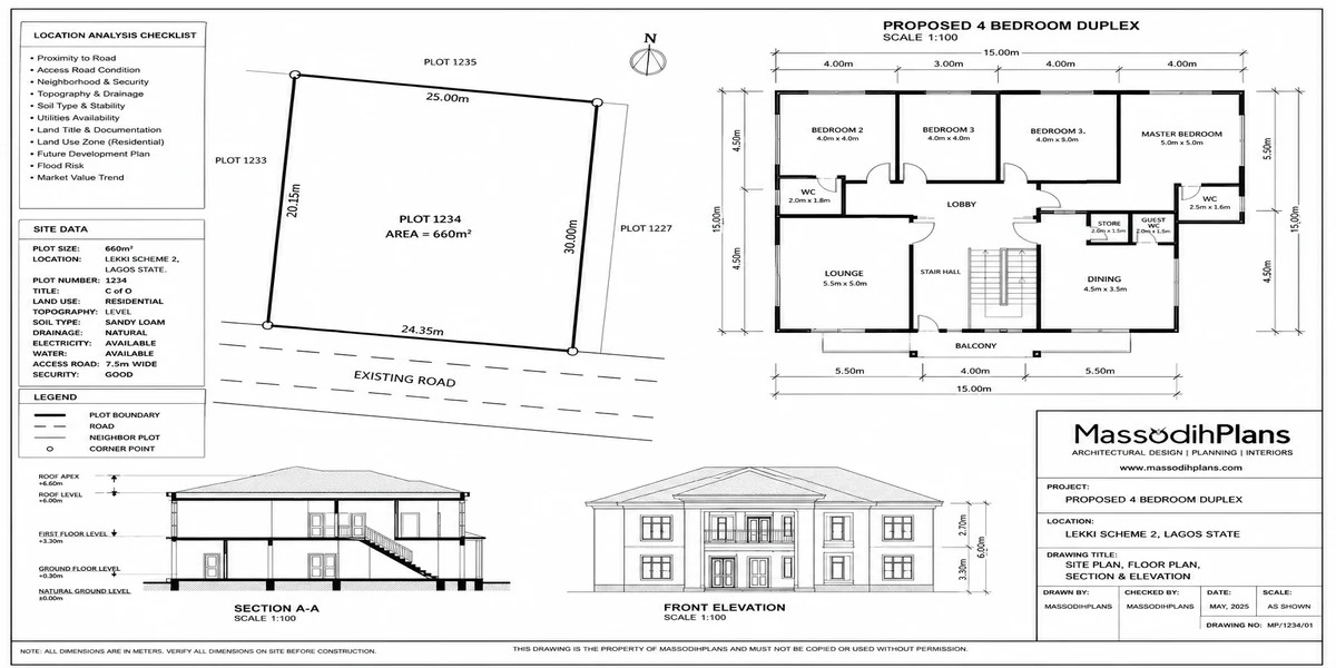
I’m not writing another one of those. I’m a registered Town Planner, and reading a location not the paperwork attached to it, the actual ground is literally part of my training and daily work. So this is the conversation I’d have with you if you called me before signing anything: how do you actually look at a piece of land and know, with your own eyes and a few simple checks, whether it’s a location worth building your life savings into.
Why “Good Location” Can’t Just Mean “Near the Road”
Everyone tells you location matters. Almost nobody tells you what to actually look for, so it collapses into vague ideas: near the express, close to town, developing area. Those aren’t wrong, but they’re surface-level. A location is really a combination of things working together the ground itself, the water around it, the roads connecting it, the plan governing it, and the direction the neighbourhood is actually moving in. Miss any one of these, and a plot that looks perfect on a Sunday afternoon visit can turn into years of regret.
I want to walk through each of these properly, the way I’d assess a site for a client, so you can do a real version of this yourself before you hand anyone money.
Start With the Ground Itself: Topography and Soil
Before you think about roads or neighbours, look at what you’re actually standing on.
Is the land low-lying compared to everything around it?
Stand at the plot and look at the surrounding plots and the road. If your land sits noticeably lower than the road or the neighbouring compounds, water from the entire area will find its way to you during rain, whether or not there’s a drainage channel nearby. This single observation is my plot the lowest point around here tells you more about future flooding than almost any document ever will.
What does the soil feel and look like?
Sandy, loose soil drains faster but may need deeper or more reinforced foundations depending on load. Heavy clay soil holds water and swells and shrinks with moisture a real factor in foundation cracking if not properly designed for. You don’t need a lab to get a first impression: dig a small hole with a stick after rain and see how long water sits in it. If it’s still pooling after a couple of hours while a neighbouring dry patch has cleared, that’s a soil and drainage signal worth taking seriously, not commissioning a full soil test to confirm what your eyes already told you.
Check for old water marks
On fences, on trees, on the base of neighbouring buildings a faint line of discoloration a foot or more above ground level on structures nearby is often the ghost of a past flood. Ask around; long-term residents remember specific bad years even when official records don’t.
Visit the same plot twice once in dry season, once during or right after a heavy rain. A location that looks perfect in January can tell a completely different story in July. If you can only visit once, ask a neighbour directly: “how does this place behave when it rains hard?” People who’ve lived through a flood season don’t hide it they tell you unprompted.
Read the Drainage Pattern, Not Just the Plot
This is the step almost every land-buying article skips completely, and it’s arguably the most important one.
Water doesn’t respect plot boundaries. It flows across an entire area following the natural slope, and your plot is just one stop along that path. So the real question isn’t “does my plot have a drain beside it” it’s “where does water go once it leaves my plot, and where does it come from before it arrives.”
Walk the immediate area, not just your plot. Look for:
A natural or constructed drainage channel serving the street, and whether it actually connects somewhere (a river, a bigger channel, a soakaway) or just stops dead a channel that dead-ends is often a sign of an unfinished or informally-extended layout, and it will back up during heavy rain
Whether neighbouring compounds have raised their ground level significantly above the road if several plots around yours have been built up high, it’s often because the area is known to flood, and water displaced from those raised compounds has to go somewhere, often onto the lower plots nearby
Whether the road itself floods during rain, based on visible erosion patterns, sediment lines, or simply asking
A plot can have a perfect title and sit in a genuinely bad drainage position. No amount of legal verification fixes that after you’ve built.
Understand the Road, Not Just That There Is One
Every guide tells you to check if the land is accessible. Fewer tell you what “accessible” should actually mean once you dig one level deeper.
Is the access road actually motorable in the rainy season, not just the dry season?
A road that looks fine and firm in December can become impassable mud in July if it isn’t properly constructed or drained. If you’re viewing in dry season which most people do specifically ask, and if possible, look for tyre-rut patterns and erosion marks that hint at how the road behaves under rain.
Is the road officially recognized, or is it a path the community simply agreed to use?
This matters more than people realize. An officially gazetted or planned road has some protection and is more likely to be maintained or eventually upgraded by government. An informal path used by consensus can be blocked, narrowed, or built over if a neighbouring landowner decides to extend their fence and you’ll have very little formal recourse.
Does the road appear on the area’s layout or master plan, and does what’s on ground match what’s on the plan?
This is where your survey plan and the area’s approved layout genuinely intersect with location analysis not to verify ownership, but to verify that the road serving your plot is a real, protected road and not a temporary access that could disappear.
If a road looks unusually generous or well-planned for the area wide, straight, clearly laid out check whether it’s actually a planned dual carriageway or expansion corridor still awaiting full construction. Land fronting a future major road can be a genuine opportunity, but land sitting inside the reserved width of that same road, still awaiting demolition notice, is a very different and much riskier position. A quick check with the state’s ministry of physical planning or lands bureau clarifies which one you’re looking at.
Check the Area’s Zoning and Master Plan, Not Just Your Plot’s Title
Your plot’s C of O tells you who owns it. It rarely tells you what the surrounding area is officially planned to become and that second piece of information affects your land’s value and usability just as much as ownership does.
Ask your state’s ministry of physical planning (or the relevant urban/regional planning authority) two specific questions: what is this area zoned for, and is there an approved layout or master plan covering it. The answers matter because:
Land zoned strictly for agricultural or institutional use can restrict what you’re legally allowed to build, regardless of what the seller tells you
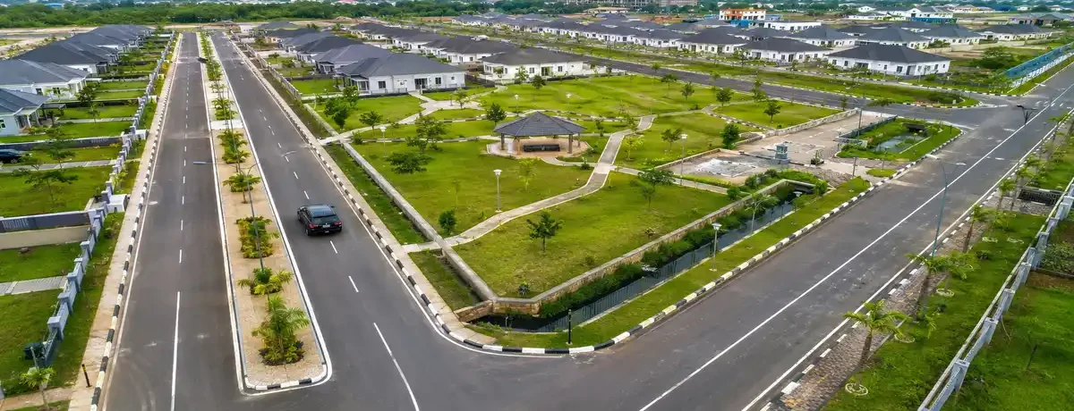
An area with no approved layout at all is more likely to develop chaotically roads narrowing over time, no consistent setbacks, drainage added as an afterthought if at all
An area inside an approved layout with defined road reserves and use zones gives you a much clearer, more protected picture of what your neighbourhood will actually look like once fully built out
This is genuinely different information from a title search, and it’s the layer most buyers never think to check because it isn’t about proving ownership it’s about understanding what you’re buying into.
Read the Neighbourhood’s Direction, Not Just Its Current State
A location isn’t static. The question that actually determines whether your land appreciates or stagnates isn’t “what does this area look like today” it’s “where is this area heading, and why.”
Look for the signals of organic, government-supported growth
New government infrastructure projects nearby (roads, bridges, drainage upgrades), new schools or health centres being built, increasing commercial activity along the main access road, and rising rather than falling numbers of new buildings under construction when you visit. These are signs of real, sustained momentum, not marketing hype.
Be skeptical of growth signals that are purely developer-driven with no supporting government infrastructure
An area can have a cluster of new estate billboards and none of the actual road, drainage, or power upgrades needed to support the growth those billboards are promising. Billboards don’t guarantee electricity will reach you in three years; a government capital project already under construction is a far stronger signal.
Ask about the area’s population and land-use trajectory from people who’ve lived there a while, not just from the agent selling you the plot
Long-term residents will tell you honestly whether the area has genuinely grown or simply had a burst of speculative land sales with little real development to show for it years later.
Drive or walk the immediate axis of the road on a random weekday, not a weekend when agents often stage more activity than usual. Genuine commercial and residential growth is visible on an ordinary Tuesday shops actually trading, buildings actually occupied, not just plots freshly cleared and fenced.
Look at What’s Around You: Environmental and Nuisance Factors
Some location problems aren’t about flooding or roads at all they’re about what’s already sitting near your plot that will affect your daily life or your resale value later.
Proximity to high-tension power lines building directly under or too close to these carries real safety risk and often restricts what you can legally construct there
Proximity to waste dumps, abattoirs, or industrial sites beyond the obvious smell and noise, these can affect groundwater quality and long-term property desirability
Proximity to a busy market or motor park can be a commercial advantage for some uses and a genuine daily nuisance (noise, traffic, congestion) for a purely residential home
Proximity to a river, lagoon, or wetland edge beautiful in photos, and often the first place utility disruption and flooding hit when water levels rise seasonally
None of these show up on a title document. All of them show up the moment you actually stand on the land and look around with intention instead of just admiring the view.
A Simple Site-Visit Method You Can Actually Use
Here’s how I’d structure an actual visit, if you’re doing this yourself rather than paying a professional to do it for you:
Visit at two different times once in dry weather, once during or right after rain if at all possible, and ideally once on a weekday to see genuine, un-staged neighbourhood activity
Walk beyond the plot boundary, not just the plot itself trace the road in both directions, look at the drainage pattern of the wider area, and observe neighbouring buildings’ ground levels
Talk to at least two long-term residents separately, not just the agent or seller, and ask specifically about flooding history, road condition in rainy season, and how the area has genuinely changed over the past several years
Check the area’s zoning and layout status with the relevant state planning authority, separate from your lawyer’s title search
Bring a simple checklist and take photos of the road, the drainage, the surrounding buildings’ ground levels, and any visible water marks so you can review it calmly later instead of relying purely on the impression of the day
Only after this, move to the legal and documentation verification that every other guide already covers well
Frequently Asked Questions
What’s the difference between checking a land’s title and analysing its location?
Title verification confirms who legally owns the land and whether the paperwork is genuine. Location analysis is a separate exercise entirely it looks at the physical ground, drainage, road reality, zoning status, and neighbourhood trajectory, all of which affect whether the land is actually good to build on and likely to hold or grow in value, regardless of how clean the title is.
Can a location with perfect documents still be a bad investment?
Yes, and this happens often. Clean title says nothing about whether the plot floods, whether the access road survives rainy season, or whether the surrounding area has genuine growth momentum. Both title and location need to check out.
How do I check an area’s zoning or master plan status in Nigeria?
Visit or contact your state’s ministry of physical planning and urban development (the name varies slightly by state) and ask specifically whether the area has an approved layout plan and what it’s zoned for. This is separate from, and in addition to, the title search your lawyer conducts.
Is it worth buying land in an area with no approved layout plan at all?
It can still be worth it depending on your goals, but you should go in aware that development, road width, and drainage in such areas tend to happen informally and inconsistently, which can affect both your building process and the area’s long-term coherence and value.
What’s the single biggest location red flag most buyers miss?
The plot sitting visibly lower than the surrounding road and neighbouring compounds. It’s simple to spot with your own eyes, it costs nothing to check, and it predicts flooding risk more reliably than almost anything else you can observe on a single visit.
Before You Move Forward
Everything in this guide is something you can genuinely check yourself, with your own eyes, before you spend a naira on legal fees. Documentation verification still matters enormously please don’t skip your lawyer and your surveyor but it answers a different question than the one this guide answers. Documents tell you if you can legally own the land. Location analysis tells you if the land is actually worth owning.
If you’re at the stage of evaluating a plot and want a second, professional set of eyes on the site itself drainage, topography, zoning fit our Services page outlines how we support clients through exactly this kind of pre-purchase site assessment. If you already have land and are moving into design, browse our Plans Library for house plans suited to different plot conditions, or visit Plan School to understand the planning and approval process ahead. You can also explore more land and building guides on our Homepage.
- How GIS and Mapping Can Improve Residential Site Planning in Nigeria Today
- How Road Access Affects Residential Building and House Planning in Nigeria
- How to Read a Satellite Image Before Buying Land in Nigeria: Full Guide
- How GIS Can Help Identify Flood-Prone Areas Before You Build in Nigeria
- How to Analyse Your Plot Using Satellite Imagery Before Building a House
- How to Use Satellite Maps to Study Land Before Buying Property in Nigeria
Author
Massodih Okon is a Nigerian built-environment professional with academic and professional experience in urban and regional planning, geography, architectural design, Landscape Design, GIS and land development.
He holds a Master’s degree in Urban and Regional Planning from the University of Uyo and a first degree in Geography and Regional Planning.
Through MassodihPlans, he publishes practical guides on Nigerian house plans, building design, physical planning, site planning, development approval and residential construction. Read the full author profile →