Surveying and Property Boundaries: How to Verify Your Plot Before Building
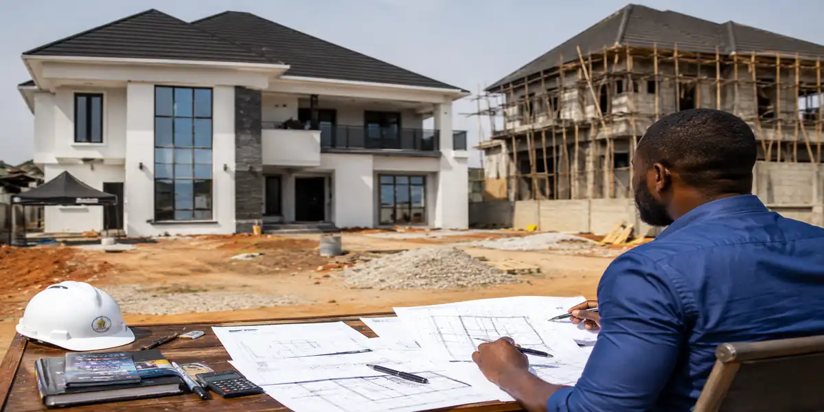
A client called me two weeks into foundation work on a project in Uyo, panicked, because his neighbour’s mason had just knocked down part of his fence and started laying blocks on what my client believed was his own land. Both men had survey plans. And both survey plans looked genuine. Both showed the disputed strip as theirs. Nobody had mobilized until this point without knowing that.
That call is the reason this article exists. Not because surveying is exciting content it isn’t but because almost nobody explains it in a way that actually stops that phone call from happening to you. So let’s go through it properly: what a land survey is, who’s qualified to do one, the difference between the half-dozen survey terms people throw around interchangeably, what it costs, and exactly how to verify your plot’s boundaries before you commit a single bag of cement to it.
Verifying Your Plot Isn’t One Step — It’s a Sequence
Most people treat “surveying my land” as a single task they tick off once. It isn’t. Between buying land and finishing a building, there are actually several distinct surveying moments, each answering a different question:
- Before you buy: does this land exist as described, and is it free of legal encumbrance?
- Before you design: what does the ground actually look like levels, slope, existing features?
- Before you build: are the physical boundaries on the ground exactly where the paperwork says they are?
- During construction: is the building itself being set out in the right position on the plot?
A single “survey plan” from the point of purchase does not automatically answer all four of these. This is the gap that causes most of the disputes and rework I get called in to fix, and it’s the thread running through everything below.
Land Survey and Land Surveying: Getting the Basic Terms Straight
And “Land survey” and “land surveying” get used loosely, so let’s fix that first. Land surveying is the profession and the technical process measuring, calculating, and mapping land using instruments and mathematics. A land survey is the output of that process for a specific piece of land: the measured record of its size, shape, position, and boundaries.
In Nigeria, land surveying is a regulated profession, not a trade anyone can practice with a tape and confidence. The measurements a surveyor produces feed directly into your title documentation, your building approval, and if things go wrong a court case. That’s why the next section matters more than most guides make it sound.
Land Surveyor and Property Surveyor: How to Confirm Yours Is Actually Registered
“Land surveyor” and “property surveyor” are used interchangeably in everyday conversation and refer to the same professional in Nigeria’s context someone licensed to measure and document land. The word that should matter to you more than either title is: registered.
In Nigeria, only a surveyor registered with the Surveyors Registration Council of Nigeria (SURCON) can legally produce a survey plan your state government or bank will accept. This isn’t a formality you can skip to save money, because an unregistered survey isn’t just risky it’s often outright useless the moment you try to get building approval, secure a loan against the land, or resolve a dispute in court.
Here’s how to actually confirm registration, not just take someone’s word for it:
- Ask for the surveyor’s SURCON registration number directly, not just their business card
- Cross-check that number against SURCON’s public register rather than accepting a photocopy of an old certificate
- Confirm they are currently practising, since registration can lapse or be suspended
- For any survey plan you’re handed rather than commissioning yourself, check that the name and seal on the document match a real, currently registered surveyor fraudulent survey plans frequently borrow a real surveyor’s name and seal number without their knowledge
A survey plan with a beautiful seal, an official-looking stamp, and confident language is not the same thing as a survey plan from a currently registered surveyor. Verify the registration independently before you rely on the document for anything purchase, approval, or construction.
Property Survey vs. Boundary Survey vs. Property Boundary Survey: These Aren’t the Same Thing
This is where a lot of confusion actually costs people money, because these three terms sound like synonyms and aren’t quite.
Property survey is the broad term any survey undertaken to document a property, which could include its size, boundaries, and sometimes its features and levels.
Boundary survey is narrower and more specific: a survey whose entire purpose is establishing precisely where the legal edges of a plot sit, usually by re-locating or re-establishing beacons against the coordinates on record.
Property boundary survey is essentially the same task as a boundary survey, but the phrase is more commonly used when the purpose is explicitly resolving a dispute or confirming edges before a sale or construction in other words, the same technical work, framed around a specific decision you’re about to make.
Why the distinction matters practically: if you ask a surveyor for “a survey” without specifying, you may get a general property survey that confirms size and location but doesn’t rigorously re-establish every corner against the original coordinates. If your actual concern is “does my fence sit where my title says it should,” you need to ask specifically for a boundary survey and say so.
When you contact a surveyor, don’t just say “I need my land surveyed.” Say exactly what decision you’re trying to make buying, building, resolving a boundary disagreement because the scope of work, and sometimes the cost, changes depending on which one it is.
Beacons and the Boundary Map: How to Physically Check Your Plot’s Edges
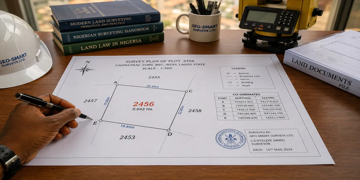
Every registered survey plan comes with a boundary map showing your plot’s shape, dimensions, and beacon positions numbered concrete or stone markers placed at each corner of your land. This map is the document; the beacons are the physical reality it’s supposed to match. Verifying your plot means checking both, and checking that they agree with each other.
Here’s a walkthrough I actually use with clients before we commit to any design work:
Locate every beacon shown on the boundary map. If any beacon is missing, damaged, or looks disturbed, treat that as a serious flag, not a minor inconvenience missing beacons are one of the most common precursors to a boundary dispute, whether through natural loss, road works, or deliberate interference by a neighbour or land grabber.
Measure the distance between beacons yourself with a tape, even roughly, and compare it against the dimensions stated on the boundary map. A measurement that’s noticeably off not just a few centimetres from tape sag, but metres means the physical ground and the paper document have drifted apart, and you need a professional re-survey before doing anything else.
Walk the full perimeter physically, not just the front boundary facing the road. Side and rear boundaries are where encroachment and disputes most often start, precisely because they’re the ones people check least.
Compare what you see against what your neighbours have built. A neighbour’s fence, wall, or building that appears to cross onto your side of a beacon line is worth raising immediately and calmly, before either of you pours concrete over the disagreement.
Photograph every beacon with a visible reference point a nearby fixed structure or landmark so you have dated evidence of their condition and position at the point you checked them.
None of this replaces a professional re-survey where something looks wrong. It’s a first-pass check that tells you whether you need to escalate to one and in my experience, most people skip even this basic walk-through, then are shocked when a dispute surfaces mid-construction.
Topographic Survey and Topographic Map: What They Actually Add (and What They Cost)
A boundary survey tells you where your plot’s edges are. It does not tell you what the ground inside those edges actually looks like and that gap is exactly what a topographic survey fills.
A topographic survey measures and records the physical features and elevation changes across your site: ground levels, slopes, existing drainage paths, trees, structures, and any other features that affect design. The output is a topographic map (or contour plan) a drawing showing your site’s shape using contour lines that represent elevation changes, the same principle used on any geographic contour map, just at the scale of your individual plot.
You need one specifically when:
- Your plot has any visible slope, or you suspect it does a site that looks flat to the eye is very often not flat enough to ignore for foundation and drainage design
- You’re building on land near a water body, a valley, or any low-lying area prone to flooding
- Your architect or structural engineer specifically requests contour information to finalize foundation type and design levels
- You’re planning significant earthworks, retaining structures, or a multi-unit layout where accurate levels affect several buildings, not just one
Topographic survey cost in Nigeria varies with plot size, terrain complexity, and location, but as a rough working range for a standard residential plot, expect professional fees from roughly ₦150,000 to ₦600,000+ for a typical plot, rising with larger sites, difficult terrain, or where drone/aerial methods are used for greater accuracy over a wider area. Always get a specific quote tied to your plot’s actual size and condition rather than budgeting off a generic figure a swampy, irregularly shaped plot costs meaningfully more to survey accurately than a flat, regular one.
If your site looks even slightly uneven, ask your surveyor for a topographic survey before your architect finalizes floor levels not after. I have seen floor level and drainage decisions get expensively reworked because contour data arrived after the design was already locked.
Site Survey vs. Building Survey vs. Construction Survey: Different Stages, Different Jobs
These three terms get used almost interchangeably online, but they belong to different points in a project’s life, and mixing them up leads people to ask a surveyor for the wrong service at the wrong time.
Site survey happens before design. It’s a general term covering the data-gathering surveys boundary, topographic, sometimes soil-related done to give your architect and engineer accurate information about the plot before they design anything.
Building survey applies to an existing structure, not raw land. It’s an inspection and measurement of a building already standing used when buying a property with an existing house, assessing structural condition, or documenting an existing building before renovation or extension.
Construction survey happens during building, not before it. It’s the ongoing surveying work that sets out the building’s actual position on the ground marking where foundations should be dug, checking that walls are rising in the correct position and alignment relative to the approved drawing, and verifying levels as construction progresses.
Here’s the sequence that should actually happen on a new build: site survey (before design) → design based on that data → construction survey (setting out and checking positions during building). A building survey only enters the picture if you’re dealing with an existing structure rather than building from scratch.
Never assume your contractor’s “eyeballing” of the building position against the boundary is close enough. A construction survey that formally sets out the building’s corners relative to your verified beacons, done at the start of foundation work, is the cheapest insurance you will ever buy against building your house too close to or over a boundary line.
Cadastral Survey and Cadastral Mapping: The National Layer Behind Your Plot
Here’s the layer almost nobody explains in plain language, and it’s genuinely worth understanding because it explains why some of your boundary problems exist in the first place.
A cadastral survey is the official surveying process that ties your individual plot into the government’s broader land registration and taxation system it’s what officially records your parcel of land as a distinct, numbered unit within the state’s land records. Cadastral mapping is the resulting map layer: a systematic record of all registered parcels in an area, showing how each plot relates to its neighbours and to the government’s control points and coordinate system.
Practically
Practically, this is what connects your survey plan to the state government’s records and it’s exactly the layer states check when you submit a plan for building approval, or when you search a title. Several states now run digital platforms built on this cadastral layer Lagos has LAGIS, Abuja has AGIS, and other states are progressively digitizing their own cadastral records where you can check a plot’s coordinates against the official government map to confirm it isn’t sitting inside a government acquisition, a road setback, or another encumbered zone.
There’s a more technical piece here that almost no consumer-facing article mentions, and as someone with GIS training, I think it’s worth knowing even in plain terms: Nigerian cadastral coordinates have historically been recorded on the Minna Datum, a specific reference system tied to Nigeria’s national geodetic network, while most consumer GPS devices and phone map apps default to WGS84, the global standard used by GPS satellites. The two systems don’t line up perfectly without a proper transformation.
This is one real, technical reason a coordinate you read off your phone at your plot can appear to sit slightly differently from where your survey plan places it and it’s exactly why “I checked it on Google Maps” is not the same thing as a professional boundary verification. Always let your registered surveyor handle coordinate verification against the correct reference system rather than cross-checking coordinates yourself on a consumer map app and assuming any discrepancy means fraud.
Land Measurement and Property Measurement: Why the Numbers Often Don’t Match
This is one of the most common sources of buyer frustration, and it deserves a straight explanation.
“Plot” is not a fixed, legally defined unit of land size in Nigeria it’s a convention that varies by location and developer. Depending on where you are, a “standard plot” might be understood as 648 square metres (an older convention based on 60ft × 120ft), 900 square metres (common in some newer estate layouts), or another size entirely depending on local practice. This is exactly why two people can each believe they’re buying “a plot” and end up with meaningfully different actual land measurements.
Land measurement and property measurement both refer to establishing the actual size of a parcel, but discrepancies between the size stated on paper and the size you measure on the ground happen more often than most buyers expect, for a few real reasons:
- Erosion and natural land change over years, particularly along waterways and slopes
- Road widening or drainage works that quietly reduce a plot’s usable size without the title documentation being updated to reflect it
- Simple errors in the original survey calculation, sometimes carried forward through multiple resales without anyone re-verifying
- Beacon displacement or loss, after which a plot gets re-measured against an incorrect reference point
The safeguard is straightforward even if the underlying reasons are messy: always have the land re-measured against its actual current beacon positions before you rely on a stated size, especially if the existing survey plan is more than a few years old or the land has changed hands multiple times.
Plot Survey and Site Measurement: Your Verification Checklist Before You Mobilize
This is the practical section the specific checklist I actually walk clients through in the window between “I’ve bought the land” and “we’re breaking ground,” because this is the last real checkpoint before mistakes become expensive to fix.
Confirm the survey plan’s registration SURCON number checked, not just visually inspected
Confirm the plan is deposited and available at the Surveyor-General’s office for your state, not just held privately by the seller or a previous surveyor
Walk and photograph every beacon, checking condition and rough distance against the boundary map
Chart the coordinates against the state’s cadastral/GIS platform where available, to rule out government acquisition or setback issues
Commission a fresh boundary re-survey if the existing plan is old, the land has changed hands more than once, or any beacon is missing or disturbed
Commission a topographic survey if your site shows any slope, drainage complexity, or proximity to water
Set a construction survey appointment with your surveyor for the exact day foundation setting-out begins not “sometime during construction,” a fixed point tied to your building schedule
Compare final site measurement against your building plan’s footprint, confirming your proposed structure, with required setbacks on all sides, genuinely fits within the verified boundary not the boundary you assumed you had
Do this checklist before you commission architectural drawings, not after. I have had to redesign floor plans because a verified boundary turned out narrower than the client believed, and the original design simply didn’t fit the real plot with proper setbacks included.
What to Do When Your Survey and Your Neighbour’s Survey Disagree
This is the situation nobody wants, and it’s exactly what opened this article. If you find yourself here, resist the urge to resolve it by simply building faster or louder than the other party.
Stop construction on the disputed section immediately while the disagreement is unresolved continuing to build over a live boundary dispute only raises the cost and stakes of whatever resolution eventually comes.
Get both survey plans professionally compared, ideally by a neutral registered surveyor who didn’t produce either original plan, checking both against the government’s cadastral record rather than against each other alone.
Request the original deposited plans from the Surveyor-General’s office for both parcels the office copy is the authoritative reference, not whatever version either party is holding.
Document everything in writing dates, measurements, photographs, and any communication with your neighbour because if the dispute escalates to a legal resolution, this record matters.
Involve your local planning or lands authority where the discrepancy appears to stem from official records rather than a private surveying error.
Treat legal action as a last resort, not a first response many boundary disputes resolve through professional re-survey and documented agreement once both sides see the same verified data, without needing court involvement at all. Before hiring a surveyor, property buyers should understand the role of professional regulation. In Nigeria, the Surveyors Council of Nigeria (SURCON) regulates and controls the practice of surveying
Red Flags That Should Stop You Before You Build
- A survey plan you cannot verify against SURCON’s register or the Surveyor-General’s deposited records
- Beacons that are missing, visibly disturbed, or inconsistent with the boundary map’s stated distances
- A seller or existing owner who resists a fresh boundary re-survey, especially on older or multiply-resold land
- Any indication the plot falls within a government acquisition area, road reserve, or drainage setback on the state’s cadastral platform
- A significant gap between the size stated on your title documents and what an actual re-measurement shows
- A neighbouring structure that appears to cross a beacon line without any documented agreement addressing it
Frequently Asked Questions
What is the difference between a land survey and a survey plan?
Land surveying is the process and profession; a survey plan is the specific registered document produced for one piece of land, showing its measurements, beacons, coordinates, and boundaries.
How do I verify a surveyor is legitimate in Nigeria?
Ask for their SURCON registration number and cross-check it against SURCON’s public register directly, rather than relying on a printed certificate or verbal assurance.
Do I need a topographic survey for a flat-looking plot?
Ground that looks flat to the eye can still have enough elevation variation to affect foundation and drainage design. If there’s any doubt, or your architect requests it, get one it’s a small cost relative to the design and drainage problems it prevents.
What’s the difference between a site survey and a construction survey?
A site survey gathers data about the land before design begins. A construction survey happens during building, setting out and checking the actual building’s position against the verified boundary as construction progresses.
Can I rely on Google Maps coordinates to check my boundary?
No. Consumer map apps use a different global reference system (WGS84) than Nigeria’s historical cadastral coordinate system (Minna Datum), and the two don’t align without proper transformation. Boundary verification needs to go through your registered surveyor, not a phone app.
How often should an old survey plan be re-verified?
There’s no fixed legal interval, but any survey plan more than a few years old, or land that has changed hands more than once since it was produced, is worth re-verifying against current beacon positions before you build or resell.
Conclusion
Verifying your plot isn’t a single signature on a single document it’s a sequence of checks that starts before you buy, continues before you design, and doesn’t fully finish until construction is set out correctly on the ground. Most boundary disputes I’ve been called into weren’t caused by fraud. They were caused by someone skipping one step in that sequence and assuming the paperwork alone was enough.
If you’re already working through your building approval documentation, our related guide on Lagos building approval requirements covers the survey plan’s role in that specific process in more depth. For design work that starts from a properly verified plot, browse our Plans Library, or visit Plan School to understand how surveying fits into the wider approval and design process. If you’d like direct support verifying a plot or coordinating a survey before you commit to a design, our Services page outlines how we help clients through exactly this stage. You can also explore more land and building guides on our Homepage.
- GIS Property Planning: How GIS Mapping Solves Land and Site Problems
- Land Use: How Is Land Used? Planning, Mapping, Zoning and Development
- Drainage, Flood & Environment: How to Manage Stormwater and Reduce Flood Risk
- How Much Does Home Renovation Cost? A Practical Guide to Remodeling and Home Improvements
- Interior Home Design: How to Plan Beautiful Rooms, Layouts and Decor
- Building Approval and Permits: What You Need Before Starting Construction
Author
Massodih Okon is a Nigerian built-environment professional with academic and professional experience in urban and regional planning, geography, architectural design, Landscape Design, GIS and land development.
He holds a Master’s degree in Urban and Regional Planning from the University of Uyo and a first degree in Geography and Regional Planning.
Through MassodihPlans, he publishes practical guides on Nigerian house plans, building design, physical planning, site planning, development approval and residential construction. Read the full author profile →