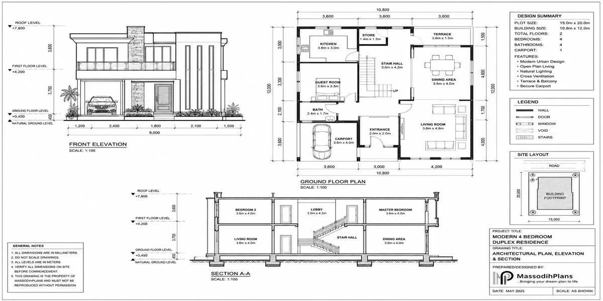
urban design architecture
Urban design and modern architecture are not simply about making cities and buildings look beautiful. They are about creating places that work places where people can live, move, work, interact, feel safe, and enjoy a good quality of life. Urban design focuses on the relationship between buildings, streets, public spaces, movement, landscape, infrastructure, and people, while modern architecture focuses more closely on how individual buildings are planned, designed, constructed, and experienced.
If you are a student, property owner, developer, architect, planner, or simply someone trying to understand why some buildings and neighbourhoods feel comfortable while others feel confusing or unpleasant, this distinction matters.
A good building does not exist in isolation. Its orientation, entrances, setbacks, height, materials, circulation, natural lighting, ventilation, landscaping, parking, and relationship with surrounding streets can influence the wider urban environment. Likewise, a well-designed street or public space can make even ordinary buildings feel more connected, useful, and welcoming.
In this guide, I will take you beyond the usual definitions. We will examine the core principles of urban design, the foundations of modern architectural design, the building-design process, the relationship between architecture and urban planning, and the often-misunderstood role of architects in shaping the built environment. I will also show you how these ideas apply to real development decisions, including site planning, movement, climate, human comfort, sustainability, functionality, aesthetics, and the Nigerian context.
Most importantly, I want you to leave with a practical understanding not just academic definitions. By the end, you should be able to look at a building, street, neighbourhood, or development proposal and begin to understand why it works, where it fails, and what a better design could achieve.
Why a Building Is Never Just a Building
Ask most people what an architect does, and they’ll describe someone who designs how a house or office looks and functions on the inside. That’s true, but incomplete. Every building also does something outward-facing the moment it’s built:
- It defines part of a street’s character, whether it means to or not
- It either supports or interrupts the flow of people and vehicles around it
- It affects light, privacy, wind, and drainage for the plots beside it
- It adds to (or strains) the shared infrastructure roads, drainage, power of its neighbourhood
- It contributes, in aggregate with thousands of other buildings, to what a city actually feels like to live in
Modern architecture with its clean lines, open facades, and large glazing makes these outward relationships more visible, not less. A glass-fronted modern house has a much more direct visual and functional relationship with its street than a traditional walled compound does. That’s exactly why understanding this relationship matters more, not less, as architectural style has modernized.
When reviewing any building design, ask two questions beyond “do I like how it looks”: how does it meet the street, and what does it do to the plots around it? Those two questions catch most design problems before construction, not after.
How Buildings Relate to the Street
The street is the first and most immediate layer of urban context a building sits in, and it’s where good or bad design becomes obvious fastest.
Street Frontage and Facade
How a building addresses the street its entrance position, fencing height, and how much of the facade is visible versus hidden behind a solid wall determines whether a street feels open, safe, and walkable, or closed off and hostile. Nigeria’s common pattern of high perimeter walls with a small gate creates a very different street experience from a design that engages the street with a visible entrance, some transparency, and active frontage.
Setbacks and the Space Between Building and Road
Setback distances aren’t arbitrary bureaucracy they preserve sightlines for road users, allow space for drainage channels, and give a street visual breathing room. A building that pushes right up to its boundary, even where technically within its plot, changes how the whole street reads and functions.
Access, Parking, and Traffic Impact
A building’s design has to account for how vehicles enter and exit relative to the street sightlines at the gate, whether cars queue onto the road while waiting to enter, and whether the street itself has the width to absorb the traffic the building generates. This is a design decision, not just a traffic engineering afterthought, and it’s one of the most commonly under-planned aspects of Nigerian residential and commercial buildings.
Pedestrian Experience at Street Level
Even in car-dominated Nigerian cities, ground-floor design a shaded walkway, a usable pavement edge, a covered entrance shapes whether a street is comfortable to walk along. Modern architecture’s emphasis on clean facades and material honesty can either enhance this (through texture, shade, and human-scale detailing at ground level) or ignore it entirely if the building was designed purely as an object to be viewed, not a space to be walked past.
How Buildings Relate to Public Space
Public space parks, drainage easements, shared green areas, road reserves is where individual buildings either give back to their surroundings or quietly erode them.
Buildings as Edges to Public Space
A building facing a park, open space, or public square has a responsibility to that space that an interior-facing building doesn’t. Windows, entrances, and active ground-floor uses oriented toward public space create informal surveillance and life that makes the space feel safer and more used an empty, blank wall facing a public space does the opposite, making it feel neglected and unsafe.
Encroachment on Shared Space
One of the most persistent urban design failures in rapidly growing Nigerian cities is private building encroachment onto drainage easements, road reserves, and designated public space extending fences, structures, or paving into land that was never meant to be built on. This isn’t just a legal violation; it directly causes the flooding and congestion problems residents then blame on “poor city planning” generally.
Contribution to Green and Open Space
Even where a project isn’t required to provide public space, individual building choices permeable paving instead of full concrete coverage, retained trees, a landscaped setback instead of bare block contribute cumulatively to a neighbourhood’s overall green cover and stormwater absorption. Multiply one plot’s bad choice by an entire street of similar plots, and you get the localized flooding patterns common across many Nigerian urban areas.
Before finalizing fence lines and paving, confirm your plot’s exact boundary against your survey plan and check whether any part of your intended building or fence falls within a drainage easement or road reserve. Encroachment discovered after construction is far more costly to correct than a boundary check before you build.
How Buildings Relate to the Neighborhood
At the neighbourhood scale, a building’s relationship to the buildings around it becomes the main design consideration.
Height and Massing Among Neighbours
A three-storey modern block built among single-storey bungalows creates overshadowing, privacy conflicts, and a jarring streetscape regardless of how well the building itself is designed. Good architectural design reads the height and massing pattern of the surrounding neighbourhood before finalizing a building’s form, not after.
Privacy Between Plots
Modern architecture’s large windows and open balconies, designed purely for internal light and view, can create direct sightlines into a neighbour’s bedroom, bathroom, or compound if window positions aren’t checked against the neighbouring building’s layout. This is one of the most common and avoidable design oversights I encounter, and it’s almost always caused by designing the plot in isolation instead of studying its immediate neighbours.
Shared Drainage and Ground Levels
Neighbouring plots share stormwater flow paths whether their owners acknowledge it or not. Raising one compound’s ground level to solve its own flooding, without checking how water moves across the surrounding plots, frequently just pushes the flooding problem onto a neighbour instead of solving it.
Estate Covenants as Private Urban Design Rules
Where a plot sits within a planned estate, the estate’s own design guidelines on roofing style, fence height, setback, and sometimes even facade material function as a private layer of urban design control, separate from and often stricter than state planning requirements. Ignoring these because state approval was granted is a common and legally risky mistake.
How Buildings Relate to the City
At the widest scale, thousands of individual building decisions add up to determine whether a city actually functions.
Density and Infrastructure Capacity
Roads, drainage, water supply, and power infrastructure are sized (or, in much of urban Nigeria, under-sized) for a specific level of density. Every building added beyond what that infrastructure was planned for adds strain which is a core reason many rapidly redeveloped Nigerian neighbourhoods experience worsening traffic, flooding, and power problems even as individual buildings become more architecturally sophisticated.
Connectivity and the Street Network
Cities built around interconnected street grids distribute traffic across multiple routes. Cities or estates built around isolated cul-de-sacs feeding a single collector road concentrate all traffic onto that one route, regardless of how well-designed the buildings along it are. This is a citywide pattern that individual architectural excellence cannot fix.
Cumulative Identity and Character
A city’s visual identity is rarely the result of one landmark building it’s the accumulated effect of thousands of ordinary buildings making similar or different choices about material, height, and street relationship. Modern architecture’s rise across Nigerian cities is visibly changing urban character at exactly this cumulative level, one plot at a time.
Climate and Environmental Load at City Scale
Individual passive design choices orientation, shading, permeable surfaces seem small at the plot level but compound significantly at city scale, affecting urban heat, flooding severity, and overall liveability. This is why sustainable design is increasingly treated as a city-level concern, not just an individual client preference.
The Architect’s Role in Creating Functional Urban Environments
This is where the building-to-city relationship becomes a job description. A good architect isn’t only solving the problem inside the plot boundary they’re actively managing the building’s relationship to everything outside it.
1. Reading Context Before Designing
Before a single wall is drawn, a good architect studies the site’s street relationship, neighbouring buildings, access, drainage pattern, and any estate or zoning constraints. Skipping this step is the single most common reason a well-designed building still creates real problems for its surroundings.
2. Translating Regulation Into Design
Setbacks, plot coverage limits, height restrictions, and drainage requirements exist precisely to manage the building-to-street and building-to-neighbourhood relationships described above. An architect’s job includes making these regulatory constraints work as part of a coherent design, not treating them as obstacles to minimize.
3. Designing the Building’s Public Face Deliberately
How a building meets the street and any adjacent public space its entrance, fencing, ground-floor treatment should be a deliberate design decision, not a leftover after the “real” design (the interior) is finished.
4. Coordinating With Planners and Engineers
On any project with real urban-context implications, an architect works alongside town planners (zoning and layout), structural engineers (foundation and safety), and drainage/civil engineers (stormwater management) to ensure the building’s relationship to its surroundings is technically sound, not just visually resolved.
5. Advocating for the Public Realm, Not Just the Client’s Plot
The most responsible architectural practice includes pushing back, where necessary, against client requests that would harm the street, a neighbour, or shared infrastructure even when those requests are technically within the client’s rights. This is a professional and ethical dimension of the role that goes beyond drafting drawings.
6. Supervising Construction Against the Approved Relationship
Construction oversight isn’t just about matching internal finishes to drawings it includes making sure boundary walls, ground levels, and drainage are actually built as designed relative to the street and neighbouring plots, since these are the elements most often quietly altered on site to save cost or time.
Ask any architect you’re considering hiring how they approach the relationship between your building and its street and neighbours not just the building’s internal layout. Their answer tells you quickly whether you’re getting a building designed in isolation or one designed as part of its actual context.
Architects’ role in shaping the cities where people live, work, and interact goes beyond simply designing individual buildings they are responsible for creating spaces that are functional, sustainable, and aesthetically pleasing. That responsibility functional urban environments, not just attractive individual buildings is the thread running through every relationship covered in this guide. 10jayst
Practical Questions to Ask Before You Build
How does my proposed building meet the street entrance, fencing, and visibility and does that support or undermine the street’s character?
Does any part of my building, fence, or paving fall within a drainage easement, road reserve, or other public space?
How do my window and balcony positions relate to my immediate neighbours’ buildings, and could they create privacy conflicts?
How does stormwater currently move across my plot and the surrounding plots, and what happens to that flow once I build?
Does my plot sit within an estate with its own design covenants, in addition to state planning requirements?
Is the access road wide and capable enough to handle the traffic my building will add to it?
Has my architect actually studied the surrounding context, or only the plot itself?
Frequently Asked Questions
How does a building’s design affect the street it’s on?
Through its frontage, setback, entrance treatment, and fencing these determine whether a street feels open, safe, and walkable, or closed off. Access and parking design also directly affect traffic flow on that street.
What is the architect’s responsibility toward neighbouring buildings?
To design window, balcony, and boundary elements with the neighbouring buildings’ privacy and drainage in mind, not just the client’s plot in isolation and to respect any shared infrastructure or drainage paths between plots.
Why do individual well-designed buildings sometimes still create urban problems?
Because urban problems traffic concentration, flooding, infrastructure strain are often the cumulative result of citywide patterns like street connectivity and density, which no single building’s design, however excellent, can resolve alone.
Do architects have a role in public spaces, or only private buildings?
Yes. How a building’s ground floor and entrance engage an adjacent park, square, or public space directly affects whether that space feels safe, active, and used architects influence this even when not directly designing the public space itself.
What’s the difference between an architect and a town planner in this context?
An architect designs how an individual building relates to its immediate context street, neighbours, public space. A town planner sets the broader zoning, density, and infrastructure framework within which all of that design happens.
My Final submission to you all
A building that ignores its street, its neighbours, its public spaces, and its city is a building with a blind spot, no matter how well-resolved its interior is. The strongest architecture reads all four of these relationships street, public space, neighbourhood, city before a single wall goes up, and the architect’s real job is managing that outward relationship as carefully as the inward one. That’s the layer of thinking this guide has tried to make explicit, because it’s the one most “modern architecture” content skips entirely.
If you’re planning a project and want a design resolved at both the building and urban-context level, our Services page outlines how we approach architecture alongside site and planning considerations. Browse our Plans Library for designs developed with real Nigerian street and plot realities in mind, or visit Plan School to understand the planning and approval process before you commission a design. You can also explore more architecture and planning guides on our Homepage.
Get related Guides here:
- Architecture & Architectural Design: Complete Guide to Modern Houses, Building Design and Modern Architecture
- How to Fast-Track Building Approval in Lagos Without Breaking the Rules: Legal Ways to Avoid Costly Delays
- Building Legally in Lagos: Complete Guide to Planning Approval, Permits, Inspections, and Construction Rules
- Why Building Approval Gets Delayed in Lagos: Common Rejection Problems and How to Get Your Plans Approved
- Urban Planning & Urban Design: Complete Guide to Modern Cities, Development and Renewal
- Urban Planning & Urban Design: Complete Guide to City Planning, Zoning and Land Development
- ArchDaily Inspired Designs for Modern Homes and Contemporary Architecture
- Architect’s Guide to Better Project Planning, Design, and Client Results
- Architecture Ideas That Match Global Design Trends and Modern Living
- Architectural Design Principles Every Architect and Homeowner Should Know
- Architectural Drawings Guide: Types, Symbols, Standards, Dimensions and Examples
- Architectural Engineering and Architectural Design Courses for House Building Plans
Author
Massodih Okon is a Nigerian built-environment professional with academic and professional experience in urban and regional planning, geography, architectural design, Landscape Design, GIS and land development.
He holds a Master’s degree in Urban and Regional Planning from the University of Uyo and a first degree in Geography and Regional Planning.
Through MassodihPlans, he publishes practical guides on Nigerian house plans, building design, physical planning, site planning, development approval and residential construction. Read the full author profile →