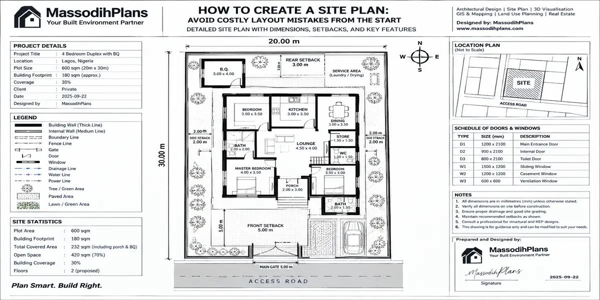
How to Create a Site Plan: Site Analysis
Introduction on How to Create a Site Plan: Site Analysis, Layout and Development Guide Today
Let me tell you what actually happens in my office almost every week. A client walks in sometimes it’s a young couple who just bought their first plot, sometimes it’s a contractor who needs paperwork sorted before he can mobilize to site, sometimes it’s a student who’s been asked to submit a “site analysis” for a studio project and has genuinely never heard the term before that week. All three of them use different words site plan, site layout, plot plan, development plan and all three of them are, half the time, asking me about overlapping things without realizing it.
So before I give you a single drawing tip, I want to do something I haven’t seen any article actually commit to doing properly: sort out what each of these terms really means, side by side, so you stop guessing which document you’re supposed to be asking for. Then we’ll build one, properly, from the ground up the way I actually do it on real sites, not the way a software company’s blog does it to sell you a subscription.
First, Let’s Settle the Confusion: Site Plan vs. Site Layout vs. Plot Plan vs. Development Plan
Every one of these terms gets thrown around loosely online, and it’s genuinely part of why people struggle. Here’s the honest breakdown, the way I’d explain it to a student sitting across from me.
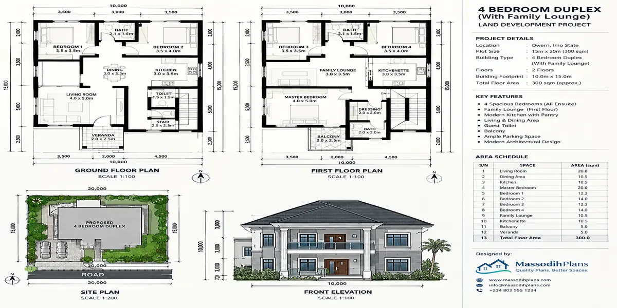
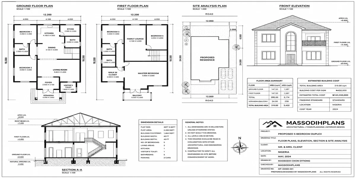
Site plan the umbrella term. A scaled, top-down drawing of a property showing the building footprint, boundaries, access, and outdoor features. If someone says “give me your site plan” without further explanation, this is the general document they mean.
Site layout / site layout plan a more detailed working-out of how everything is arranged on that site: building position, driveways, parking, green areas, utility runs. Think of “site plan” as the document, and “site layout” as the thinking that produced it.
Plot plan / plot plan drawing a simpler, often smaller-scale version used specifically for a single residential plot, usually for building permit submission. It shows the house footprint on the plot with setbacks and boundary dimensions, without necessarily going into the full landscaping and utility detail a bigger site plan would carry.
Building layout narrower still. This usually refers to how the building itself sits and is oriented on the site, sometimes bleeding into how its internal zones relate to the plot, rather than the whole property’s arrangement.
Property layout essentially the same idea as site layout, but the word “property” gets used more in real estate and legal contexts, while “site layout” gets used more in design and construction contexts. Same concept, different professional audience.
Site development plan
Site development plan this is where people get tripped up the most. A site development plan isn’t just a drawing it’s usually a fuller package: the site plan drawing plus supporting studies (drainage, utilities, sometimes phasing) submitted for approval on larger projects, often required by planning authorities before construction can begin.
Land development plan operates at a bigger scale again, often covering subdivision of a larger parcel into multiple plots, roads, and infrastructure before individual buildings are even designed.
Development plan vs. development proposal a development plan is the technical/design document. A development proposal is the pitch the narrative, financial, and policy document that accompanies the plan when you’re trying to get a project approved, funded, or both. If you’ve been asked for a “proposal” and you hand over only drawings, you’ve handed over half of what was actually requested.
Important note please, When a client or an authority uses one of these terms, don’t assume you know which document they mean ask them directly what it’s for (a permit application? a bank loan? an internal design review?). The purpose tells you exactly which of the documents above you actually need to produce.
What Site Planning and Site Design Actually Involve (They’re Not the Same Thing)
Site planning is the process the thinking, analysis, and decision-making that happens before and during the creation of a site plan. It’s a verb dressed as a noun.
Site design is closer to the creative and technical resolution of that thinking how the buildings, spaces, and circulation are actually shaped and detailed, once the planning decisions (zoning compliance, access points, drainage direction) have already been made.
Put simply: site planning decides what goes where and why. Site design decides how it looks and feels once it’s there. You need both, in that order, and skipping the planning step to jump straight to a pretty layout is the single most common reason site plans get rejected at approval stage.
Site Analysis: The Step Nobody Wants to Slow Down For
If there’s one section of this guide I want you to actually sit with, it’s this one. Site analysis is the homework everyone wants to skip, and it’s the reason a shocking number of “beautiful” site layouts turn out to be unbuildable, or get rejected, or flood in the first heavy rain.
A proper site analysis sometimes called a site analysis plan when it’s presented as its own drawing covers:
Topography: the slope, high points, and low points of the land. This alone determines drainage direction, foundation type, and where water will naturally want to go once you’ve built over the ground that used to absorb it.
Soil condition: whether the ground can carry your intended structure without expensive foundation work, and whether it drains well or holds water.
Existing vegetation and features: trees worth retaining, existing structures, water bodies all of which affect what you can and can’t do with the layout.
Access and frontage: which side of the plot faces the road, how wide that road is, and whether it can actually handle the traffic your development will generate.
Sun path and wind direction: often skipped by non-professionals entirely, yet this single factor decides which side of your building should carry the biggest windows and which side needs the least glazing.
Utilities: what water, power, and drainage infrastructure already exists at or near the site, and what you’ll need to extend or install.
Legal and regulatory constraints: zoning classification, setback requirements, easements, and any covenants attached to the land.
Neighbouring context
Neighbouring context: what’s built around the site already, since your layout has to sit sensibly next to it, not in isolation.
Site assessment is often used interchangeably with site analysis, but in stricter professional use, an assessment tends to be the evaluation step judging whether the site is suitable and safe for what’s proposed while analysis is the broader data-gathering and interpretation process that feeds into that judgment. In practice, most people use the two words for the same activity, and I won’t pretend the industry is perfectly consistent about it either.
Site feasibility study goes one level further than analysis. It doesn’t just describe the site it answers the question “should this project actually happen here, and can it be done within the available budget, timeline, and regulatory framework?” A feasibility study typically combines the site analysis findings with cost estimates, regulatory risk, and sometimes market or investment viability, especially on commercial projects. If you’re spending significant money on land or a large development, a feasibility study is not optional homework it’s the document that stops you from losing that money on a site that was never going to work.
Note Before You Build: I have seen people buy land first and commission a site analysis afterward, purely because the price looked good. Do the analysis, or at minimum a basic feasibility check on drainage, access, and zoning, before you pay for land not after. A cheap plot with a soil or drainage problem is rarely actually cheap once you’ve built on it.
Residential, Commercial, Building and Property Site Plans: What Actually Changes Between Them
People search these as if they’re different products, and to be fair, the requirements genuinely do shift depending on which one you’re producing.
Residential site plan: focused on a single house or a small number of dwelling units, showing the house footprint, driveway, setbacks, and often landscaping. Approval requirements are usually more straightforward than commercial work.
Commercial site plan: has to account for customer and staff parking counts, loading/delivery access, signage placement, and often stricter drainage and fire-access requirements because of the higher occupancy and traffic the building will generate.
Building site plan: sometimes used loosely to mean the same as a residential or commercial site plan, but occasionally used specifically to describe the plan submitted at building-permit stage, distinct from an earlier concept or planning-permission-stage site plan.
Property site plan: again, largely the same document, but the phrase leans toward legal, real estate, and boundary-documentation contexts you’ll see this term used more often around title deeds, surveys, and property transactions than around active construction drawings.
House site plan: essentially a residential site plan, but the phrase is used more by homeowners searching for what they need, rather than by professionals describing what they’re producing.
The honest takeaway: the underlying document is more similar than the terminology suggests. What actually changes is scale, the specific data the approving authority wants to see, and how much traffic/utility/safety analysis is expected.
How to Actually Create a Site Plan: The Real Process, Step by Step
This is the part everyone wants, so let’s get into it properly not a generic six-step listicle, but the actual sequence I follow.
Step 1: Get Your Survey Plan First
You cannot create an accurate site plan without an accurate survey of the land boundary dimensions, coordinates, and any existing beacons. Skipping this and estimating boundaries from memory or a rough sketch is the single fastest way to produce a site plan that gets rejected or, worse, that misplaces a building relative to its actual legal boundary.
Step 2: Conduct the Site Analysis
Everything covered in the section above topography, soil, access, sun path, utilities, regulatory constraints gets gathered and documented before a single line of the actual layout is drawn.
Step 3: Confirm Zoning and Setback Requirements
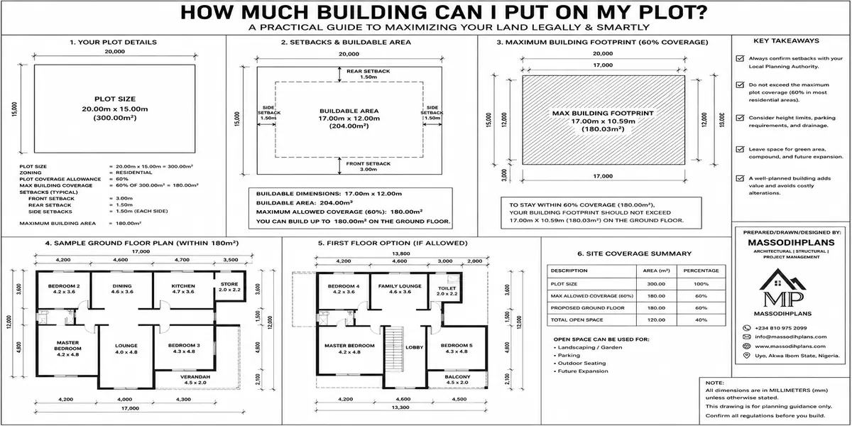
Contact the relevant planning authority (or check your development’s estate covenants, if applicable) for the exact permitted setbacks, plot coverage, and any height or use restrictions on that specific plot. This defines the “buildable envelope” you’re actually working within.
Step 4: Establish the Building Footprint and Orientation
Position the building within the buildable envelope, factoring in your sun path and access findings from the analysis stage not just where it “looks nice” on the paper.
Step 5: Lay Out Circulation — Vehicular and Pedestrian
Driveways, parking, walkways, and entrance points, checked for realistic turning radii and sightlines at the road junction, not just drawn as neat lines.
Step 6: Position Utilities and Drainage
Water supply, power connection points, septic or sewer connection, and critically the direction stormwater will flow once the ground is built over. This has to work with the site’s actual topography, not against it.
Step 7: Add Landscaping and Outdoor Features
Trees to retain, green areas, fencing, and any other outdoor elements, positioned to support rather than block the circulation and drainage decisions already made.
Step 8: Draw to Scale With a Proper Legend
Every site plan needs a scale bar, north arrow, a legend explaining every symbol and line type used, and clear dimension labels. A drawing that looks complete but is missing these is not a professional document reviewers and contractors read plans by their labels and symbols, not by guessing what a shape represents.
Step 9: Cross-Check Against Regulatory Requirements Before Submission
Re-verify setbacks, coverage ratios, and any required notations (fire access, easements) against your local authority’s checklist before you submit, rather than finding out what was missing after a rejection.
Listen very well always: Keep a personal checklist of your local planning authority’s exact site plan requirements every authority has slightly different expectations, and half of the rejected submissions I’ve seen fixed were rejected for a missing notation or label, not an actual design flaw.
Site Layout Plan: Getting the Arrangement Right, Not Just Legal
Once the technical boxes above are checked, the actual quality of a site layout comes down to a few judgment calls that separate an average layout from a genuinely good one:
Efficient land use without overcrowding maximizing usable space while still leaving room for light, air, and drainage between structures
Clear separation of vehicular and pedestrian movement especially important on commercial and multi-unit residential sites, where mixing the two creates real safety risk
Logical zoning within the site grouping service areas (refuse, utilities, deliveries) away from entrances and outdoor living/leisure areas
Future flexibility leaving reasonable room for expansion or changes in use, rather than designing a layout so tight that no future adjustment is physically possible
Land Development and Land Development Plans: The Bigger Picture
Land development operates a level above individual building site plans it’s the process of taking a larger, often raw parcel of land and preparing it for construction, which usually includes subdividing it into plots, laying out roads, and installing shared infrastructure (drainage, power, water reticulation) before any individual building design even starts.
A land development plan is the technical document guiding that process showing the subdivision layout, road network, plot boundaries, and infrastructure routing for the whole parcel. If you’re buying a single plot inside an estate, the land development plan is the document that determined your plot’s shape, size, and access long before your own site plan for your specific house was ever drawn.
This matters practically: if the estate’s land development plan has a drainage or access flaw, every individual site plan built within it inherits that flaw, no matter how well each individual house is designed.
Development Plan vs. Development Proposal: Why This Distinction Actually Matters
I mentioned this briefly above, but it deserves its own honest explanation, because I’ve seen real projects stall over this confusion.
A development plan is the technical package site plan, supporting drawings, sometimes phasing diagrams describing what will physically be built.
A development proposal is the persuasive package often built around that same development plan that explains why the project should happen, who’s behind it, what it will cost, what the expected return or community benefit is, and how it complies with policy. Investors, banks, and some approval committees ask for a proposal specifically because a set of drawings alone doesn’t tell them whether the project makes financial or strategic sense.
If you’re approaching a bank, an investor, or in some cases a planning committee handling a larger development, producing only the technical development plan when a proposal was actually requested is one of the quiet reasons good projects get delayed or turned down not because the design was wrong, but because the ask was answered incompletely.
Manual Sketch vs. CAD vs. GIS — Which Should You Actually Use?
Most articles on this topic either assume you’re using expensive software or don’t mention tools at all. Here’s the honest, practical breakdown of your real options, based on what I actually use across different project scales.
Hand sketch: fine for very early concept discussions with a client, or a rough feasibility check before you’ve committed money to formal drawings. Never acceptable for a permit submission.
CAD (AutoCAD and similar): the industry standard for producing accurate, scaled, submission-ready site plans. This is what most planning authorities expect to see, whether as a printed drawing or a digital submission.
GIS (Geographic Information Systems): this is the layer most homeowner-facing guides skip entirely, and it’s genuinely valuable, especially at land development and feasibility scale. GIS lets you overlay real topographic, flood-risk, soil, and land-use data onto your site useful for feasibility studies, larger land development plans, and any situation where you need to understand a site’s characteristics against wider geographic data rather than just what a single survey shows. On projects where drainage or flood risk is a real concern (which, across much of Nigeria’s low-lying urban terrain, is more often than people assume), a GIS-informed site analysis catches risks that a standard survey and sketch simply won’t reveal.
Please Before You Build: If your site sits in a flood-prone or low-lying area, don’t rely on a visual site visit alone to judge the risk. A GIS-based flood and drainage check, even a basic one, before you finalize your layout can be the difference between a site plan that survives its first rainy season and one that doesn’t.
Reading a Site Plan Like a Professional: Symbols and Legend Basics
If you’ve ever been handed a site plan and struggled to actually understand what you’re looking at, you’re not alone this is rarely explained in plain language.
Solid boundary lines mark legal property lines; dashed lines usually indicate setbacks or easements, not the actual boundary
North arrow and scale bar always check these first; without them, no distance or orientation on the drawing means anything reliable
Hatching patterns distinguish paved areas, landscaped areas, and building footprints from each other
Contour lines (where shown) indicate ground elevation changes closely spaced lines mean steeper slope, widely spaced lines mean gentler slope
Utility symbols (often specific icons or line styles for water, power, and drainage runs) show existing and proposed service routes
The legend ties every symbol and line style used on that specific drawing to its meaning always check it rather than assuming a symbol means what it meant on a different drawing you’ve seen before, since conventions can vary between offices and authorities
Common Reasons Site Plans Get Rejected (and How to Avoid Every One of Them)
Missing or inaccurate survey data the boundary shown doesn’t match the legal survey
Incorrect or unclear setbacks either not shown, or not matching the authority’s actual requirement for that zone
No drainage provision, or a drainage direction that conflicts with the site’s real topography
Missing scale, north arrow, or legend technically incomplete regardless of design quality
Access or parking that doesn’t meet minimum requirements, especially common on commercial submissions
Encroachment on easements or road reserves building or paving extending into land legally reserved for drainage or future road widening
Inconsistency between the site plan and other submitted documents (floor plans, structural drawings) reviewers cross-check these, and mismatches trigger queries or outright rejection
A Quick Global-and-Local Reality Check
Terminology and specific submission requirements shift slightly depending on where you’re building. In Nigeria, site plans and site development plans are typically reviewed against state-level physical planning and urban development regulations, with additional requirements where a plot sits within a registered estate layout. And in the UK, the equivalent process runs through planning permission and building regulations as two distinct approval tracks. In the US and Canada, requirements are typically set at the municipal or county level, with site plan review often handled separately from building permit review. In Australia and South Africa, similar dual-track systems exist at state/provincial and local council level. The underlying document a scaled, analyzed, properly legended site plan stays remarkably consistent worldwide; what changes is which specific authority reviews it and which exact notations they require.
Frequently Asked Questions
What is the difference between a site plan and a floor plan?
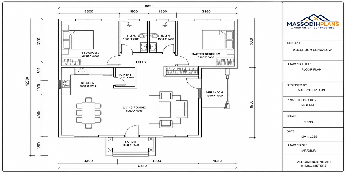
A site plan shows the entire property from above boundaries, building footprint, access, and outdoor features. A floor plan shows the interior layout of one level of a building. They’re complementary documents, not substitutes for each other.
Do I need a professional to create a site plan, or can I do it myself?
For a permit submission, most authorities expect a professionally prepared, scaled, and properly labelled site plan. You can and should be involved in the decisions behind it, but the final submitted drawing generally needs to come from a qualified architect, planner, surveyor, or engineer to be accepted.
What’s the real difference between a site analysis and a feasibility study?
Site analysis describes and evaluates the site’s physical and regulatory characteristics. A feasibility study goes further, combining that analysis with cost, timeline, and viability assessment to answer whether the project should proceed at all.
Why did my site plan get rejected even though the design looked fine?
Rejections are very often technical, not aesthetic a missing scale or legend, an incorrect setback, an inconsistency with the survey, or a drainage provision that doesn’t match the site’s real topography. Check the technical completeness before assuming the design itself was the problem.
What should I bring to a first meeting with a site planner or architect?
Your survey plan if you have one, any zoning or estate covenant documents for the plot, and a clear statement of what you actually need the document for (permit application, bank submission, internal design review) that last point alone determines which specific document you actually need produced.
Conclusion
A site plan is never really “just a drawing.” It’s the physical record of a whole chain of decisions what the land can actually support, what the law allows, where water will go, and how people and vehicles will move compressed into one scaled document. Get the analysis and the terminology right first, and the drawing itself becomes the easy part.
If you’re at the stage of turning raw land into a buildable project, our Services page outlines how we handle site analysis and layout work from first survey to final approval. Browse our Plans Library for house designs already matched to real plot and site conditions, or visit Plan School to go deeper into reading and evaluating site and building drawings before you commission your own. You can also explore more planning and design guides on our Homepage. Read also the following:
- Construction: A Complete Guide to Building Projects, Materials and Services
- Building Cost and Construction Cost: How Much Will Your House Really Cost?
- House Plans and Floor Plans: How to Choose the Right Layout for Your Needs
- My Tenant Won’t Leave. What Can I Do? Legal Steps for Landlords in Nigeria and Beyond
- How Do I Evict a Tenant? 10 Legal Steps for Landlords in Nigeria and Beyond
Author
Massodih Okon is a Nigerian built-environment professional with academic and professional experience in urban and regional planning, geography, architectural design, Landscape Design, GIS and land development.
He holds a Master’s degree in Urban and Regional Planning from the University of Uyo and a first degree in Geography and Regional Planning.
Through MassodihPlans, he publishes practical guides on Nigerian house plans, building design, physical planning, site planning, development approval and residential construction. Read the full author profile →