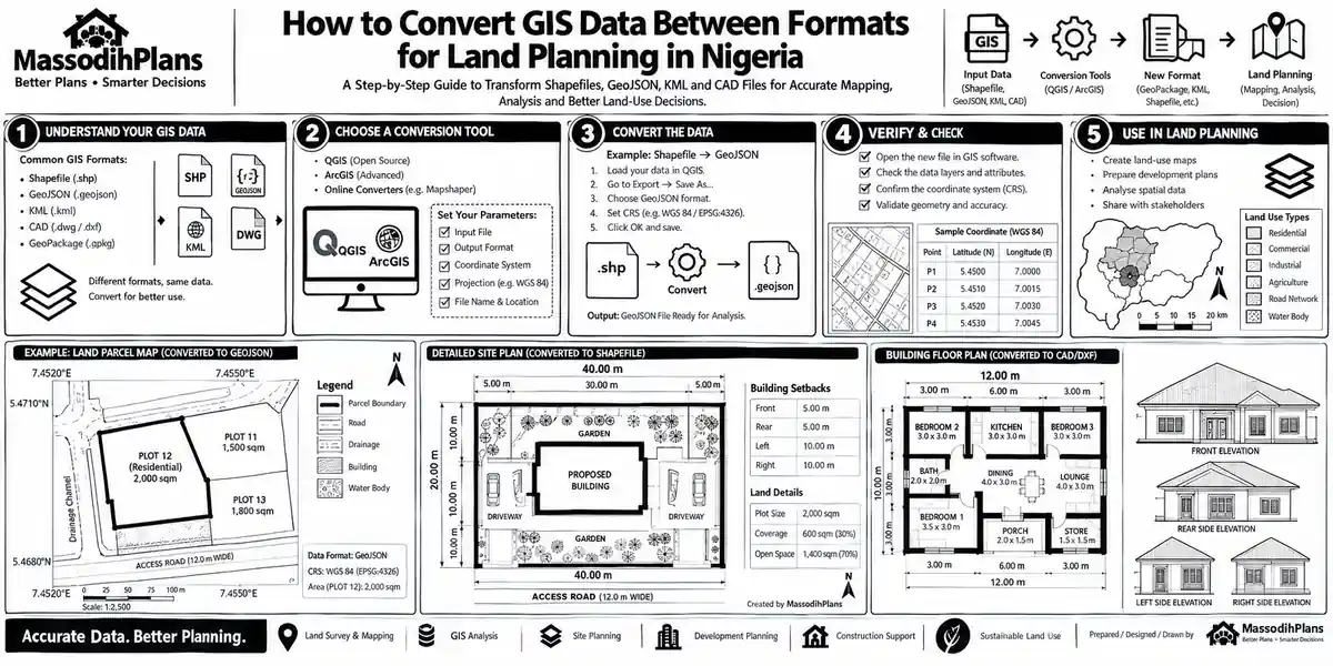
Let me guess why you’re here. You’ve got a file sitting on your desktop maybe
Day: 9 October 2026
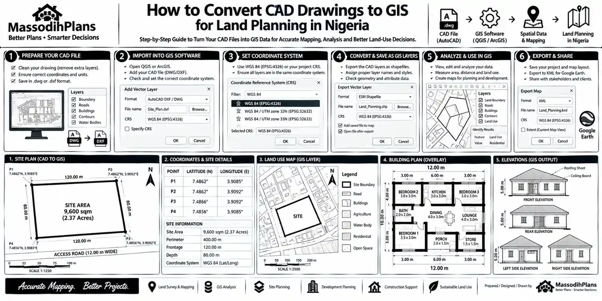
How Do I Convert CAD Drawings to GIS? GIS for Land-Site Planning in NigeriaHow Do I Convert CAD Drawings to GIS? GIS for Land-Site Planning in Nigeria
A student of mine once sent me a DWG file at past 11pm with a
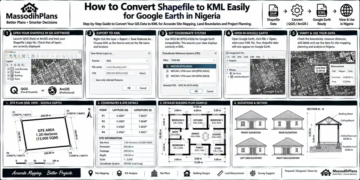
How Do I Convert Shapefile to KML? — Nigerian GIS and Site Mapping TutorialHow Do I Convert Shapefile to KML? — Nigerian GIS and Site Mapping Tutorial
Somebody send you a shapefile of a plot of land maybe your surveyor, maybe a
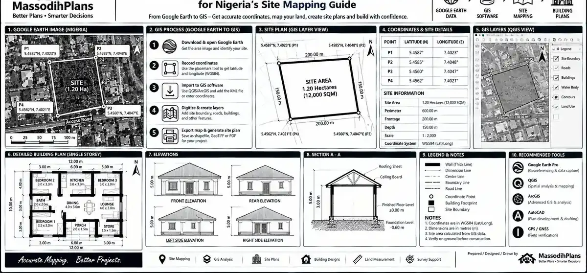
How Do I Convert Google Earth Data to GIS? for Nigeria’s Site Mapping GuideHow Do I Convert Google Earth Data to GIS? for Nigeria’s Site Mapping Guide
A student sent me a KML file last month. He had digitized his project area
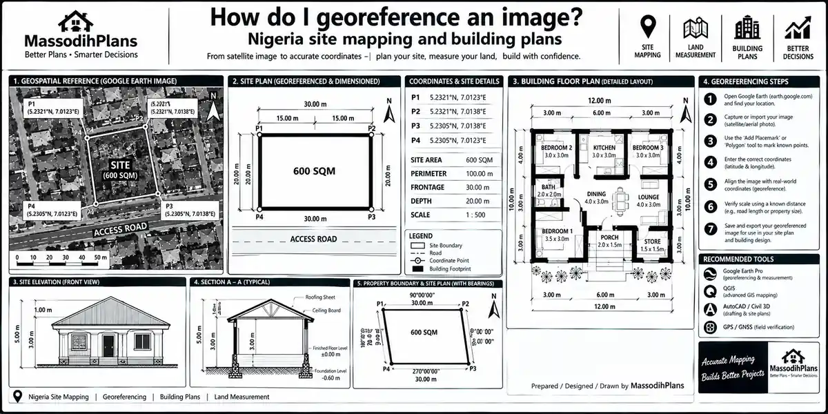
How do I georeference an image? Nigeria site mapping and building plansHow do I georeference an image? Nigeria site mapping and building plans
Introduction to How Do I Georeference an Image? Complete Guide (QGIS, ArcGIS, Scanned Maps &
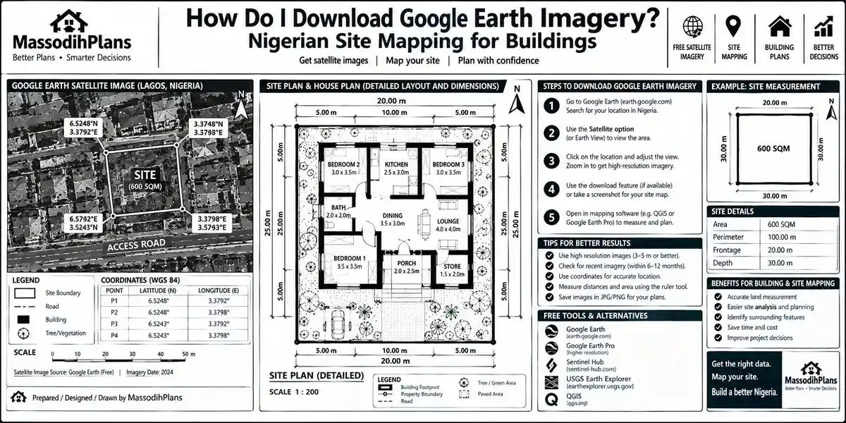
How Do I Download Google Earth Imagery? Nigerian Site Mapping for BuildingsHow Do I Download Google Earth Imagery? Nigerian Site Mapping for Buildings
Somebody in my DMs last week sent me a screenshot of a Google Earth view
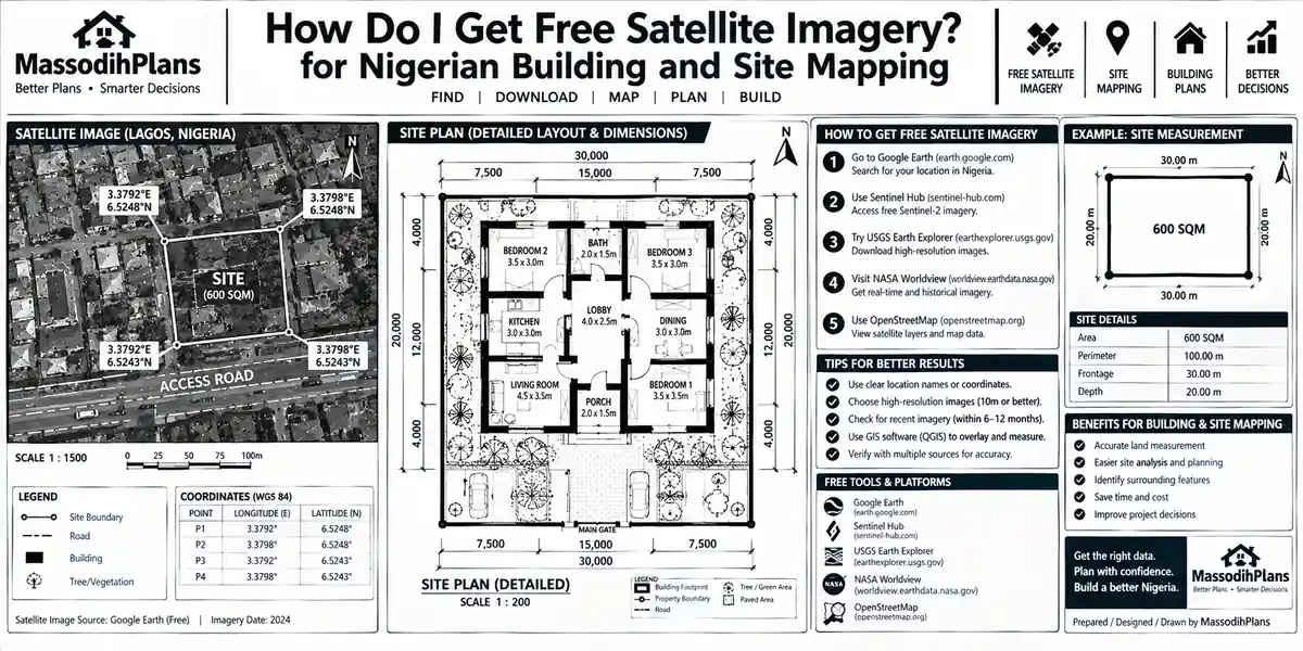
How Do I Get Free Satellite Imagery? for Nigerian Building and Site MappingHow Do I Get Free Satellite Imagery? for Nigerian Building and Site Mapping
A client once sent me coordinates for a “prime waterfront plot” he was about to

How Do I Fix the Coordinate System? GIS Layer Alignment for Site Plans FastHow Do I Fix the Coordinate System? GIS Layer Alignment for Site Plans Fast
Oya, close every other tab. Bring your laptop closer. I want us to settle this
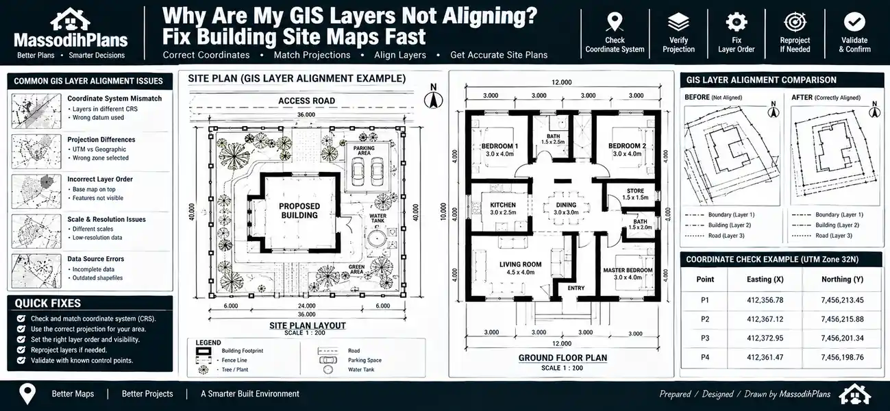
Why Are My GIS Layers Not Aligning? — GIS Fixes for Building Site Plan MapsWhy Are My GIS Layers Not Aligning? — GIS Fixes for Building Site Plan Maps
Picture this. You’ve loaded your base map, your survey points, your satellite imagery, and your
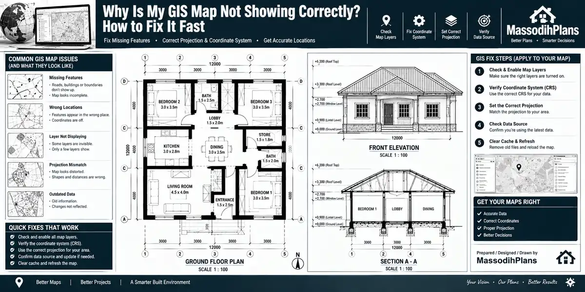
Why Is My GIS Map Not Showing Correctly? (Real Fixes That Actually Work)Why Is My GIS Map Not Showing Correctly? (Real Fixes That Actually Work)
Picture this. You’ve just finished digitizing a client’s boundary, you hit render, and what comes